The second day of my SEKI Loop took me to the really High Sierra. Despite four days of acclimatization, the altitude still slowed me down to half my normal hiking speed. But I did climb Forester Pass: the highest point on the John Muir Trail and Pacific Crest Trail and the border of Kings Canyon and Sequoia National Park.
Day 2: Upper Vidette Meadow to Tyndall Creek
Start: Upper Vidette Meadow, John Muir Trail (Wenck JMT guidebook nr. 11.10)
End: Tyndall Creek campground (Wenck JMT guidebook nr. 12.06)
Distance: 12.6 miles (20,3 km)
Elevation gain: 3,337 ft (1.019 m)
Elevation loss: –2,343 ft (–713 m)
Highest point: Forester pass, 13,138 ft (4.004 m)
Time: 6:50 hrs moving time; 9:45 hrs total time
Date: August 31, 2018
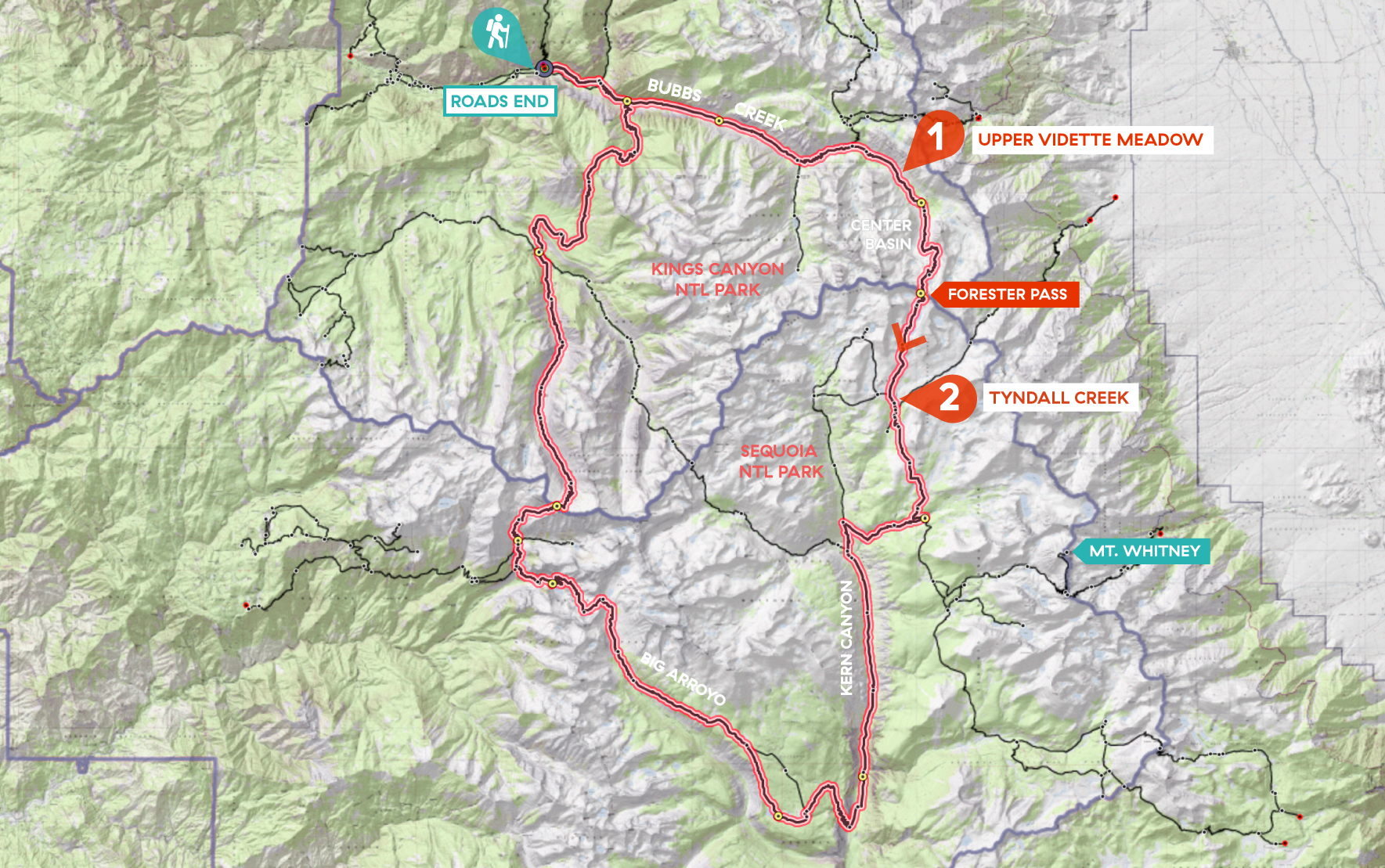
Day 2 of my SEKI loop, map base layer by Sierramapper.
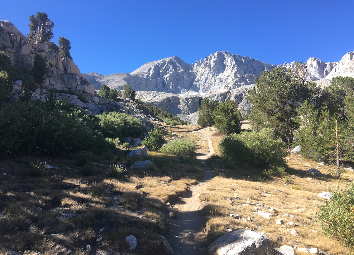
Leaving Vidette Meadow
The second day of my thru-hike started after a quiet and moonlit night at the Upper Vidette Meadow camp site. Waking around 6 am, it took me more than an hour to break up camp, eat breakfast until I hit the trail at 7:15 am.
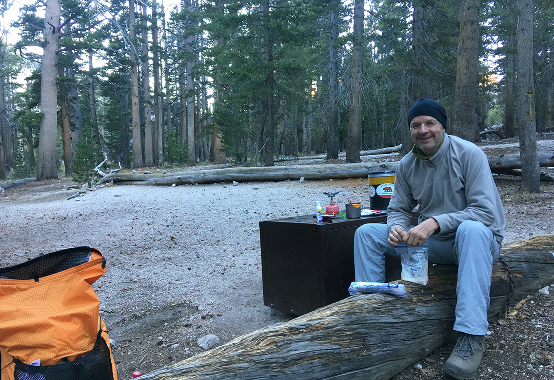
At ± 9,850 ft (3.000 m) it had been a chilly night and the morning started cold. I was happy with my Zpacks possum down gloves the first mile of trail, as I was leaving the lodgepole forest. Every step higher revealed more and more of the mountain tops that lay in front of me – and behind me.
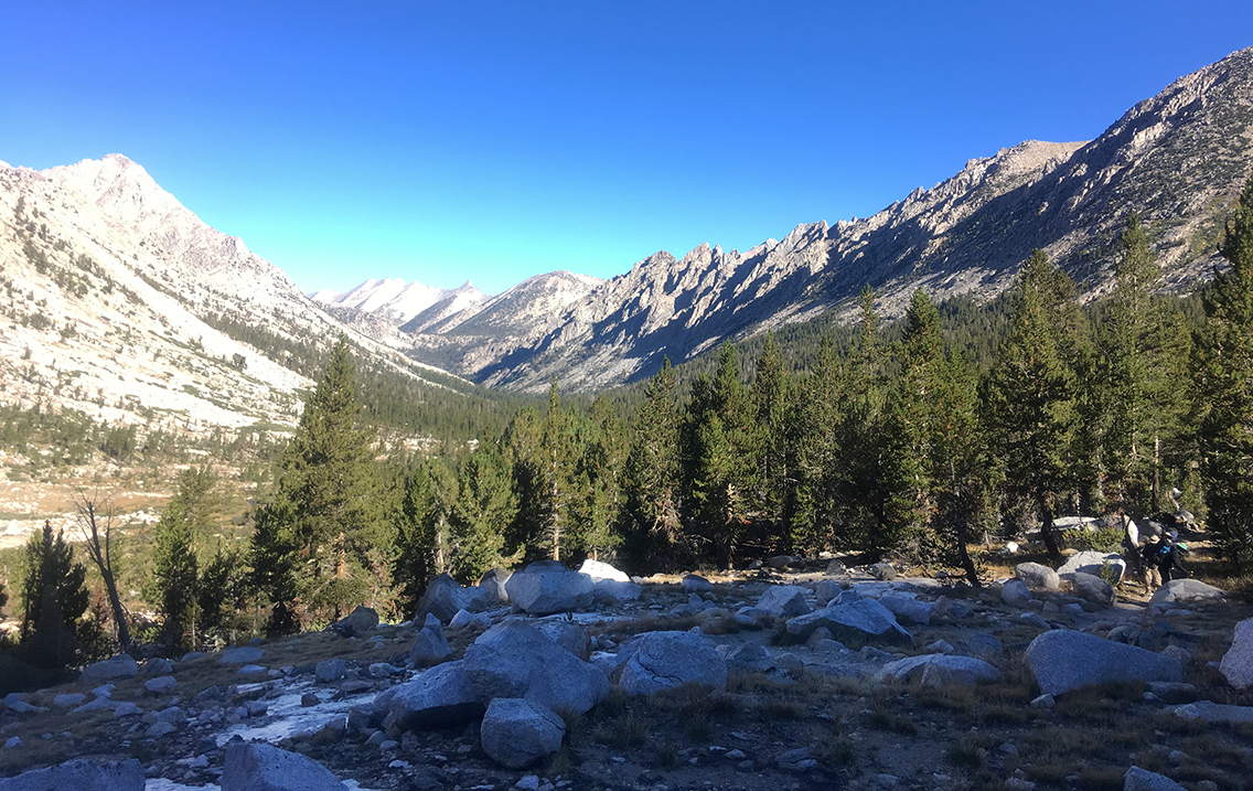
View South from John Muir Trail towards Center peak and Kings Kern Divide.
Looking at the immense granite walls, I wondered where the Forester Pass would be located. I couldn’t imagine a trail up those mountains. Even this early in the morning, the first hikers were coming down from Forester Pass. One of them told me the pass would be invisible until the last mile or so.
Higher altitude and a silent lake
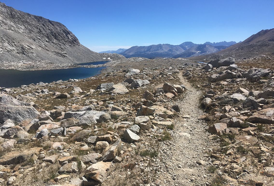
After a steady climb of about three hours I reached the relatively flat meadow with a couple of beautiful lakes, where the trail makes short bend East. A good place to have a break, eat some M&M’s and drink water in the shade of a big rock.
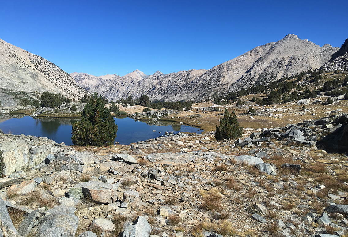
Lakes Southwest of Center Peak, just before the trail leads you to a few miles of steep switchbacks.
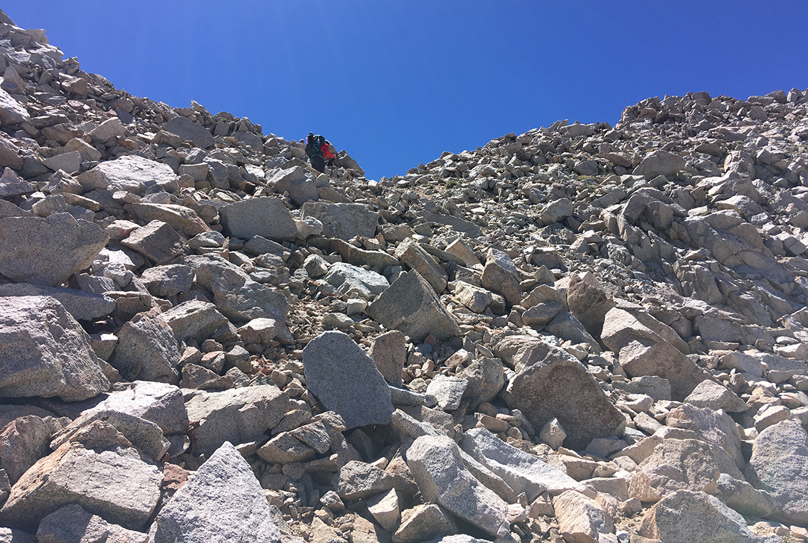
When I reached the switchbacks to the pass, the trail was getting busier. Instead of the handful of people I met in the morning, now a steady stream of hikers would come hiking up, or down, the pass.
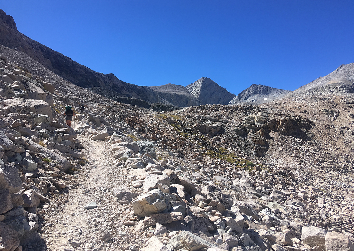
Already at ± 11,500 ft (3.500 m), the altitude with its low oxygen was slowing me down. I still had about 1,700 ft (500 m) to climb. This wouldn’t be a problem at lower elevation, but for the first time I got really slow, my heart beating like I was running. Very soon all the other hikers had outrun me, leaving me behind in perfect solitude and silence, which wasn’t bad at all.
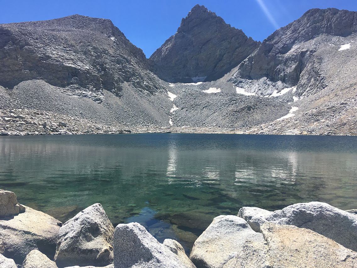
Lake at 12,250 with Junction Peak.
Pushing on, step by step, I reached the ‘Lake at 12250’ (not an official name, I believe). I took another break here to fill up on my water. The dry air gave me a constant thirst: I had been drinking about 2.5 liters of water since this morning, the fresh 2.5 liters I got from the lake would almost be gone by the time I reached the south side of the pass.
The crystal clear lake was so beautiful and so silent. Not a sound was to be heard, except for a light trickle of water. No picture can capture the sensation and magnitude of moments like this. I just sat there, like hypnotized, gazing at the water and listening to the empty silence around me.
Forester Pass
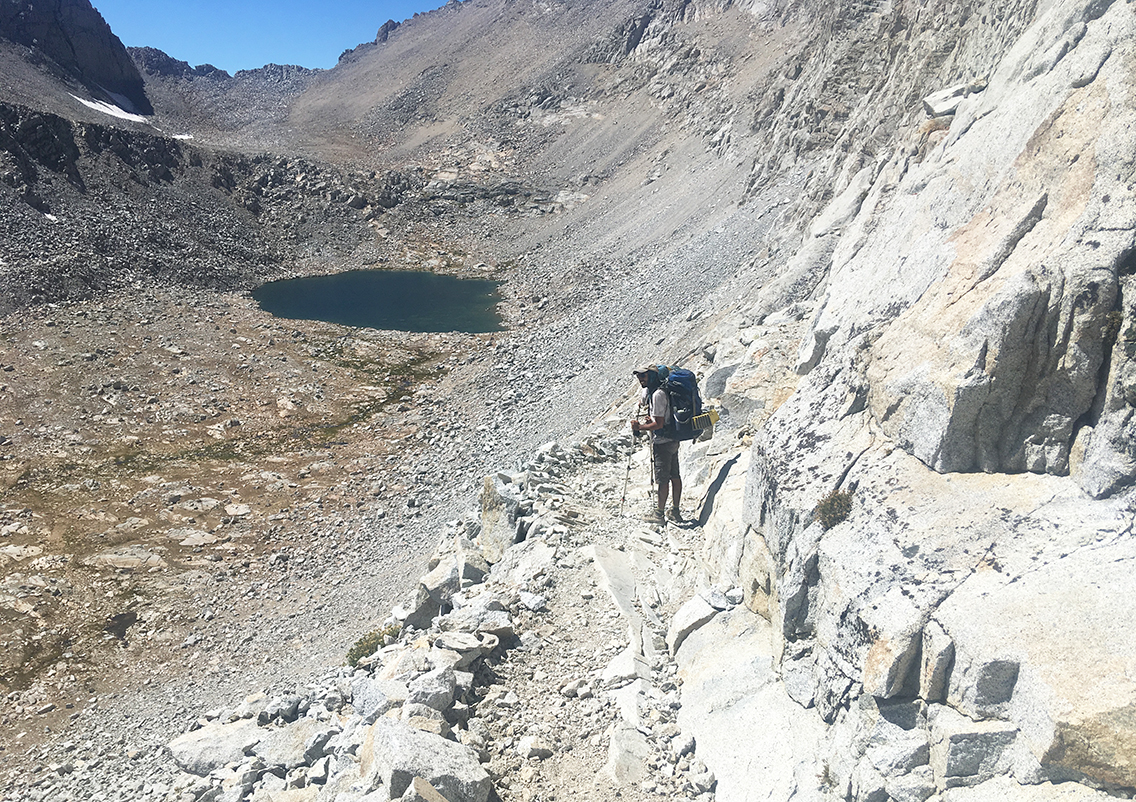
With no more than a 1,000 ft (300 m) to go up, I still couldn’t see Forester Pass. I couldn’t even see the trail for more than a short distance. All around me just a great mess of loose rocks.
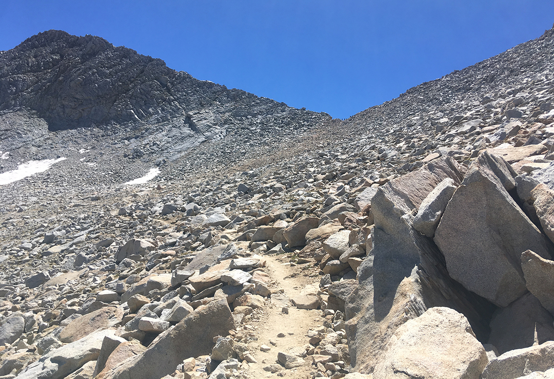
At the last series of switchbacks I had to adjust my speed more and more, until I almost stood still after every step. I felt no pain in my feet or legs, I wasn’t actually very tired, but I experienced the lack of oxygen. Living at sea level my whole life, my body apparently is not well suited for these elevations. My heart was beating like crazy and my breath was heavy.
But still: I listened to my body and kept on going as slow as it had to be. I felt kind of comical as numerous hikers were moving down so swiftly. ‘These are the days that character is built’ one of them said.
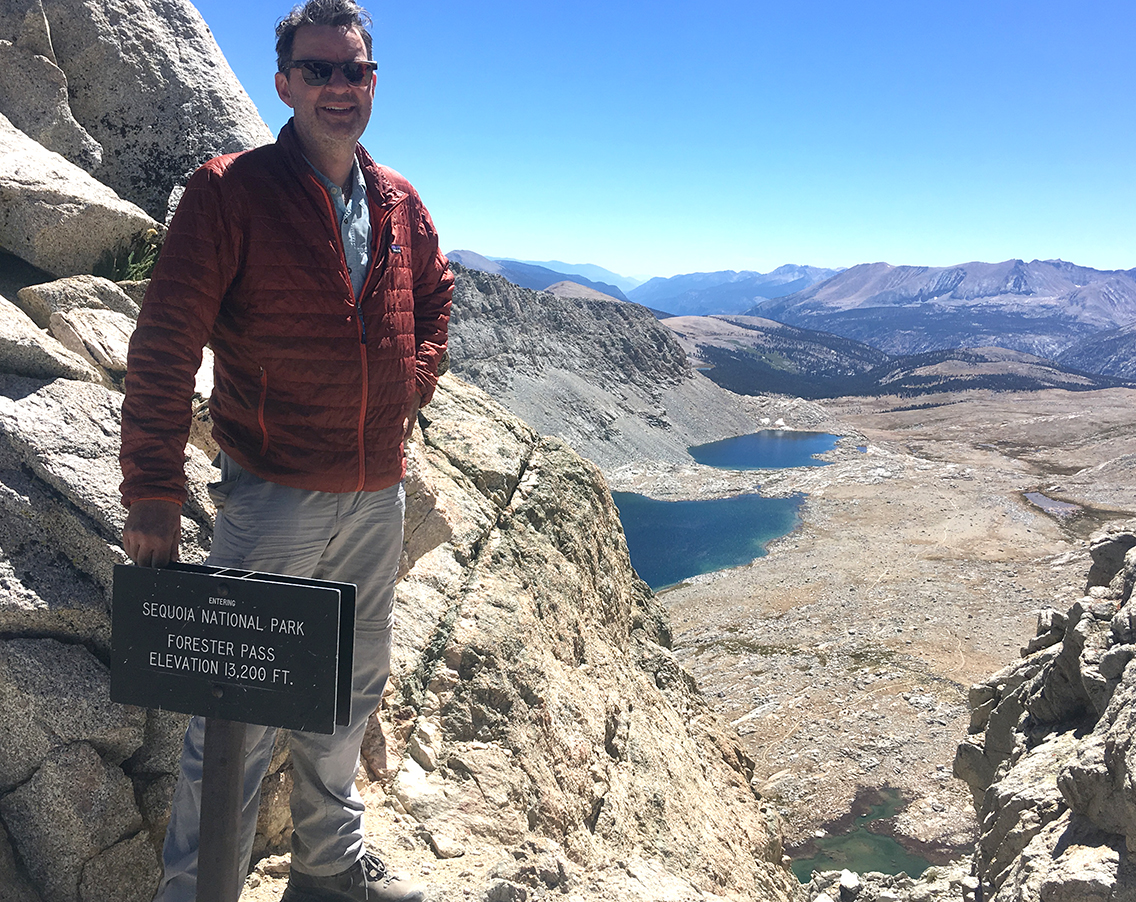
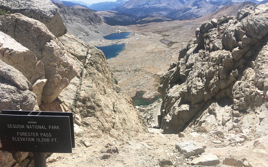
Never trust the signs: Forester pass at 13,153 feet (4,009 m), looking South to the Tyndall Creek area.
And so I reached Forester Pass at 2:15 pm, after 7 hours (including breaks). Two other hikers had just reached the pass and were gazing over the amazing valleys South and North, just like me.
The pass itself is very small, no more than a handful of people would fit here. Helping each other making photographs at the sign, we had to be constantly aware of the steep and deep abyss on both sides (don’t step back!).
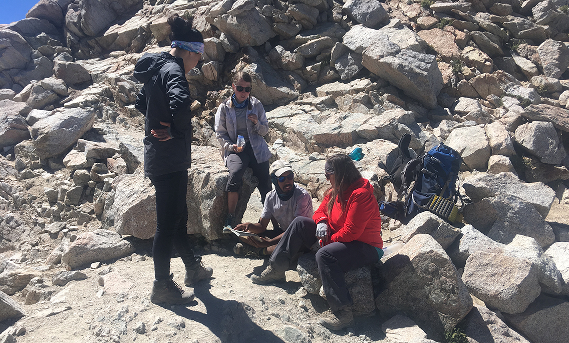
Then my hiker friends from Upper Vidette, Dev and Lily (in the middle below), made it to the top just a few minutes later. They started late this morning, but they caught up with me just now.
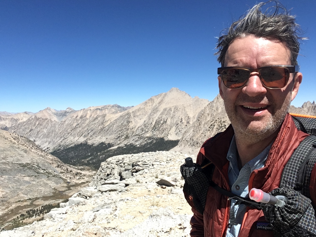
Everybody was eating chips, nuts and other salty snacks now and drinking lots of water. In the meantime I checked the altitude on my Gaia GPS app. Although the pass is officially 4.009 meter high, according Gaia the pass is 3.997 meter (never mind the official sign which is at least 50 ft off). To make sure I would really be on the elevation of at least 4,000 meter (yes, I live in a metric system), I climbed a rock until Gaia GPS indicated 4.004 m (13,138 ft ).
To Tyndall Creek
The South side of Forester Pass is quite different from the North: very steep and exposed switchbacks (with immense views) bring you down to a plateau very quickly. I wouldn’t want to climb the pass from the south! Although you’d have the advantage that the pass is better visible from the trail, long before. Or maybe that is a disadvantage, I don’t know.
This day the altitude forced me to walk as slowly as 1 mile per hour and the 12,6 miles (20,3 km) took me almost 7 hours of hiking. But I climbed 3,337 ft (1.019 m) to the highest elevation I ever was: 13,153 ft (4.009 m). And I was still almost one day ahead of my plans. Not bad for a second day in the High Sierra!
Hey there! It’s Erika, the one in red sitting in your picture. That sure was a hike getting up Forester! I have a video of those kids eating Cheez-its off the sand if you’re interested!
Hi, how nice to hear from you! Yes, it sure was pretty heavy climbing up those rocks, We were both going so slow but we made it!
I’d like to see the video, I’ll send you an e-mail.