On day 3 of the Tour du Mont Blanc I climbed up and down the amazing number of 4 mountain passes within 23 km / 12 miles. And when I finally reached Italy, I concluded the day at a tiny museum with 5 other hikers.
Day 3: Les Lacs Jovet – Col de la Seigne
Start: Les Lacs Jovet
End: La Casermetta, 30 minutes east of Col de la Seigne (wild camping)
Distance: 22,9 km (11,8 miles)
Highest Point: Col des Fours 2.669 m (8,756 ft)Elevation gain: 1.522 m (5,000 ft)
Elevation loss: 1.348 m (4,423 ft)
Time: 8:10 hrs moving time; 10 hrs total time
Date: August 14, 2019

TMB Day 3, map by France IGN Topo / Gaia GPS
Reconnecting with the TMB
The night at the lakes of Jovet was silent and misty, with clouds drifting just above the surface and a pale moon shining through. When I got up at 6 o’clock my tent was wet with condensation, and so was my quilt. There was no way to dry them this early, so I had no choice but pack it wet. For this trip I used one big pack liner on the inside of my backpack. So I stuffed all my dry gear in the liner, closed it and placed my quilt and wet tent on top. I hoped to find a sunny spot later on the trail for drying.
After a breakfast of freeze dried muesli and a cup of tea I was ready to go. I only had about 1/3 liter of clean water left. Plus some unfiltered water from the lake, just in case. This made me a bit uneasy, and I hoped to find a reliable source soon (eventually that would take me almost 3 hours).
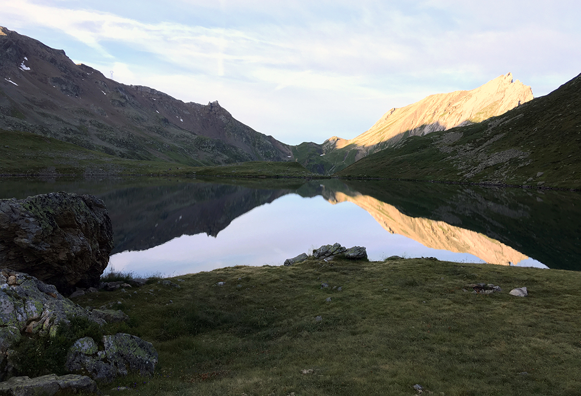
Lac Jovet at sunrise
I headed back to the TMB-trail downhill. The rising sun illuminated the mountain West of the lake. The Plan Jovet was full of sheep now, with about 3 dogs and a shepard guarding them. The dogs ran up to me and started barking real loud. The shepard said the dogs were afraid of hiking poles, so I held them close to my body and, walking on, the dogs finally let me go in peace.
Reconnecting with the TMB in 30 minutes, I turned left, up to the first pass of today: the Col du Bonhomme. The steep trail directed me to the small snowfield that was visible below a distinctive chimney-looking mountaintop (the Rocher du Bonhomme).
Looking up to the Col du Bonhomme with Rocher du Bonhomme
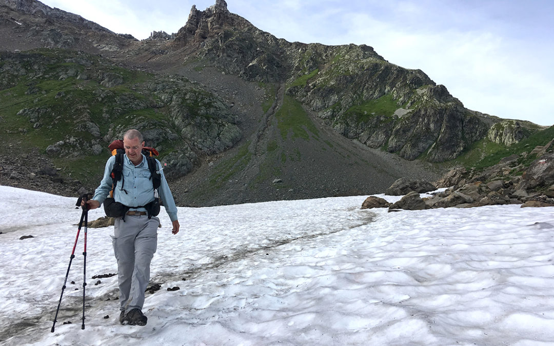
When I reached the snowfield, I was exited to be in the snow in the summer! The trail hardly touched the snow though, just after a few meters the trail went up on the right side. A bit further the trail diverged into two separate trails. I got a bit confused, but both trails ended just below the col.
First pass: Col du Bonhomme
The TMB was still very quiet at this hour: I only met a few other hikers until the Col du Bonhomme (2.329 m / 7,641 ft). I hoped to find a water source on the pass, but there was only a very small (closed) little shed and a big concrete waymarker. So I had to be very economic with the little water I had.
Col du Bonhomme
Looking back from the col I could see the two lakes that I left this morning, and even further to Les Contamines.
I did not stay very long at the pass, knowing I had to push on with 3 more passes ahead of me. The other side of the Col du Bonhomme was even more remote, and had an amazing view over the mountains.
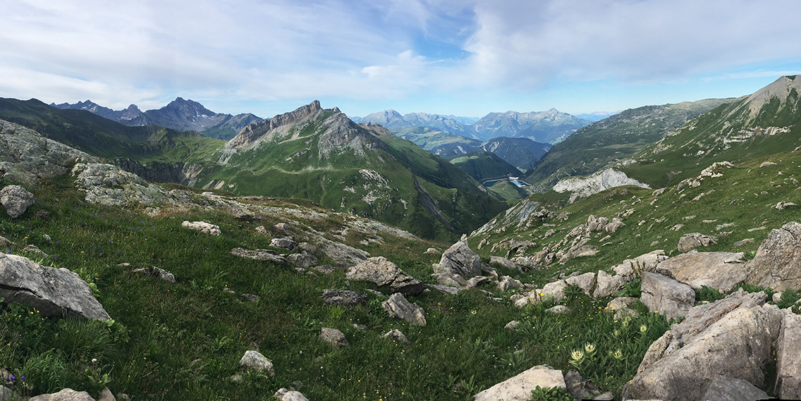
Second pass: Col de la Croix du Bonhomme
The TMB continued over a rocky trail and after an hour I reached the next mountain pass with the confusing name of Col de la Croix du Bonhomme (2.483 m / 8,146 ft). It was marked by one giant cairn. This pass had even more spectaculair views than the previous one.
A few minutes down the col I saw the refuge, and I was sure I could resupply my water there, so I slurped last water I had and walked down.
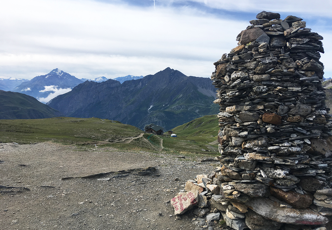
Col de la Croix du Bonhomme with the refuge
The refuge looked abandoned at this hour, except for a small fire that was burning in an oil drum in front of the building. I walked around the refuge until I found the wooden stairs up to a nice balcony with picnic tables, and the first rays of sun in one of the corners. I got my tent and quilt out of my pack, and let them dry on the railings. My tent still had ice crystals on the bottom!
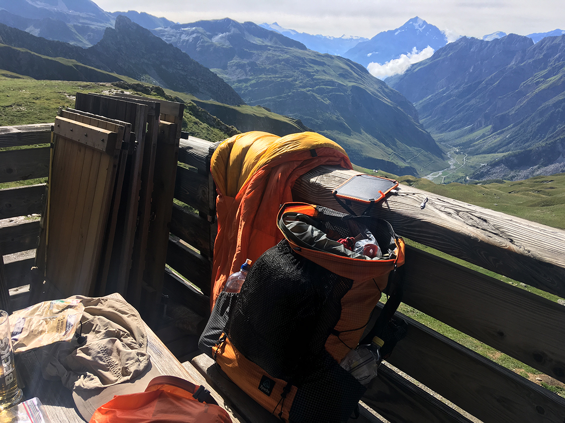
At the Refuge du Col de la Croix du Bonhomme
After two drinks (first hot chocolate, then apple juice), filling my water bottles and a talk to two other hikers, my tent and quilt were dry enough to pack. More and more hikers arrived at the hut now and it was time for me to move on.
From the Col de la Croix du Bonhomme there are two options: continue on the main TMB down to the village of Les Chapieux, or take the variant up another pass: Col des Fours, one of the highest points of the TMB. I chose the variant, skipping Les Chapieux completely and straight on towards Italy at Col de la Seigne.
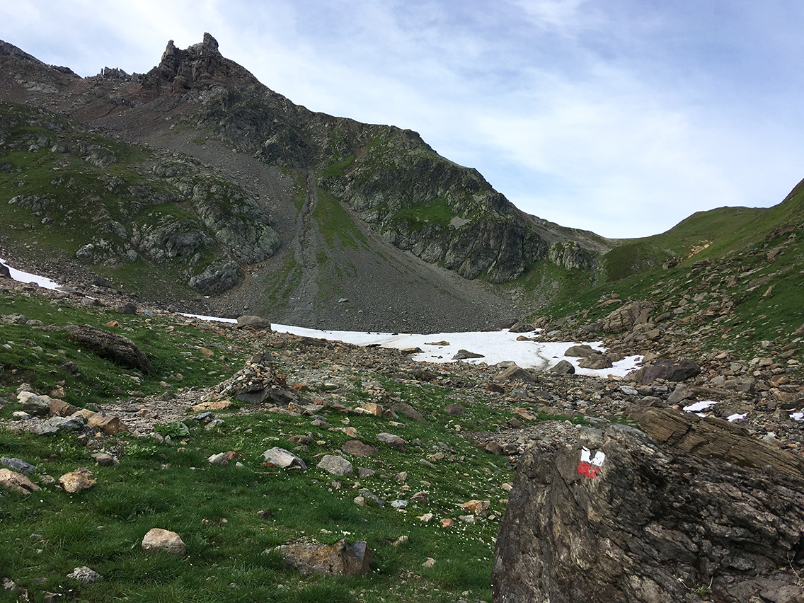
Third pass: Col des Fours
The trail up Col des Fours first meets with a giant electricity pylon, which makes the place otherworldly strange. Then the trail got quite rough, steep and rocky. In about half an hour I was on top of the pass: at 2.665 m (8,743 ft) one of the two highest point of the TMB. I would not say the col is very beautiful itself, it is mostly grey gravel and feels desolate. But the view was spectacular: it was here when I saw the top of the Mont Blanc for the first time.
Col des Fours with view of the Mont Blanc from the southwest.
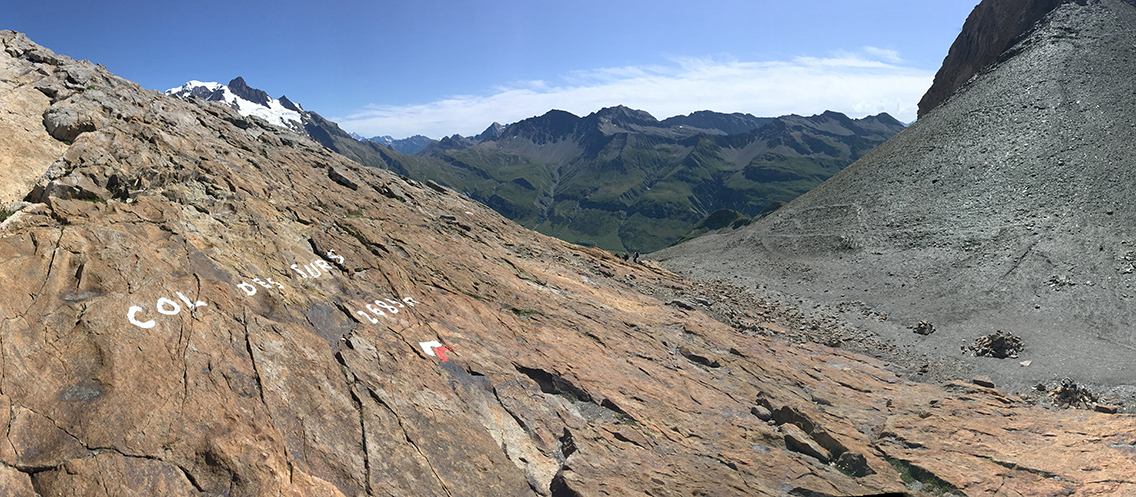
From the col there is a trail up to the mountain top Tête Nord des Fours that provides a 360 degree view. But after some scrambling I just couldn’t find the trail! I must have missed an obvious marker, because I saw many hikers on the mountain top. But after 15 minutes I gave up and started my long hike down the valley. But my scramble had taken me just 3 meters of elevation higher than the col, which put me on the absolute highest point on the trail at 2.669 m (8,756 ft).
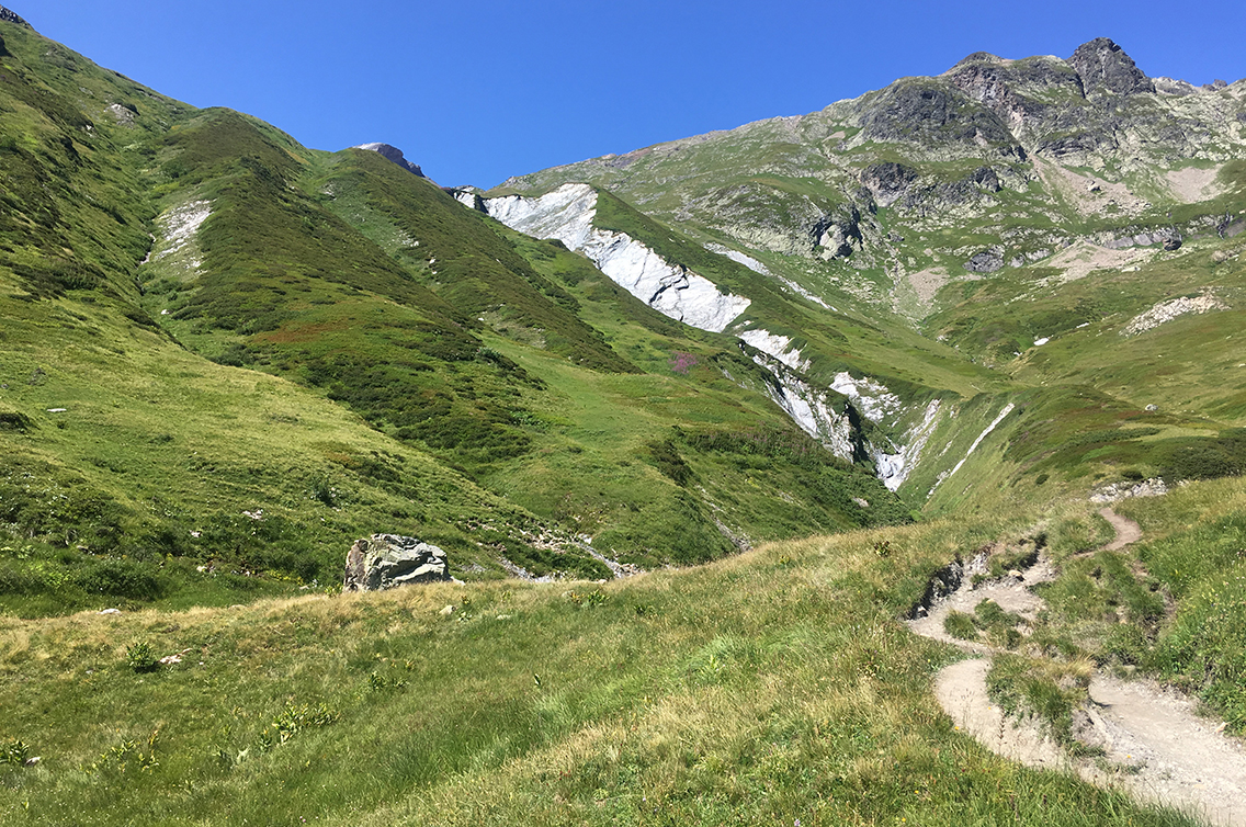
The trail going down from Col des Fours was a very steep gravel path, that reminded me of the trail up to Forester Pass from last years SEKI loop in California: a huge pile of rocks and gravel. After half an hour the trail changed to a grassy meadow though. A once big river – now a moderate stream – had cut its way through the silver-grey slate rock underneath, leaving a dramatic gash in the meadows.
Ville des Glaciers
The trail continued all the way down, passing the stream, a herd of cows – and the occasional hiker. This part of the trail was much, much quieter than the main TMB and I liked it that way.
It was 2 hours down from the col when I reached a gravel road at an abandoned house. I almost took a wrong turn here, as I automatically followed the gravel. Somehow I got an awkward feeling and I turned back after a minute. Most of the TMB is extremely well signed and until this point I believe I didn’t even once look at my map or Gaia-app. Thanks to the app I located myself and found the hardly visible trail through the dry grass: the last 15 minutes down to La Ville des Glaciers.
La Ville des Glaciers (1.789 m / 5,869 ft) is, contrary to its name, not a village. It is a farm (you can buy cheese there) with a parking lot. It is also the bus-stop for the small bus that connects with the village of Les Chapieux.
It had been quite hot coming down the pass, and I almost ran out of water again. Despite the public toilets at La Ville, there was no potable water. But it was nice to at least cool my head with the water.
Refuge des Mottets
From the parking, the path continues to the Refuge des Mottets. A handmade wooden sign at the parking suggested that it was only a 15 minutes walk. But even hiking quite fast on this rather level piece of the TMB, it took me half an hour to reach the refuge.
Along the trail another handmade sign said in big capital letters: NO CAMPING. Although some guidebooks and blogs suggest otherwise, camping on the TMB really is actively discouraged. I planned to spend the night on the other side of today’s last col, in Italy, but still the sign made me kind of grumpy.
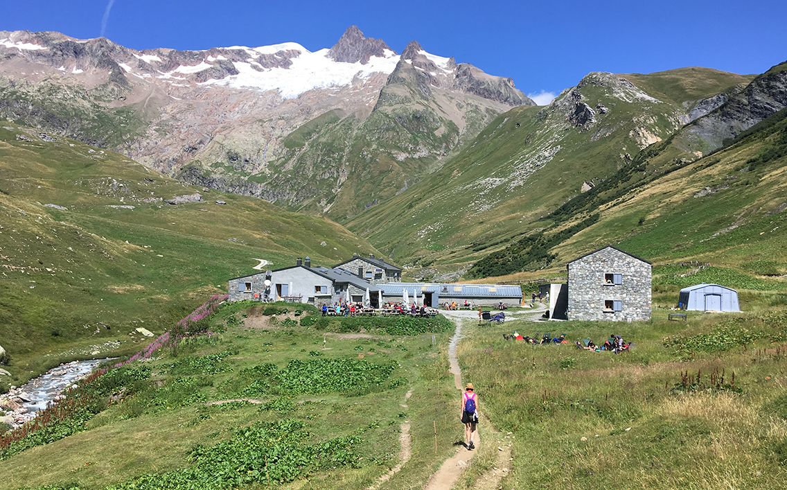
Refuge Les Mottets
At Les Mottets I filled up on fresh water and found a nice shady spot at the main building. I took off my shoes to cool my overheated feet and put on a pair of the plastic flip flops the refuge provides. I bought two cans of drinks and an apple inside the building and sat down with a 3-dimensional map of the entire Mont Blanc massif behind me. This is the kind of map I should have had before I started my trip!
I rested, drank and ate my apple and studied the map. There was no public toilet here, which was another thing that made me grumpy. It was almost 3 in the afternoon now, and I was tempted to abandon my plan and try to stay at the hut (and get acces to the toilet and showers). But I stuck to my plan to push on to the other side of Col de la Seigne.
Fourth pass: Col de la Seigne
Behind Les Mottets I saw a small French-Italian-American memorial of an aircraft accident in 1946. From there the TMB continued up the hill, quite steep for the first half hour. It was hot at these lower elevations, but as soon as I got higher, it cooled down a bit, especially when the wind started blowing. I still had a long way to go to the pass, and this one being nr. 4 today, I started to get tired.
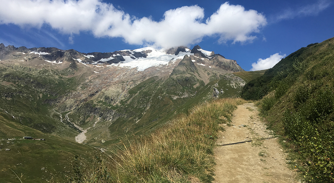
The trail was virtualy empty now, due to the late hour I suppose. I only met one trail runner that passed me just when I had a short break drinking my rehydration lemonade. Although tired, I enjoyed the emptiness, silence and the magnificent views all the way back to the Col des Fours.
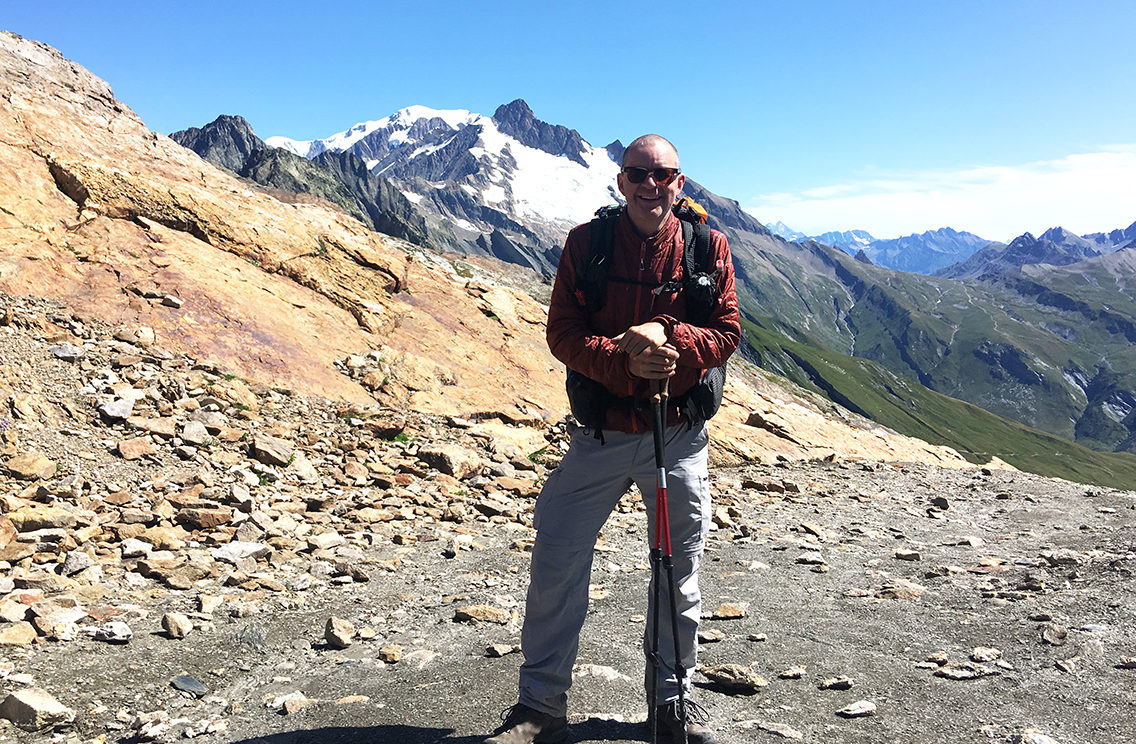
Col de la Seigne at 2.516 m (8,255 ft) with the distinctive snowy cap of Tré la Tête behind me.
It was 4:30 in the afternoon when I finally reached the Col de la Seigne, about 2 hours after I left Les Mottets and more than 8 hours since I started today’s hike. It seemed ages ago since I left the lakes this morning!
The trail running man was still on the pass, taking the same pictures that I would make minutes later. I asked him if he would take a photograph of me on the pass, and somehow between taking the photo and walking down a few minutes later, I must have lost my hat. The wind was blowing fiercely, my hat probably blew away into Italy before I set foot over the official border.
La Casermetta
While loosing your hat is nothing to be bothered by in daily life, being on the trail, with the menacing rays of sun upon me, I did worry about it. I knew it would take at least another day before I could buy a new hat in Courmayeur. In the mean time, I improvised with my buff as protection.
Going down the trail into Italy now, a small building appeared. It could not be the next Refugio Elisabetta, it was way too soon for that. Getting closer I saw some hikers sitting on the stone bench on the sunny west side of the building, but I did not see any sign that this could be a hut or café. When I got to the building it turned out to be a small museum. Inside, a man was closing things up: it was already 5 in the afternoon.
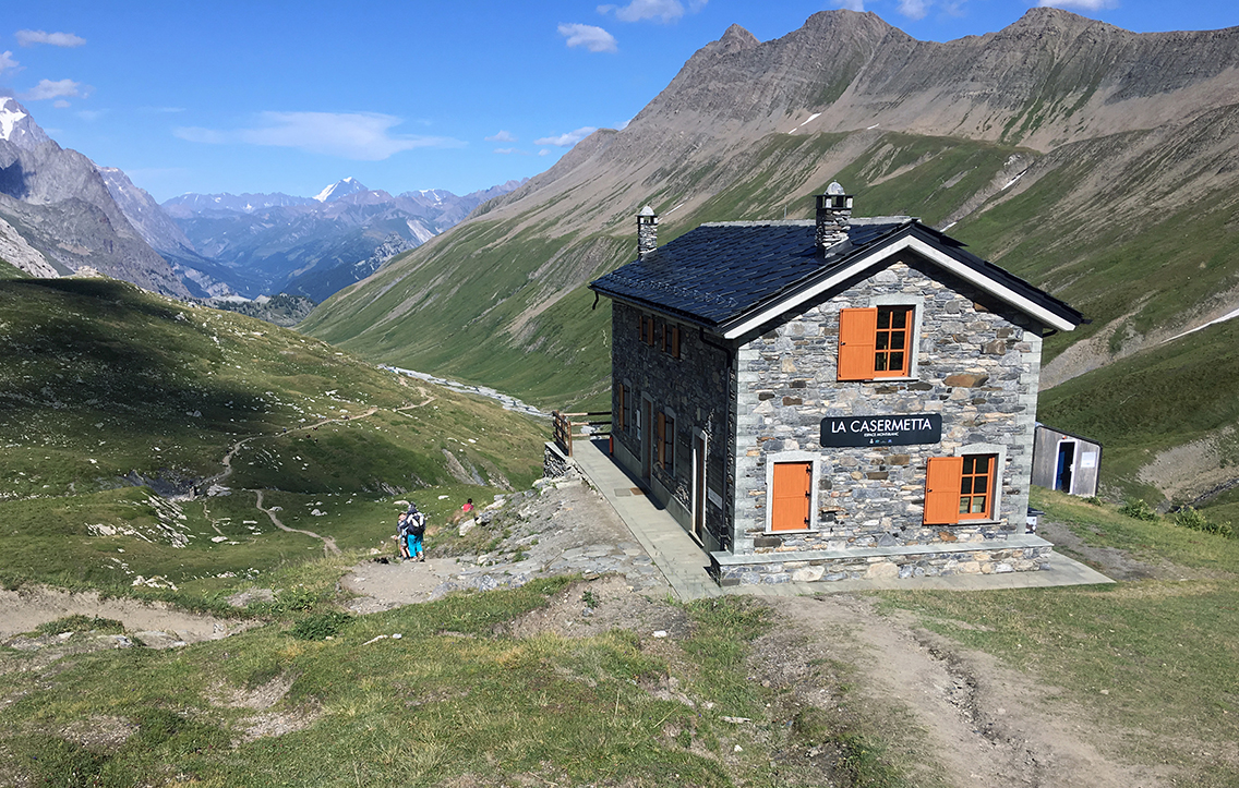
Since I almost completely drank the 2 liters of water from Les Mottets, I was in dire need of a water refill. The man in the museum was very kind and let me fill up in the small bathroom. In the museum I took a look at the beautiful scale model of the Mont Blanc massif, and we started chatting about the TMB and a possibility for camping. He showed me the NO CAMPING below 2500 m sign, but suggested ‘off-record’ that he would not mind if I put up my tent right next to the museum.
In the meantime, from the Italian side of the pass, a group of three other hikers came up, looking for a camping spot: Zahara, Miri and Lea from Israël. As the museum man was getting ready to go home (running down for an hour to his car!), we discussed what would be the best spot to put up our tents.
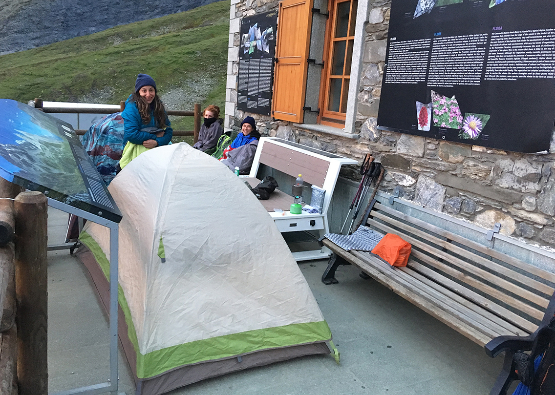
The only spot out of the fierce and cold wind was on the east side of the small building, where there was a small balcony (note: there was a power socket and Wifi here, so everyone started messaging home!). It was impossible to set up my Zpacks tent on the flat concrete though. But I was lucky that Miri offered me to use her tent, which did not need stakes. The girls wanted to share one tent anyway, to keep warm (they forgot to pack warm clothing).
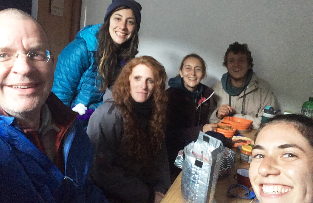
Soon two Belgian hikers joined us: mother and son Suzy and Jelle, who discovered the tiny shelter on the side of the museum with a table and a bench. They would use it as their place for the night, but not before we all had our dinners inside. So we had a cozy evening packed in that little shelter – what a good end to a long hiking day!
> Next: Day 4, Col de la Seigne – Tronchey
< Previous: Day 2, Les Contamines – Les Lacs Jovet
Very nice Pieter how you describe your TMB.
We indeed had a lovely ‘night at the museum’.
Sweet memories from an awesome trail!
Suzy
Hi Suzy, thanks! You will feature in Day 4 as well, of course!