
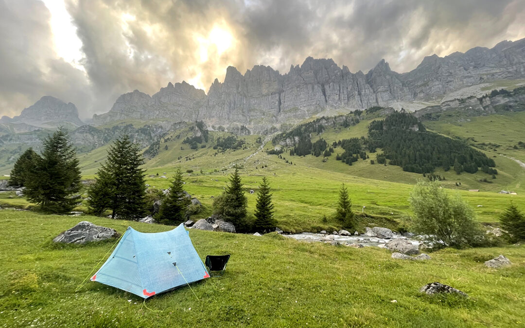
On the second part of the Via Alpina 1 the mountains were higher, the passes more spectacular and many beautiful alpine lakes made day 4 to 7 absolutely splendid. I did ‘cheat’ on this part though, by using a cable car twice to get me out of a hot valley.
The Swiss Via Alpina, part 2 (day 4–7): Rossmättli – Tannensee
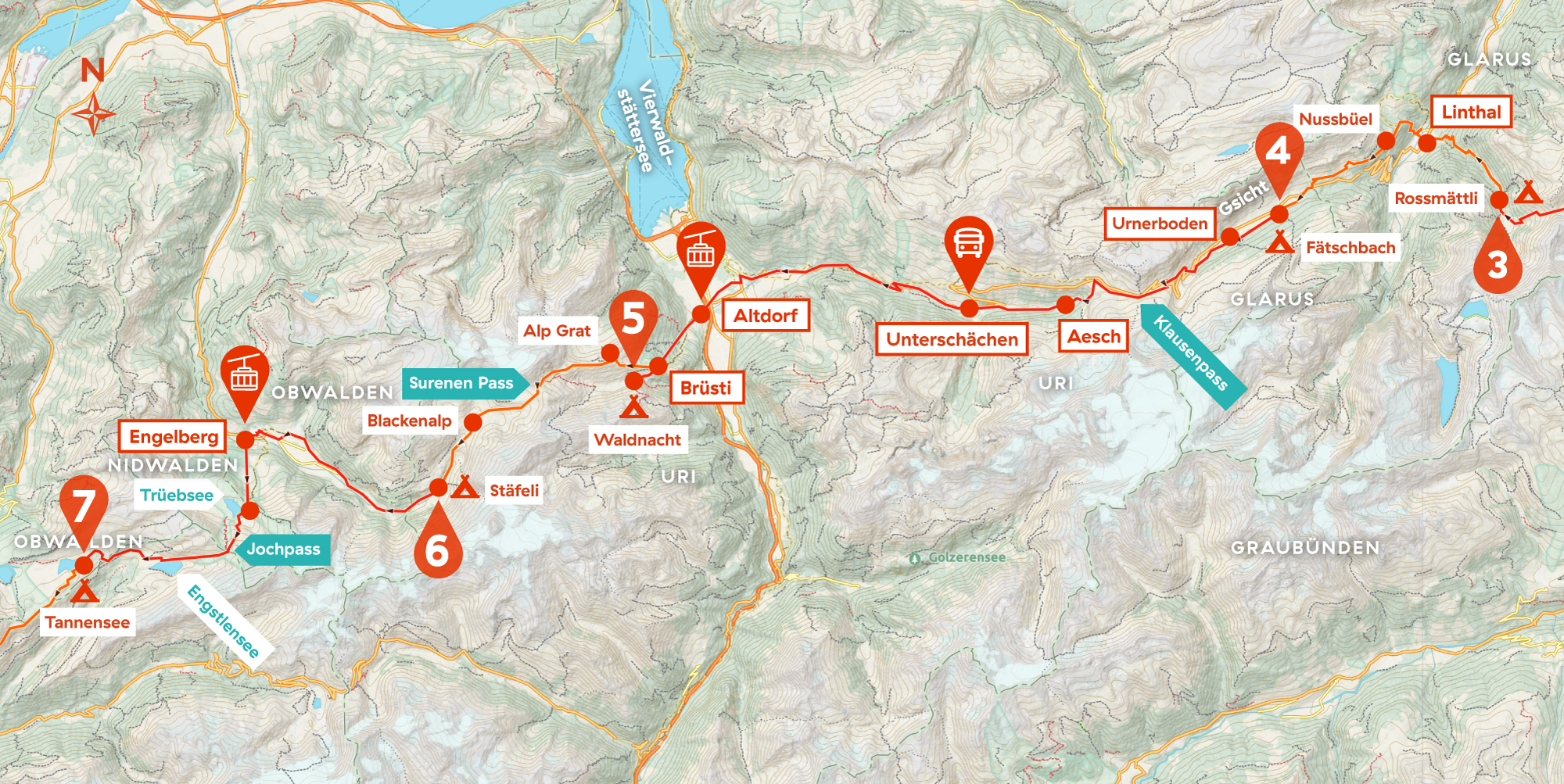
Day 4:Rossmättli – Fätschbach
Start: Rossmättli, 1.381 m (4,530 ft)
End: Fätschbach, 1.342 m (4,403 ft)
Distance: 18,6 km (11.6 miles)
Elevation gain: 862 m (2,828 ft)
Elevation loss: 889 m (2,917 ft)
Highest point: above Friteren, 1.477 m (4,846 ft)Time: 5:45 hrs moving time, 8:45 hrs total time
Date: August 14, 2025
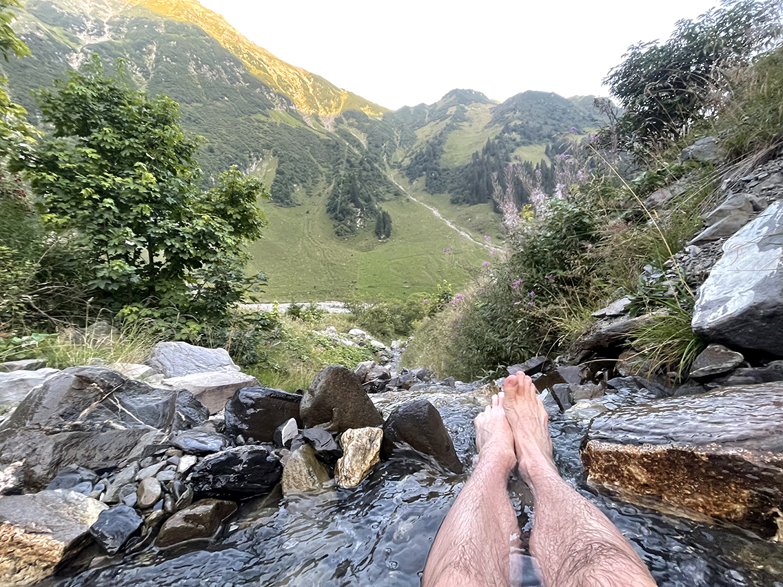
Waking up at the bivouac spot behind the bunker at Rossmättli, I noticed my tent was completely dry. This was quite unique, given the surroundings full of wet grass and a river nearby. I had slept well, and getting up at 7 a.m. felt like sleeping in. I walked back to yesterday’s waterfall near the Unterstafel farm for an ice-cold morning bath with a view.
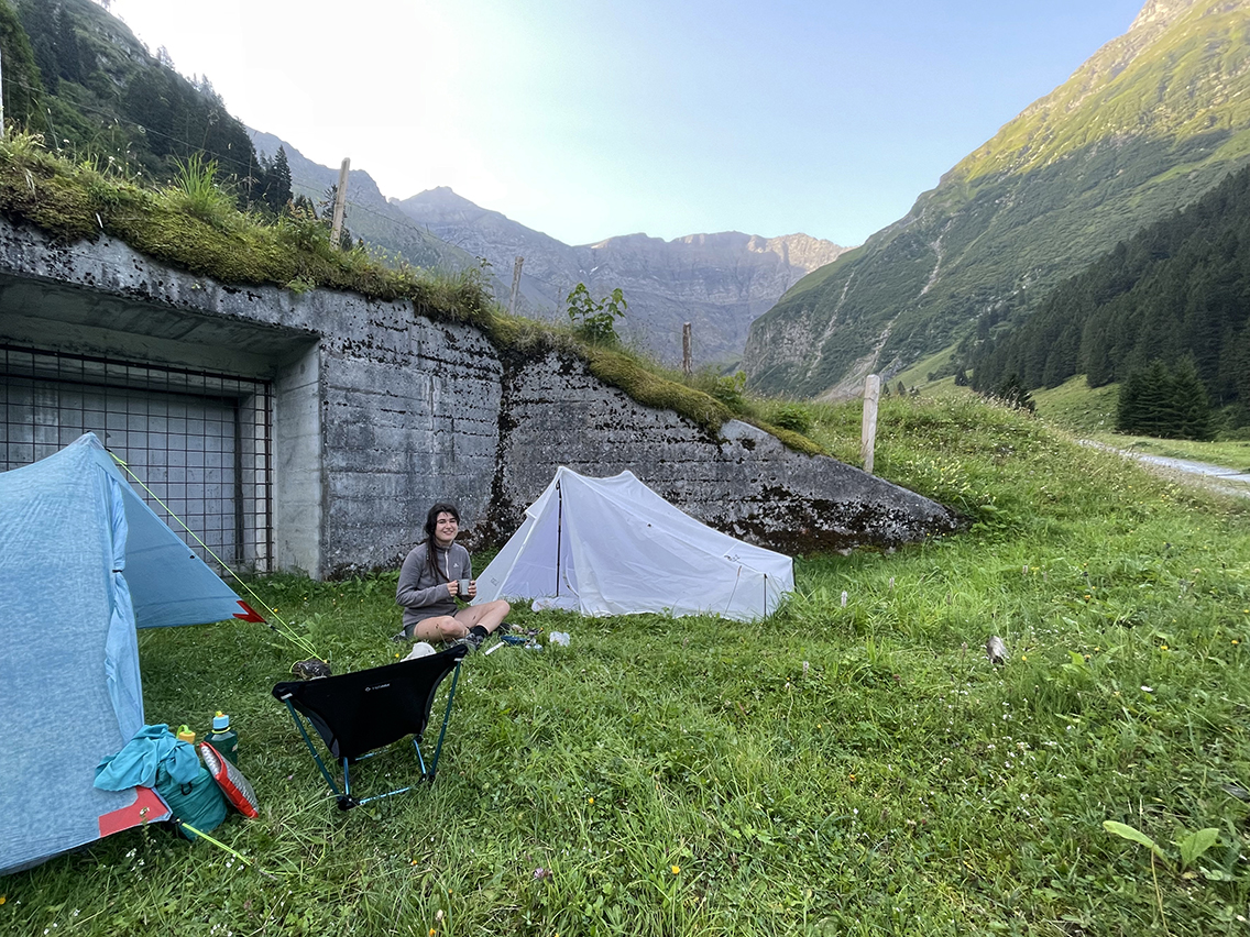
Upon returning, Sita was also awake. After a short breakfast we decided to leave this bunker entrance and move on to the next village together.
We descended in an hour and a half to Linthal, an otherwise insignificant yet well-maintained village, but for us it had the local Volg supermarket as a unique selling point.
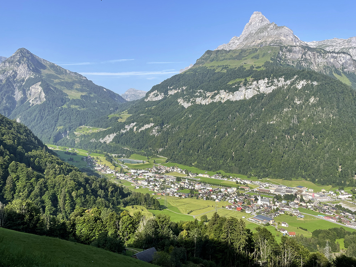
View of Linthal
Sita went looking for ‘protein’ and I searched for yogurt, which actually amounted to the same thing. We ate it, along with some fruit, in the shade of a nearby apple tree. That shade was much needed, as the air in the valley was scorching hot, even this early in the morning.
We decided to cut off a significant portion of the route from the Volg, which seemed like a smart move at the time. It avoided an entire detour on the official VA1 to the village Braunwald. The shortcut however turned out to be a steep (and I mean STEEP) trail winding uphill through a humid, hot pine forest. We each struggled on this shortcut individually.
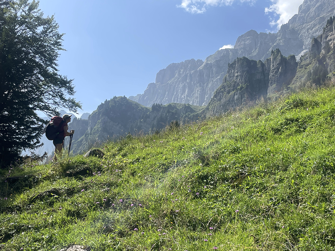
View of the Gsicht mountain range, Urnerboden
The shortcut took us two hours, which saved us an hour, but also meant we had to climb the most strenuous part of the trail so far. From that day on, I decided to use the cable car whenever leaving low-lying villages to cover the first few hundred meters of elevation gain.
At the top of the Fätsch Valley, the path changed into a normal hiking trail, just like you’d expect in the Alps: green meadows, mountain views, a light breeze, and an Alpine restaurant (Nussbüel) to order a bottle of Möhl apple cider.
A long, sometimes tedious, descent followed towards the valley. There wasn’t much special to see, except when we stumbled upon a water source . It was a cow trough with fresh, cold water which we used to cool our feet in. Cooled down, we were ready to tackle the final descent to Urnerboden.
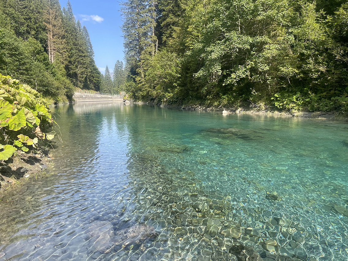
The river Fätschbach
Below in the valley, the Fätschbach river awaited, bending wide to create an azure-blue swimming lake. Sure, the water was about zero degrees, but after such a hot day there seemed to be no better idea than to slowly let myself be submerged in this blue oasis.
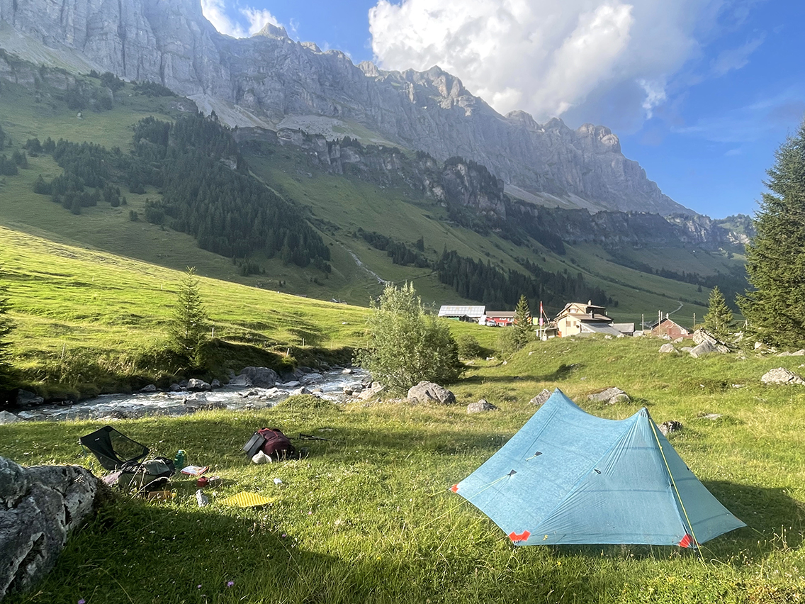
Bivouac at the Fätschbach river with the Gsicht mountain range
It was still an hour hiking to the village, but suddenly we were walking along the river, the bank of which turned out to be one big camper and picnic area. Sita called me to a halt – why weren’t we pitching our tent here, next to the river? And indeed (as would become clear the next day): there was no better site than this! So we called it a day and each searched for a flat spot without too many thistles.
I fell asleep after reading thirty pages of my book with the sound of the river in my ears.
Day 5:Fätschbach – Waldnacht
Start: Fätschbach, 1.489 m (4,885 ft)
End: Waldnacht, 1.368 m (4,488 ft)
Distance: 26,1 km (16.2 miles) + 7 km (4.3 mi) bus + 3 km (1.9 mi) cable car (Seilbahn)
Elevation gain: 1.783 m (5,850 ft)
Elevation loss: 1.734 m (5,690 ft)
Highest point: Klausenpas 1.952 m (6,405 ft)Time: 6:40 hrs moving time (incl. bus + Seilbahn), 9:25 hrs total time
Date: August 15, 2025
A long, strenuous day was on the agenda for today. Consequently, I was fully packed by around seven-thirty, ready to go. I said goodbye to Sita, who was staying for the rest of the day to ‘chill and socialize with people in the campers.’
I found it remarkable that we as complete strangers and totally different people, had spent such nice days together on the trail.
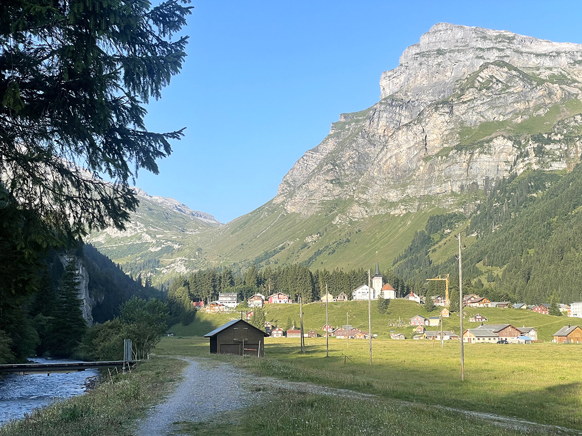
View of Urnerboden
After walking for half an hour along the river, I found everything I needed for this morning in Urnerboden: fruit, a croissant, yogurt; a toilet; a water pump. There was no sign of a potential camping site here: the one spot I had intended to visit yesterday was marked by a large red sign with a tent and a camper van crossed out, screaming NO CAMPING.
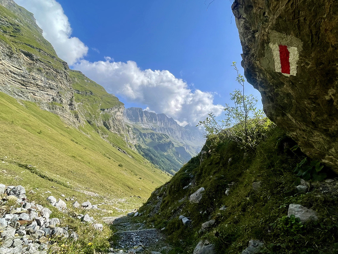
Ascend to the Klausenpass
I walked leisurely along the river and later, repeatedly crossing the road, up through the alpine meadows until I started gaining considerable altitude. After a few hours, I arrived at a collection of small houses and huts called Vorfrutt. Besides lots of cows, battered vehicles and small children on a farmer’s wife’s arm, I spotted a green Möhl parasol!
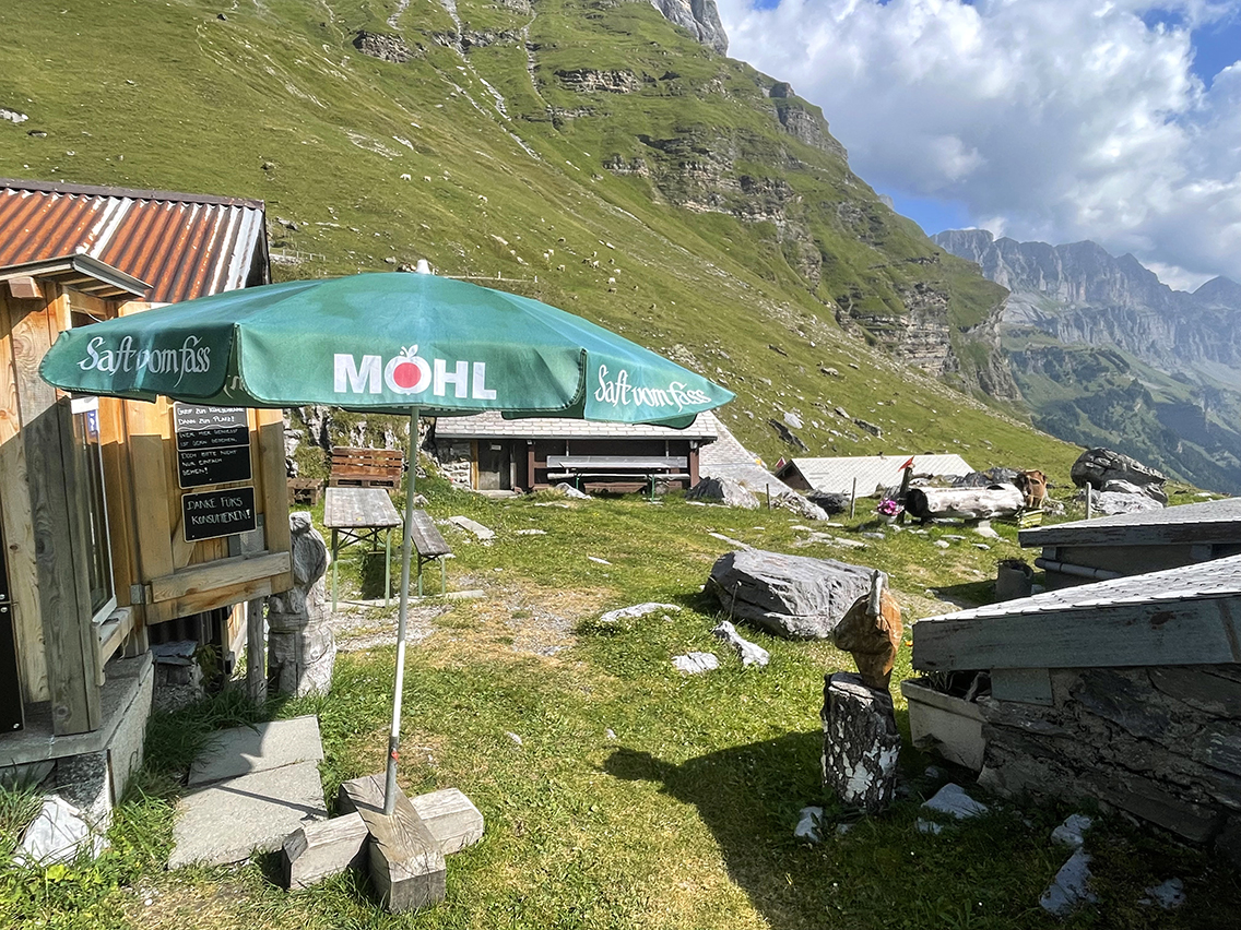
Vorfrutt
The parasol was standing next to a self-service fridge with my beloved apple cider and delicious Alpine yogurt. Note: at these kind of micro-shops you always pay in cash, I was happy thatI brought enough of that. Although there was a picnic table available, I preferred to sit in the shade of an old shed.
After this short break I felt enough energy to continue on to the Klausen Pass.
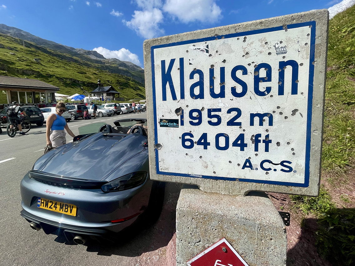
Klausenpass
I reached the Klausenpass at 11 am. It turned out to be packed with expensive cars and motorcycles. The pass was more of a very high parking lot than a mountain pass. There was, by contrast, a small chapel where a local women’s choir sang Swiss religious songs. Later this day I would learn it was the Feast of the Assumption of Mary.
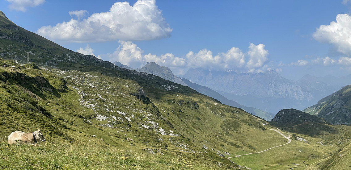
View west from Klausenpass
I hiked down the other side of the pass, passing some cows and moving away from the cars. After walking for half an hour I found a magnificent double waterfall some 50 meters below the trail. I climbed down through a steep meadow and once at the waterfall I stepped under the 3-meter-high waterfall, which massaged my shoulders like a professional wrestler.
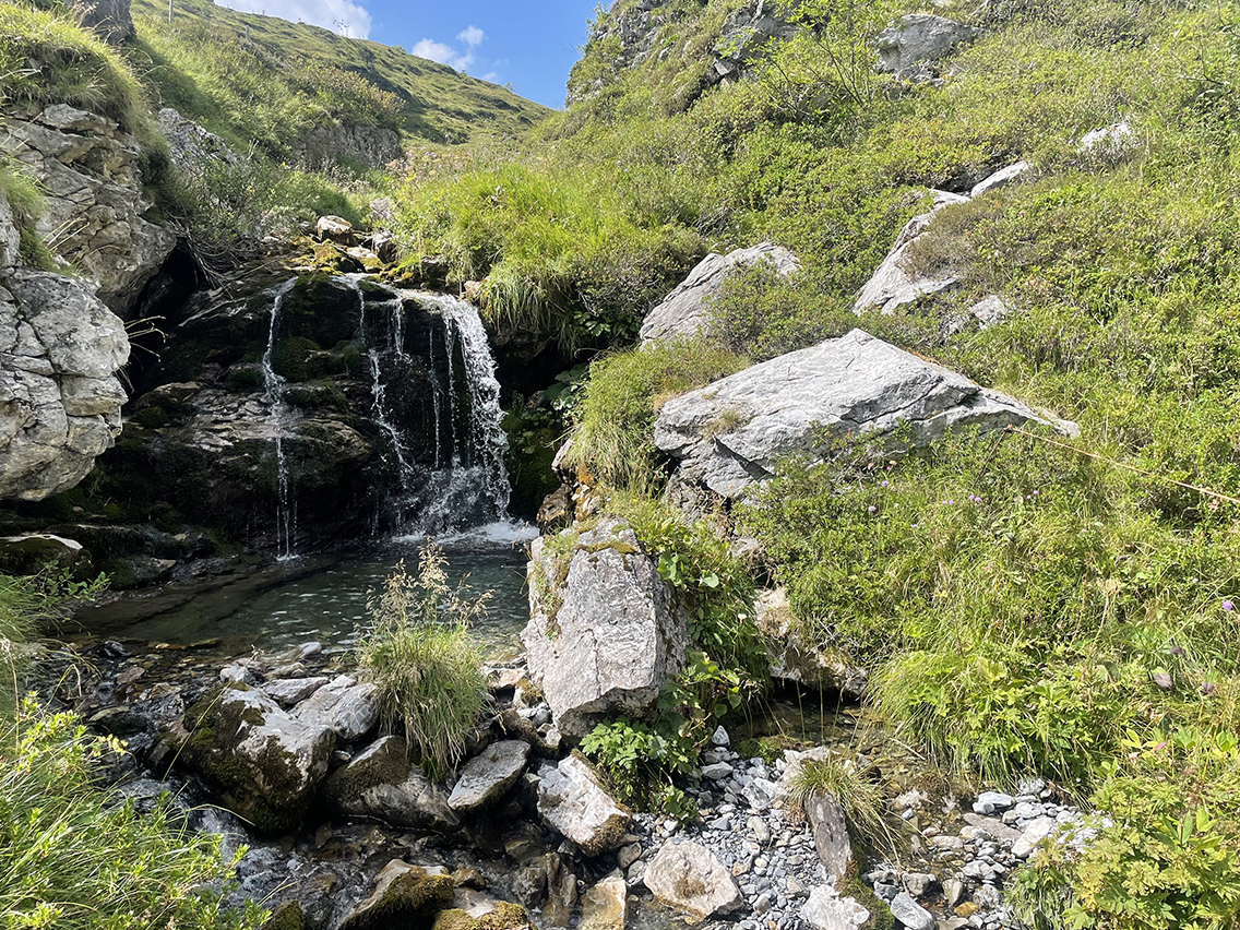
Hidden 3 m / 10 ft waterfall below the Klausenpass
I considered staying at this fabulous spot for a bivouac. It was a perfect spot, fit for one small tent – but it was way too early in the day, not even noon.
Hiking further for 20 minutes, I reached the hairpin bend in the motorway where the main Via Alpina continues north of the road. A variant trail started south-east from here, plunging into the Aesch valley.
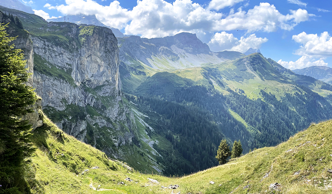
View from the trail above Aesch
I had already planned to follow this variant of the Via Alpina, because I had seen pictures of a marvelous waterfall along the route. I turned left into a spectacular descent to Aesch. The descent was precipitous, protected with wooden fences. From far away the Stäubenfall was already visible: a thundering stream faling down above the tiny village.
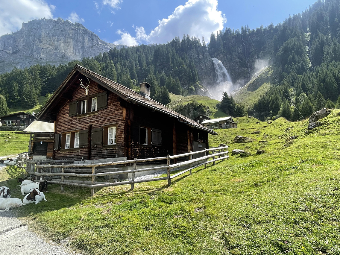
Village of Aesch with Staubenfall in the background
The closer I got, the more stunning the waterfall became. It was huge, dominating the entire valley. Many tourists had made the one hour walk from the other direction to visit. The little restaurant was closed – a bummer: it was 1 pm by now and I would have liked a wholesome break. It was closed because of the Feast of the Assumption of Mary, a holiday that is apparently taken very seriously here.
I continued on a straightforward white dusty road to the village of Unterschächen.
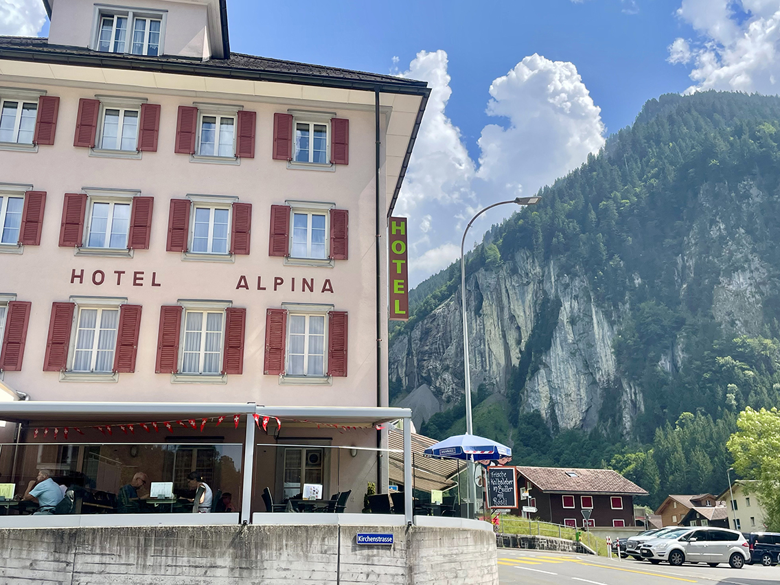
The hour-long path took me to the sweltering Unterschächen. I was lucky to find Hotel Alpina open. I set down in the shade and ordered a large plate of fries. This was my first restaurant meal so far on the Via Alpina. My Cicerone trail guide recommended to take the bus to Altdorf from here, because the official hiking trail follows virtually the same route as the bus. Riding the bus for 30 minutes spared me two hours of hot asphalt hiking.
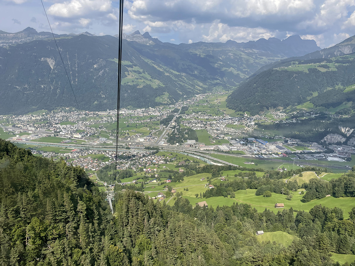
View from the Seilbahn (cable car) from Altdorf to Brüsti
In Altdorf, I tried to find a supermarket, but even the giant Migros was closed today. So I walked another half hour through the city to the cable car station. There I took the cable car to Brüsti, keeping the promise I made to myself yesterday. I was more than happy to leave the hot and busy valley.
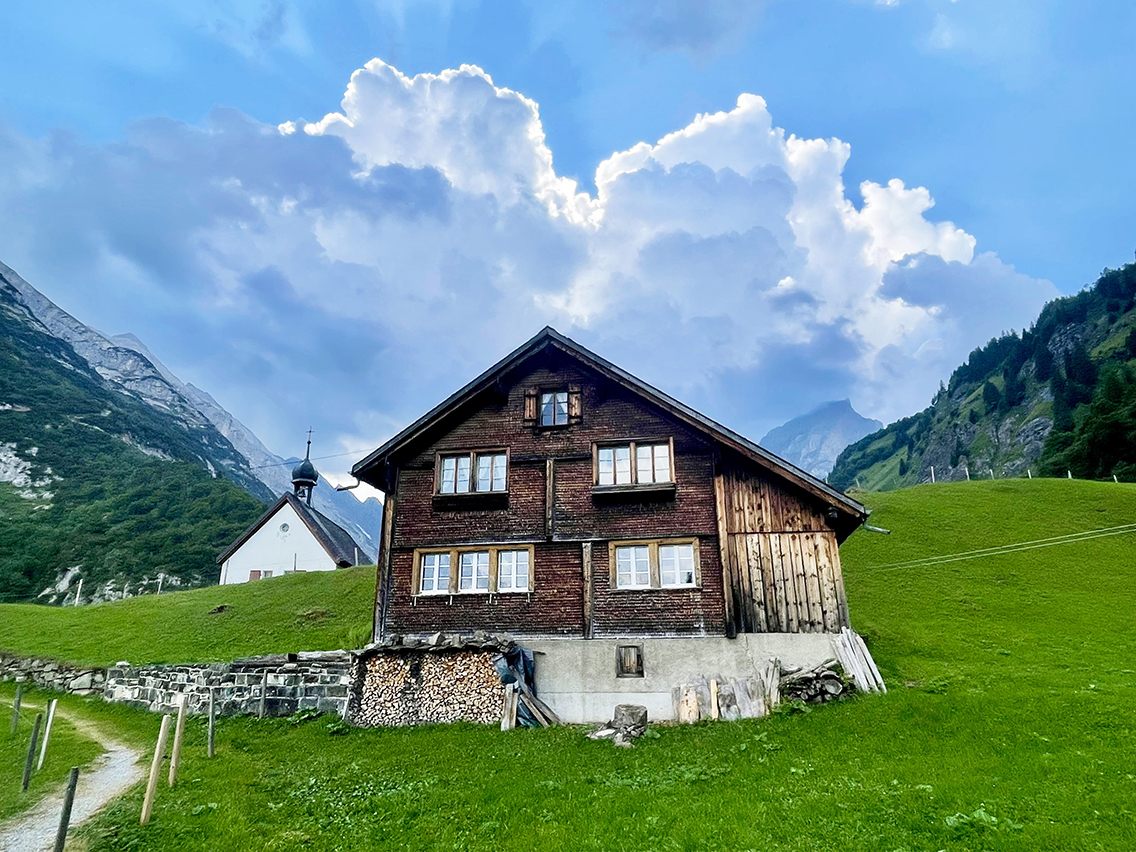
Off-route, and a fifteen-minute descent from the Brüsti cable car station, I hiked to an amazing spot by a small river, near a lake called Waldnacht Seeli. Regrettably, swimming in the lake was prohibited and also made impossible by a fence. It was not a natural lake, but the river that flowed into it was. I followed this river a bit further to a spot with picnic tables and a fireplace.
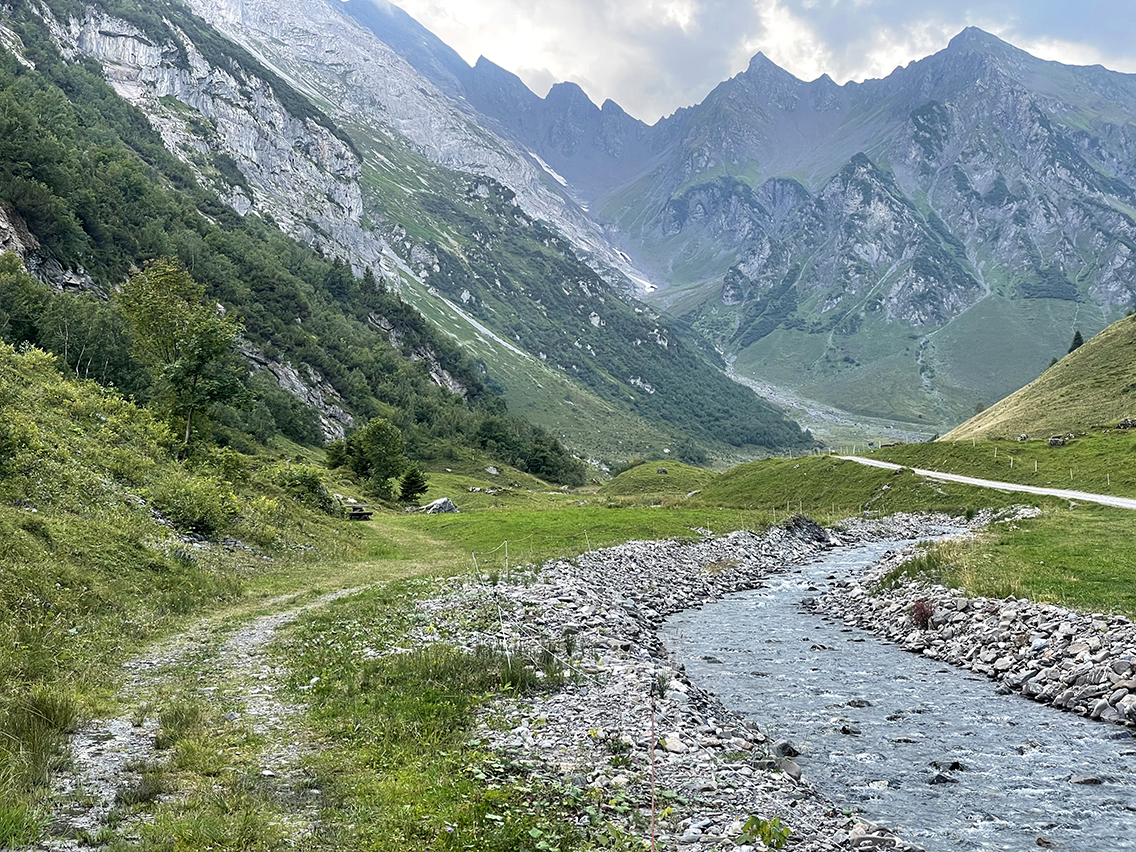
The nameless stream to the Waldnacht Seeli
The short detour to this spot was totally worth it. A quiet and beautiful view all for myself. After eating one of my home-dried meals, I read another portion of my book. The river was once again my water tap, bath, and background music that evening.
Day 6:Waldnacht – Stäfeli
Start: Waldnacht, 1.368 m (4,488 ft)
End: Wild camp at Stierenbach, 1.410 m (4,481 ft) near Stäfeli farm
Distance: 13,7 km (8.5 miles)
Elevation gain: 888 m (2,913 ft)
Elevation loss: 854 m (2,800 ft)
Highest point: Surenenpas, 2.292 m (7,520 ft)Time: 4:45 hrs moving time, 6:50 hrs total time
Date: August 16, 2025
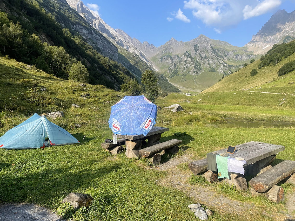
Waldnacht picnic spot and fireplace
The next morning started with a dip in the ice-cold river under the warm sun. While my tent dried from the rainfall last night, I made breakfast under a parasol. Yes, the parasol was included along with the firewood that I didn’t use yesterday night because of said rainfall.
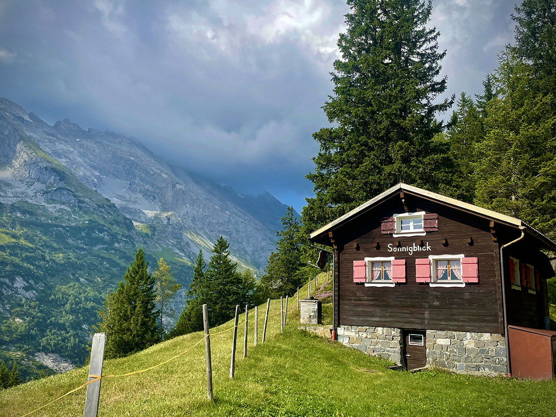
A chalet above Brüsti
I walked back the short distance to the Brusti cable car station, to connect with the Via Alpina again. A beautiful hike began. From this day on the trail, the mountains were truly ‘Switzerland-high’ again and the spectacular views countless. Although it was already starting to get quite cloudy, a little Swiss chalet claimed otherwise as it was named Sonnigblick (Sunny View).
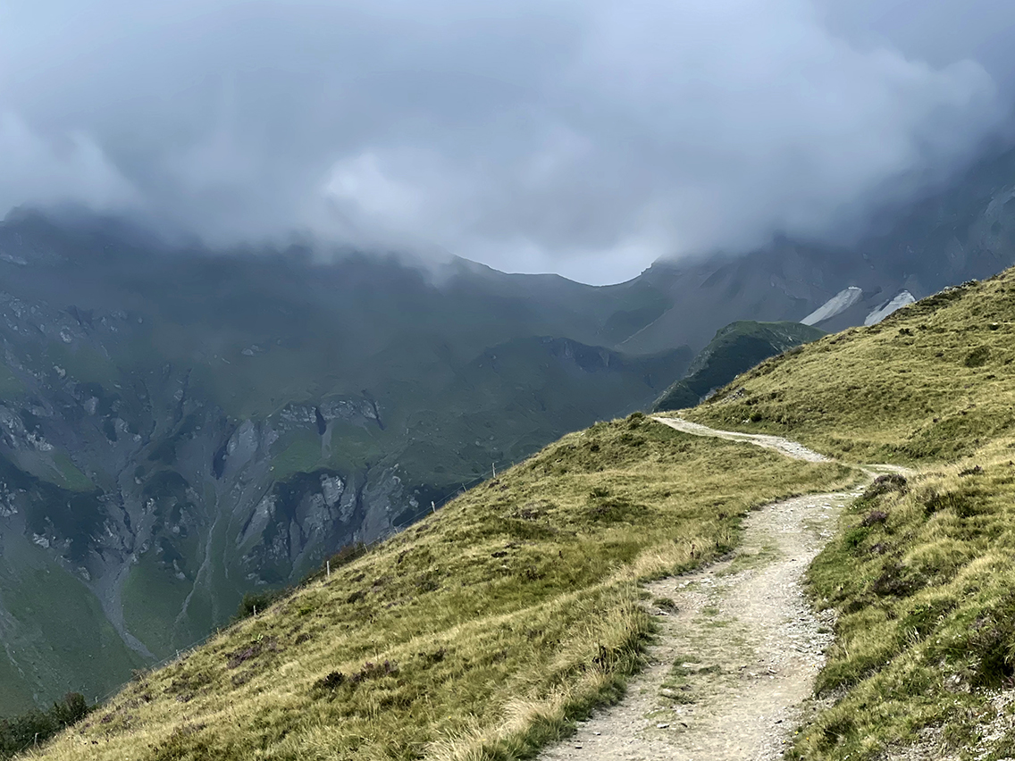
View of the Surenenpass in the distance
Over and along a mountain ridge, I headed towards the highest pass so far (Surenenpass 2.291 m / 7,520 ft).
But first, a stop at the cheese farm and hut Alp Grat, where I devoured a “strawberry milkshake” and fruit cake. The milkshake was literally a large glass of fresh milk mixed with strawberries. Delicious.
The continuation towards the pass, which was already visible in the distance, became increasingly misty. It gave the trek a wonderfully mysterious atmosphere.
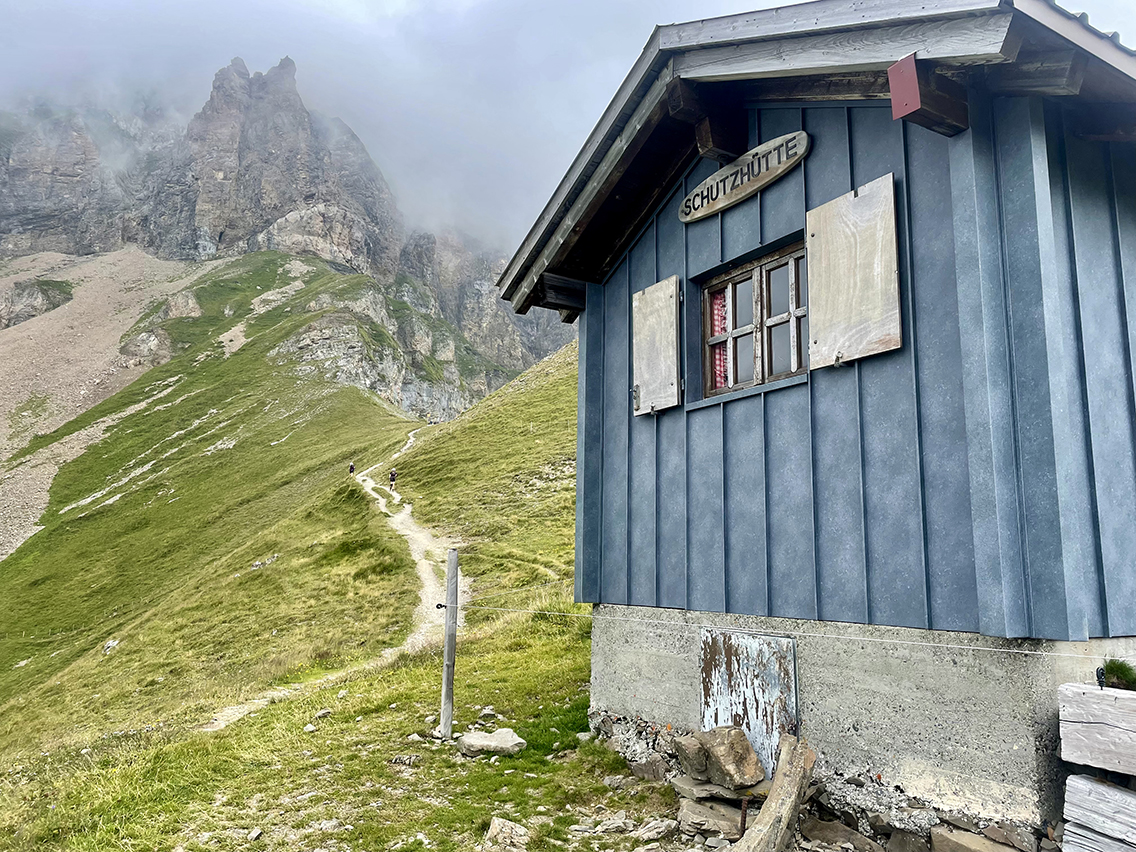
The blue Schutzhütte below the Surenenpass
Just below the pass, the sun appeared, allowing me to enjoy a magnificent view once I reached the pass. With my shoes and socks off and my feet in the grass I lied down . It had been a long time since I had lain looking at the floating clouds like that.
Just below the pass was a blue Schutzhütte, a tiny little house with a sofa bed (wooden plank) and a table. I used it to easily prepare a hot lunch (pasta with cheese).
Until a group of at least 10 people crammed themselves into the little house. I don’t know the hut etiquette exactly, but I was somewhat surprised to suddenly find myself surrounded by a large group of over-60s led by a Swiss man in a yellow T-shirt with a loud voice.
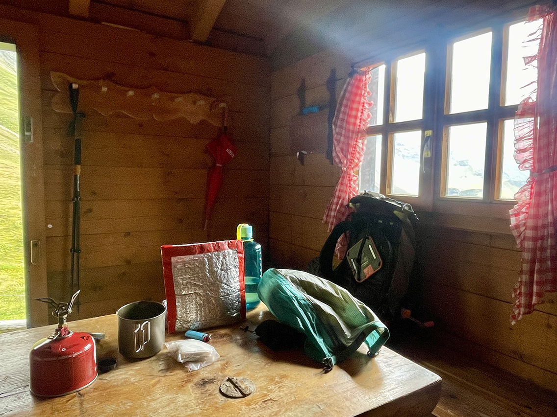
Inside the Surenenpass Schutzhütte
I left the little hut a bit flabbergasted ad continued my descent. After an hour, I arrived at Blackenalp, where a small group of old-fashioned Swiss cowherds were discussing the day. With their white or red beards, hunting hats, large clogs, and pipes and cigarettes they sat talking incomprehensible Schwytzer-Deutsch.
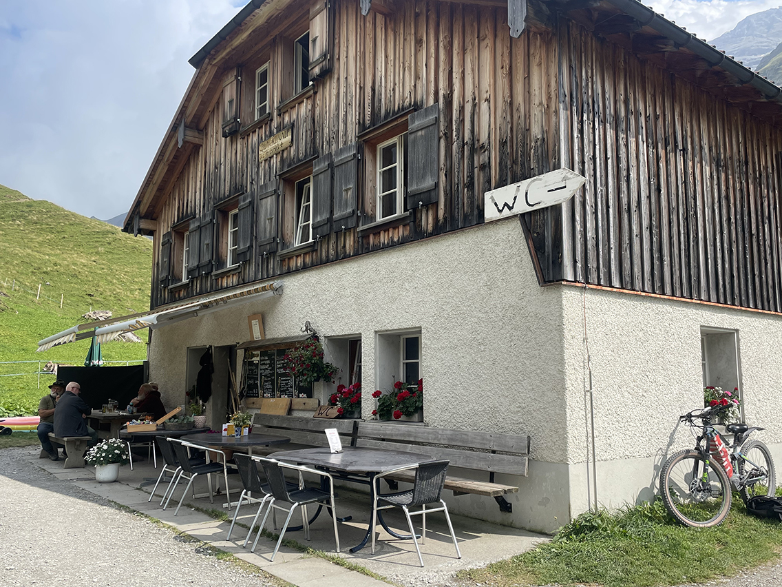
The Blackenalp Hut
A glass of Möhl later, I descended with the plan to sleep at the Stäfeli farm. However, five hundred meters before this cheese farm, I saw an irresistible bivouac spot. Next to the rumbling river Stierenbach* behind a large boulder, kept out of sight from the farm by a tall pine tree.
*Note: LIterally: Bulls brook. Everything in this canton of Uri revolves around cows and bulls. You see that reflected in the yellow flag, and everywhere around you. And beneath you, in the form of cow pats scattered on the path like piles of discarded LPs.
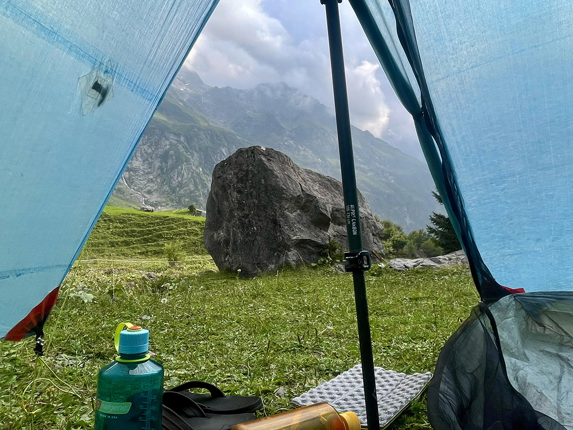
Stierenbach bivouac
It was still early; I started writing some notes and nibbling on nuts, until around six o’clock when a few drops fell.
I took shelter in my ZPacks Duplex and I didn’t get out of yhe tent after that. The rain turned into a heavy thunderstorm when the night fell. And somewhere in the dark night, right above my nose, water was dripping on my face. It took some time before I realized my tent was leaking. While the thunder was still roaring, I fixed the leak with red duct tape and got a good night’s sleep after all.
Day 7: Stäfeli – Tannensee
Start: Stäfeli, 1.410 m (4,481 ft)
End: Tannesee, 1.983 m (6,506 ft)
Distance: 24,4 km (15.2 miles)
Elevation gain: 1.431 m (4,695 ft)
Elevation loss: 868 m (2,848 ft)
Highest point: Jochpass, 2.220 m (7,283 ft)Time: 6 hrs moving time, 9:25 hrs total time
Date: August 17, 2025
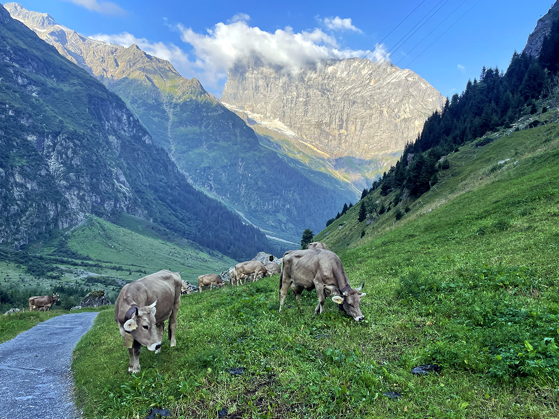
At the start of the seventh hiking day, I immediately found myself in a procession of cows on my way to the high meadows. The last Urner cows (e.g., from the canton of Uri), because I soon crossed the border into Obwalden. The ‘wanderweg’ stickers change with each canton. Now the coat of arms of Obwalden was visible: just like keys of my former hometown Leiden.
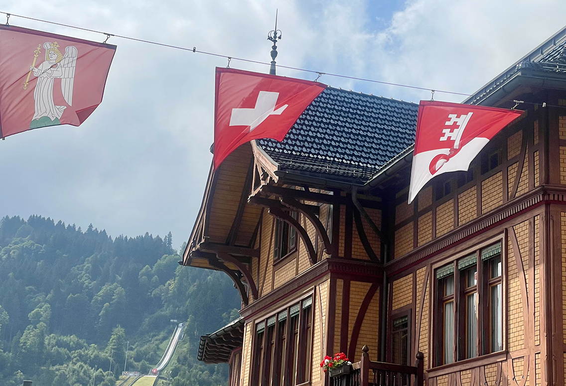
The village of Engelberg with the flags of Engelberg, Switzerland and Obwalden
I took a substantial break in Engelberg (food, drinks) before taking another cable car up to 796 meters higher, to the lake Trübsee.
Once I was going up with the cable car, huge clouds had formed above and everything was shrouded in a thick mist. The usually beautiful blue lake was invisible, and at closer inspection, half empty! Fortunately, there was still an advertising photo next to it.
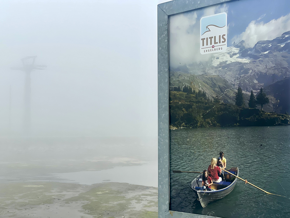
Trübsee
But there was no shortage of lakes on this day! On the other side of the pass, two more azure blue ones would follow. But first I had to climb to the pass: the Jochpass (2,207 m high). I hiked the last 413 vertical meters myself again, while most people just took the second cable car.
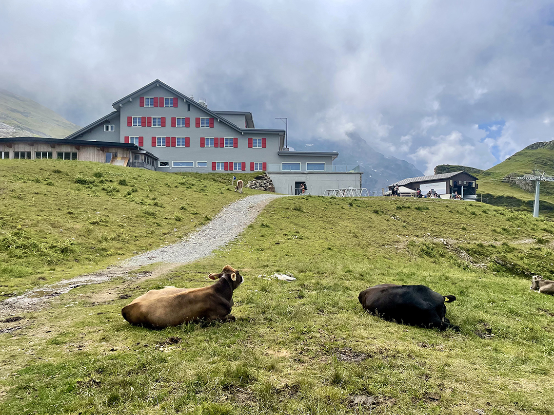
Bärghuis Jochpass at 2.220 m (7,283 ft).
An hour later I arrived in the hut on the pass. It is the kind of hut you expect on top of a ski slope, with many tables and comfortable chairs and benches. I charged my phone, power bank and myself with a plate of French fries with mayo and two glasses of Cola. I took my time and did some reading and journaling.
Descending from the pass more than an hour later I reached a saddle behind which two paradisiacal lakes appeared. The Engstlensee and further up the Tannesee, my destination for today.
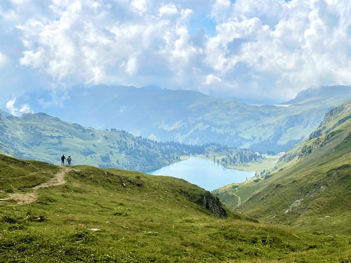
Engstlensee and Tannesee higher above on the right
The descent was wonderful, an easy trail through green meadows with the sight of the lake becoming more and more impressing. Reaching the lake within an hour, the cool waters were beckoning me to jump in – and I did.
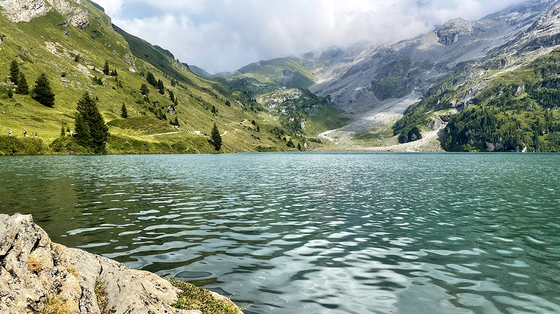
Engstlensee
Completely revitalized, I started my last climb of the day. Ahead of me, behind the beautiful Hotel Engstlenalp, lay the steep trail up a plateau. The trail was visible as a narrow cut in the dark rock. From below it looked a little frightening.
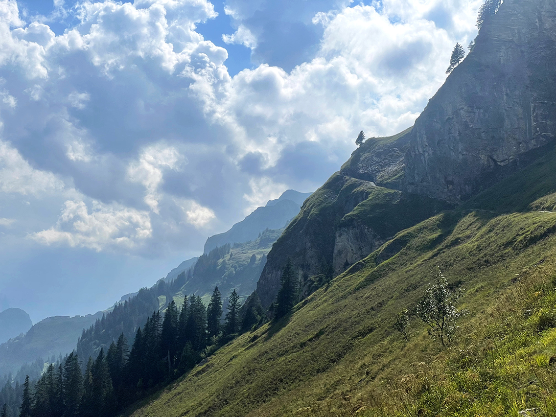
Trail to the Tannesee-plateau
Once on the trail, it wasn’t too bad, the trail was much broader than expected, and fortified with cement. On top of the plateau, 30 minutes later, there was yet another group of farm houses. I bought a cool drink of strawberry milk before I continued to the next lake.
I arrived at the Tannensee about 15 minutes later. It was 5.30 p.m. now and already too cold for a swim. Looking at a sign on the little wooden building next to the lake was a sign stating that swimming was forbidden here anyhow.
I put up my tent next to a picnic table, not fully sure wether or not is was allowed. There was a confusing text on the same little building about camping. The pictogram was a clear green tent though, so I assumed it was o.k.
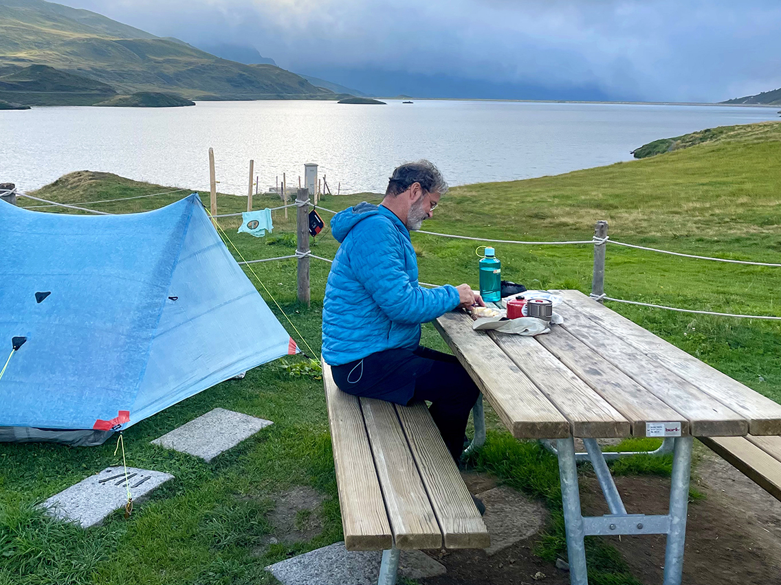
Tannensee picnic area
Soon I was joined by Maria and her daughter Leoni, who had organized a short outing with her mother for her 19th birthday the next day. They lived in the neighborhood, although they were originally Albanians from Kosovo. They were giggling the whole time because Maria was afraid of sleeping in a tent for the firt time in her life. A little later, Fabian and Bartek, two Polish students from Berlin, also arrived with their tents, so the picnic spot / fireplace was now full.
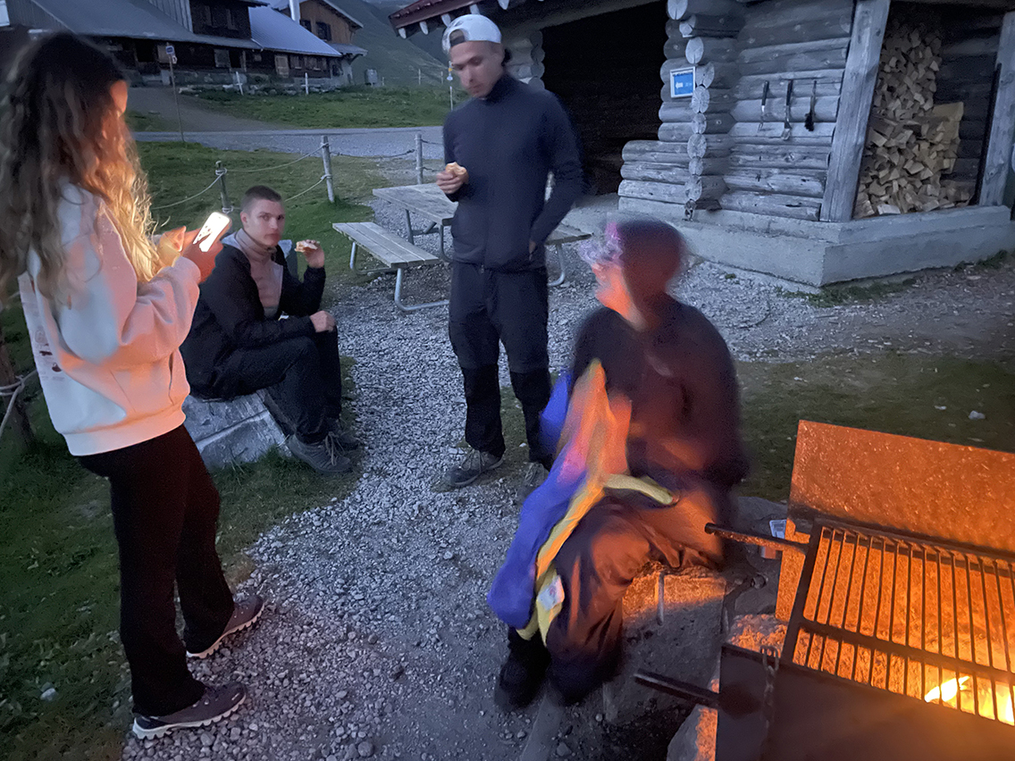
Tannensee fireplace
With the warmth of a good wood fire (offered free of charge by the Swiss government), we managed to stay outside for quite a long time, at nearly 2.000 meters elevation. With German, Polish, Albanian, Swiss German, and English as the spoken languages, it became a cozy night.
< Previous: The Swiss Via Alpina 1, part 1.
> Coming soon: The Swiss Via Alpina, part 3
0 Comments