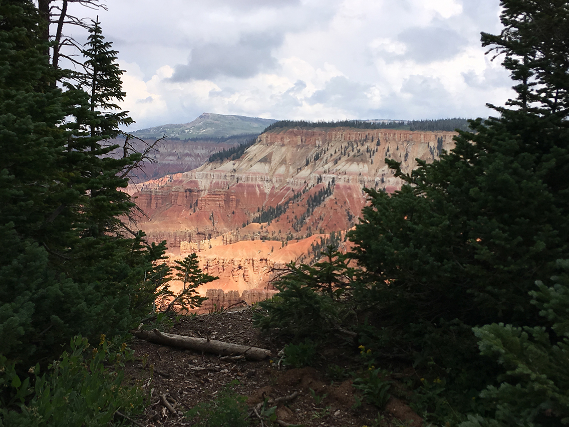
Cedar Breaks National Monument may be relatively unknown, but it is a major natural wonder in itself. It features dramatic red rock formations and 1,600 years old Bristlecone Pine trees. Thunder and lightning made us shorten our hike to just three miles. But what awesome three miles they were.
The Campground & Ramparts Trail
Location: Cedar Breaks National Monument, Utah
Start: Point Supreme Campground
Distance: 3 miles (4,8 km) roundtrip
Elevation gain: 380 ft
Time: 2 hrs
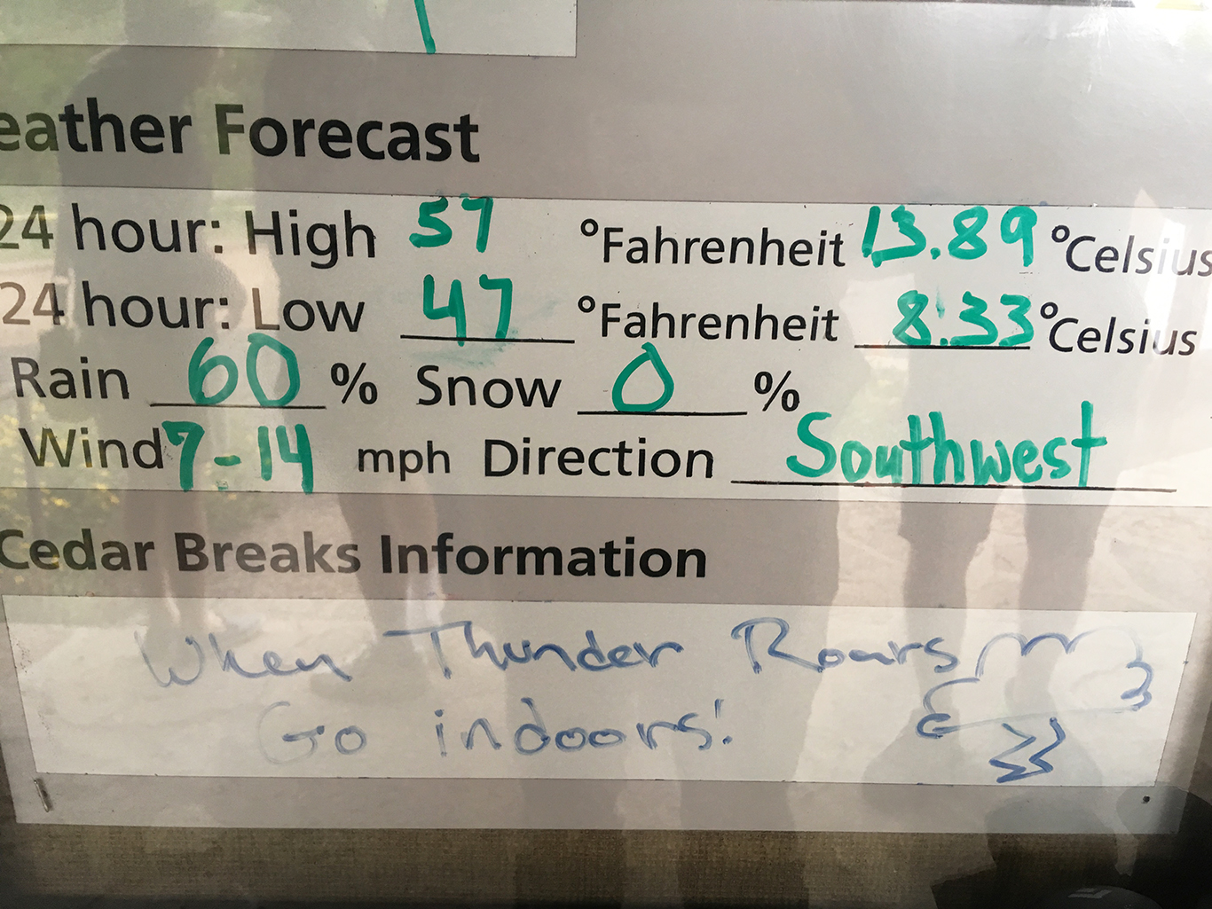
Note: lightning hazard
Cedar Breaks National Monument
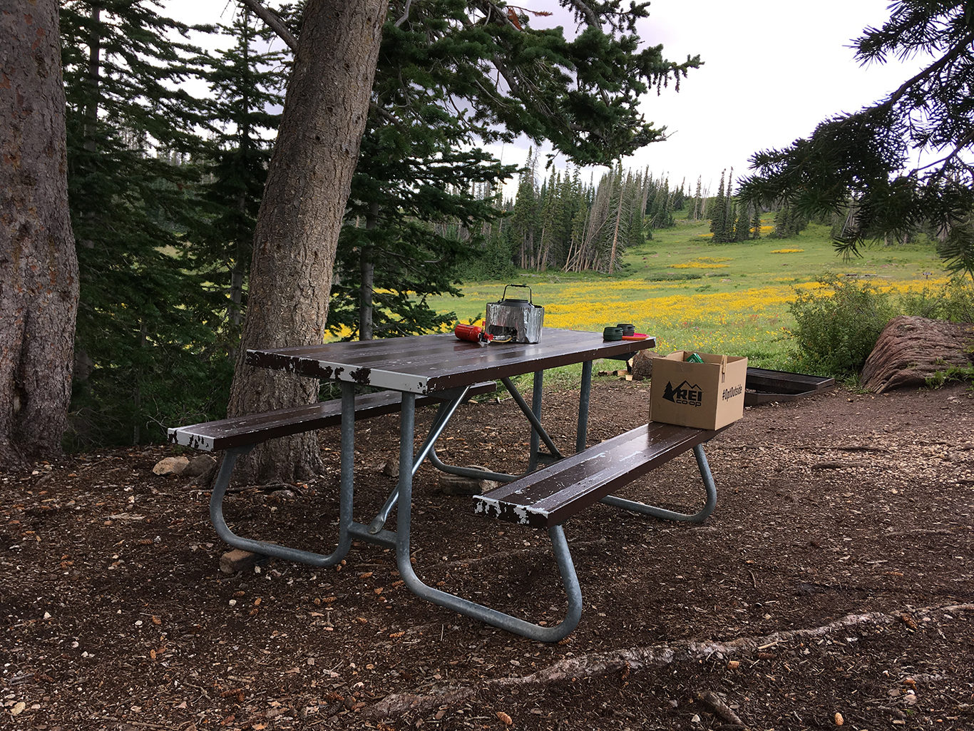
Cedar Breaks National Monument is a nice hideout from the crowds and the summer heat that you’ll experience at nearby Zion National Park. Located at 10,350 feet (3.154 m) elevation, summer temperatures are low and camp sites are easy to find at Point Supreme Campground. We arrived early to find a choice of first-come-first-served sites.
Camping at this elevation can be very cold, even mid summer. At a stormy night we needed all our clothing (including woolen hat and down jacket) to get a comfortable sleep. The camping has very nice big spots, each with a picnic table and a fire pit. There are also restrooms with showers, chopped firewood, and water spigots.
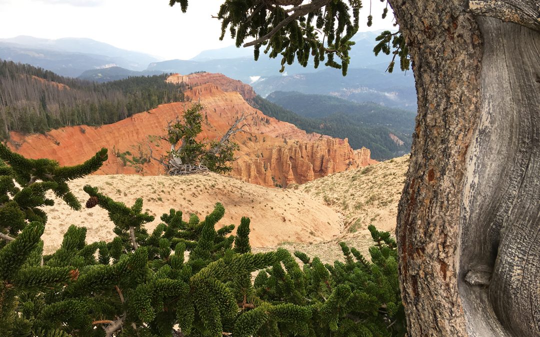
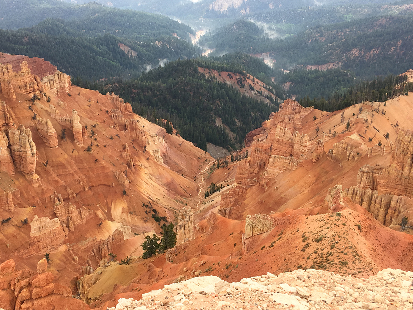
The Amphitheater
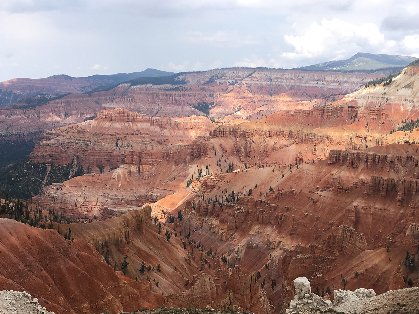
But more importantly, the view here was so impressive I did not think of all these facts at all. I stood there with my loved one and we could only respond to the majestic beauty in silence.
The Visitors Center and Point Supreme
Just a few steps further on the wheelchair accessible trail we found the Visitor Center, a tiny cabin constructed in 1937 by the famous Civilian Conservation Corps (CCC). This historic building was designed to resemble the classic National Park Service rustic architecture.
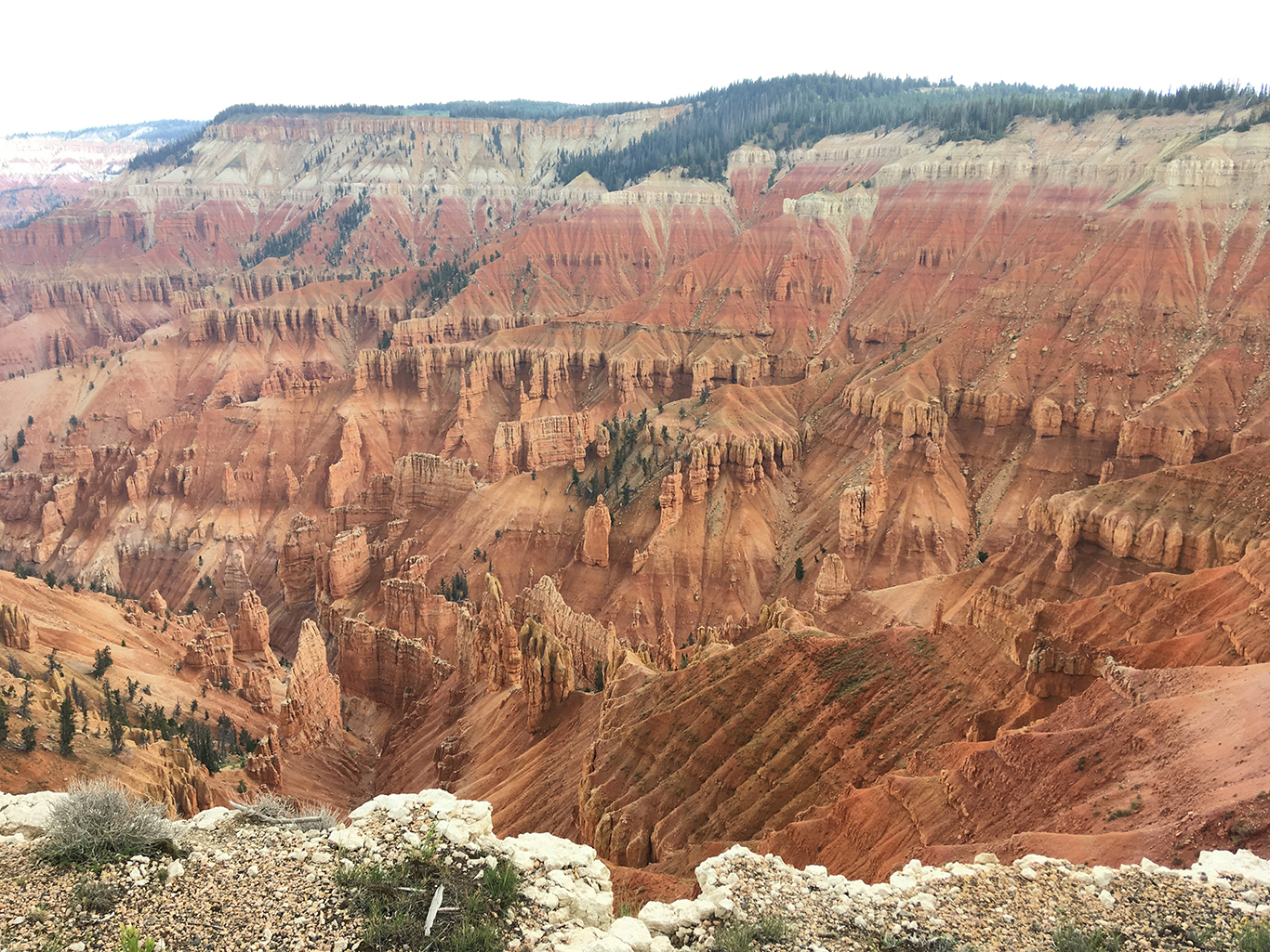
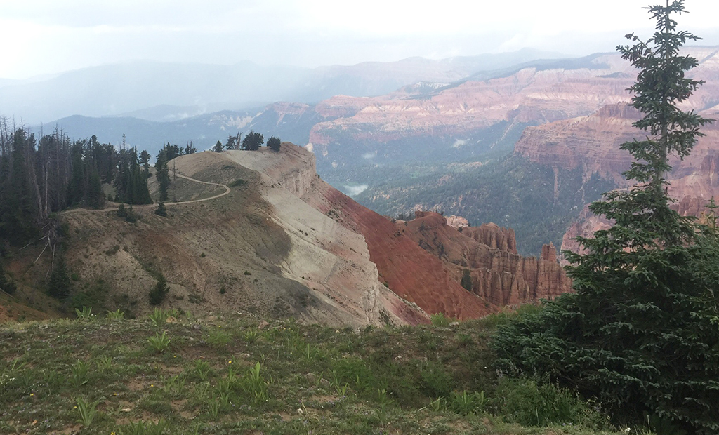
From Point Supreme we looked down into Jericho Canyon, where we made up names for the towering rocks, like The Pope, Santa Claus and many others. We tried to estimate the height of the rocks, comparing them to the trees, but the depth of the canyon was hard to imagine.
Speaking of trees, as many 75% of the trees in the monument – which are not Cedars at all but Juniper trees the early settlers mistook for Cedar – were killed by a spruce beetle outbreak in 1986–1998.
Such a shame that most visitors to the park seemed only to glimpse through their smartphones and leave Point Supreme within minutes. On the other hand, this left us mostly all alone to enjoy the views – and the upcoming thunderstorm.
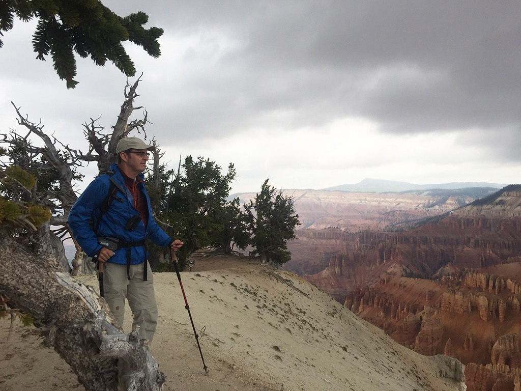
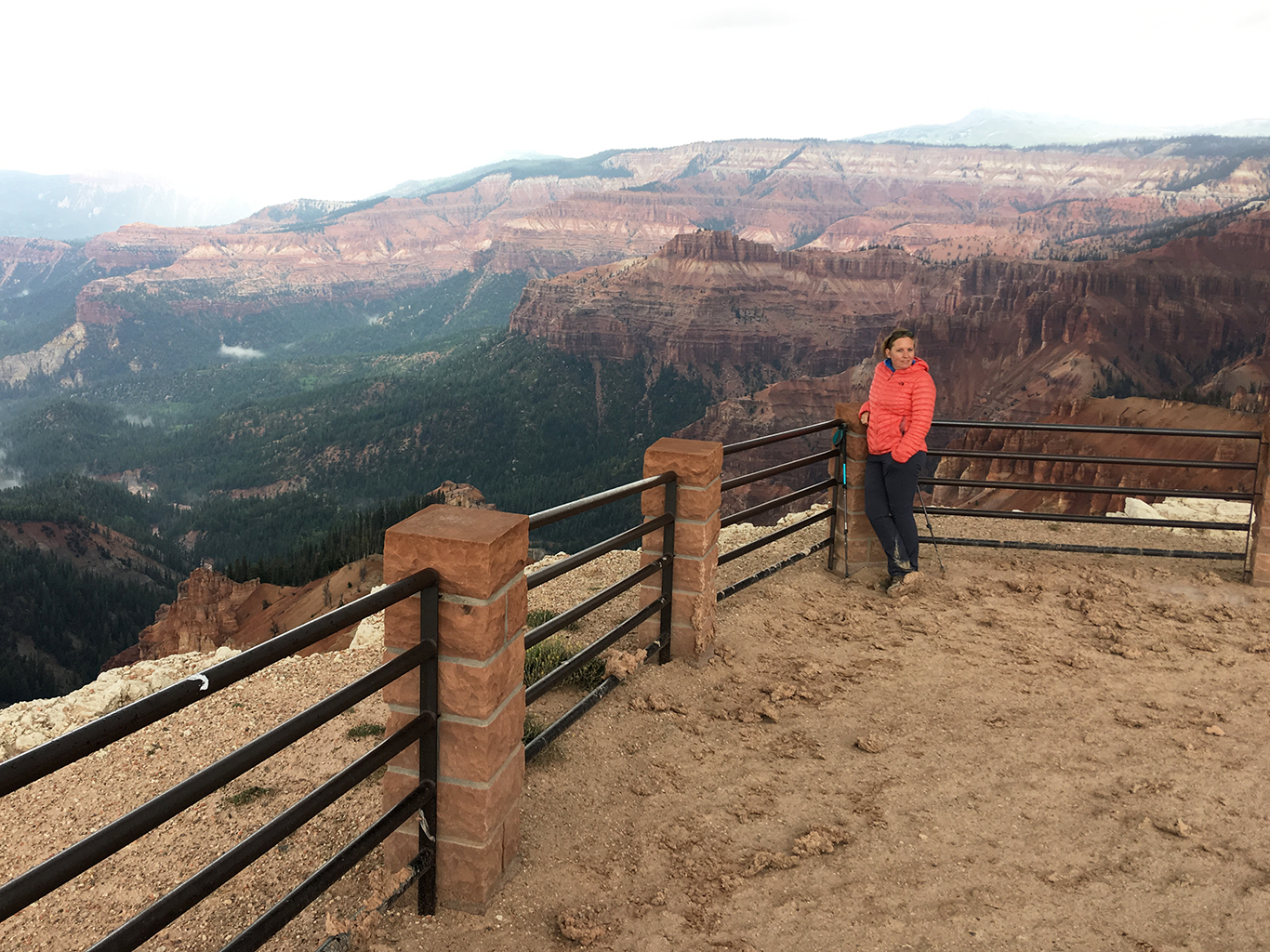
Spectra Point
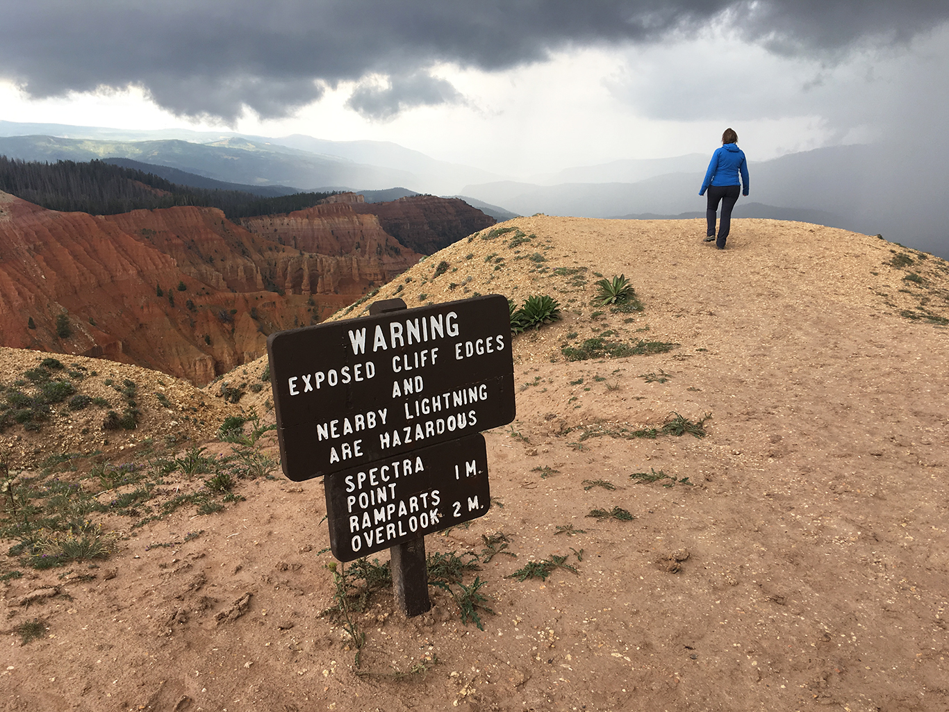
Along the trail we came to the highest point of the trail (10,478 ft / 3.194 m) on the cliffs edges near a weather station.
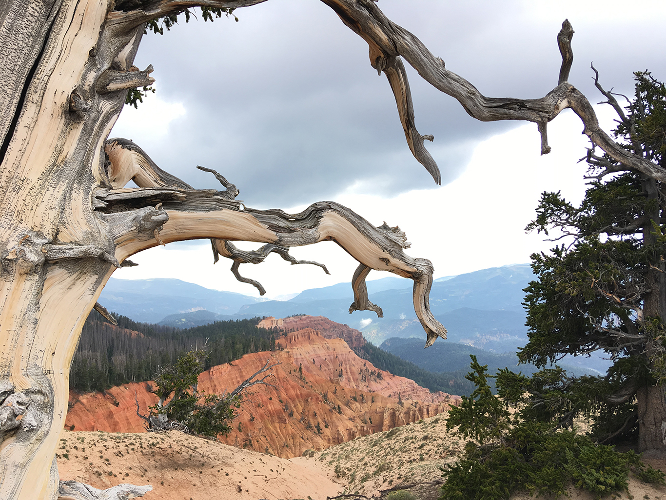
The Bristlecone Pines that grow on the cliffs edges are looking half dead, but are very much alive. These trees are a 1,000 to 1,600 years old. We took a moment to let that sink in.
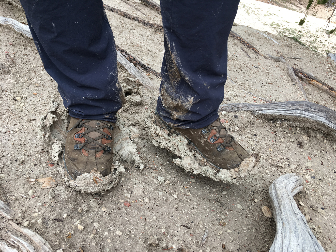
Although hiking on to the Ramparts Overlook would have been just two miles extra, the thunder and lightning came really really close again and the slippery mud began weigh heavy on our boots. Time to get back!