Stage 3 of the GR5: the Vanoise. A part of the Grande Traversée des Alpes/GR5 where all the different routes can make your head dizzy – if you’re not already dizzy from the high mountains all around you. This stage takes hikers from freezing cold mountain passes to the sweltering city of Modane close to the border with Italy.
GR5 Trail Overview Stage 3 (day 9–11)
For this trip report of the GR5/Grande Traversée des Alpes I use the 7 stages as defined in the Cicerone guidebook. This third stage starts in Landry and ends in Modane, south of Vanoise National Park. This stage can be done in 4 to 5 days, depending which of the many variants you choose. However, I was forced to make a shortcut to Modane on day three. For more general information about the GR5, read my Planning the GR5.

GR5, day 9 to 11: from Landry to Modane (note the North is left)
Vanoise Variants
Stage 3 of the GR5 has many variants. Below I will describe the main routes crossing the Vanoise.
- The GR5 makes a turn east at Tignes and continues around the main mountain range of the Vanoise, to Val d’Isère and Bessans. Then the GR5 turns east again to Plan du Lac, where the trail bends south to Modane.
- Many GTA-hikers however choose to follow the GR55 from Tignes, a trail that follows a more eastern route to Pralognan before it cintinues to Modane.
- From Bessans on the GR5 there is yet another variant: the GR5E, a valley trail called Le chemin du petit bonheur to Termignon and eventually to Modane. This trail is mainly a bad-weather alternative for the real thing on the GR5 high route.
The different trails can all be easily connected at certain points, sometimes with a short detour. This is exactly what I did. I was forced to change my plans when I learned that not only all the refuges in the Vanoise were fully booked, but also all the bivouac spots were required to be booked beforehand –and most of them were fully booked (wild camping is illegal in the Vanoise and it is heavily fined when caught).
Day 9: Landry to Col du Palet
Start: Landry, 792 m (2,598 ft)
End: Col du Palet, 2.656 m (8,714 ft)
Distance: 23,2 km (14.4 miles)
Elevation gain: 1.937 m (6,355 ft)
Elevation loss: 83 m (272 ft)
Highest point: Col du Palet, 2.656 m (8,714 ft)Time: 7:15 hrs moving time, 10:40 hrs total time
Date: August 8, 2023
Day 9 of the GR5 consisted of one long ascent into the Vanoise. Climbing out of the village of Landry, I passed through some small villages, eventually leaving all civilization behind me, all the way to the fabulous Col du Palet.
Landry to Peisey
Up at 6 a.m. at Camping Canopé in Landry. While my friends Max and Gaëtane were still asleep I stuffed my backpack with all my gear, putting my tent (wet with morning dew) on top. I didn’t feel like eating breakfast yet, I was eager to get on my feet and move into the Vanoise.
For the first time since 5 days I was hiking alone again in the morning. Combined with the steep ascent out of the valley, this morning’s hike felt more tough than usual. As I was hiking into the woods I sometimes lost the trail but after an hour I eventually reached a point where the trail took a turn south. I found myself on an easier path through many little villages, know under the common name of Peisey-Nancroix. I found a nice little bakery where I sat down in the morning sun for a pain d’amandes and a bottle of apricot juice.
Rosuel and Les Lanches
A bit further down the street I visited a Sherpa grocery for some extra provisions. Not before long I left the long row of villages and turned into the forest again, following a stream called Le Ponturin (nice opportunity for some feet cooling). With the river on my left hand, I continued further towards Les Lanchettes (campsite), passing an old mining area before I reached the last hamlet of the valley: Les Lanches and the nearby Refuge de Rosuel.

Entering the Vanoise at Les Lanches
By the time I reached Rosuel, 4 hours had passed. Now the real ascend into the Vanoise began. Refuge de Rosuel and the trail to the Lac de la Plagne were quite popular with day hikers. I passed many French families – or should I say: they passed me, because they just started their hike from Rosuel, while I had been hiking for more than 4 hours already.

Cascadede Nan Putors as seen from above Refuge de Rosuel
It was noon when I reached Point de Vue de la Rèbe, a small wooden platform perching from the mountain wall with an excellent view of the mountains and the nearby Cascadede Nan Putors. Five hours into my hike, I was tired but also feeling slightly depressed, as I missed my hiking companions from the previous week so much. Half of them had quit the trail by now and the other half – I had no idea were they were. Just as I unpacked some salty snacks from my pack to brighten my mood, I heard Vincent calling my name from the trail.

Le Ponturain stream
Happy to see each other, we reminisced about the past week we spent together with our new friends. We hiked on together for a while, but then split, each of us at our own speed, agreeing we’d wait for each other at the Refuge Entre le Lac.
Lac de la Plange to Refuge Entre le Lac
I hiked on for half an hour when I reached the point where the trail to Lac de la Plange splits (just above the stone Chalet de la Rèbe, a private hut). One trail goes left, the other follows the stream on the right side. Either trail leads to the lake in about half an hour.
I followed a fairly easy track on the right bank of the clear Ponturain, before I reached Lac de la Plagne, another beautiful alpine lake. This is where I found Vincent waiting for me, ready to take a plunge.

Lac de la Plagne, just before Refuge Entre le Lac
Jumping into alpine lakes became an addiction to me during this hike: a split second my body screams of panic when my overheated skin dips into the ice cold water – but then instantly 6 hours of weariness disappear. When I step out of the water, shivering and tingling, I am reborn and ready to hike on for a couple of hours more.
Vincent and I dried our selves, put on our clothes again and ate sardines from a can with a hunk of bread. Is there anything better?

Refuge Entre le Lac
The refuge was just 15 minutes from our swimming spot, but we thought we could afford another break at the hut with a cold drink. It was still before 3 p.m., so there was plenty of time left before the last stretch of today’s hike: the ascent to Col du Palet. Enjoying our drinks, I found Refuge Entre le Lac one of these huts with just the right atmosphere: relaxed, simple but not bare-bone, with a dream view of lakes and mountain tops. I heard a Dutch family with 3 kids check in with the warden for an overnight stay, which inspired me for a next adventure. Why not go hiking in the Vanoise with my own family next year (note to self: insert link to future hike report here).

Refuge Entre le Lac (and Lac de la Plagne) dwarfed by a giant mountain called Mont Blanc de Peisey.
The trail up to Col du Palet was longer than I expected. What I thought to be the col (a crest just above the lake) was only the beginning of a longer trail through a high plateau that eventually would ascent to the actual col. A beautiful trail at that, with a constant view of the white giant La Grande Motte. Vincent and I hiked for about 1:30 hrs in complete solitude until we reached another lake, Lac du Grattaleu. This lake lies above 2.500 m (8,200 ft), so there was no skinny dipping here.

Plan de la Grassaz, heading to Col du Palet, glacier of La Grande Motte in the distance (photo Vincent Nicod).
Col du Palet
Soon after the desolate lake, the refuge buildings came into sight. Finally! How many hours had I been hiking? It was 4:30 p.m., which meant I had been on the trail for more than 9 hours now.

Refuge du col du Palet, just below the col
At the hut I tried my best French to ask the hut warden about possibilities for a bivouac near the hut. I actually suspected the hut was fully booked, including the bivouac spots – but I wanted to give it a try anyway. As the warden was answering my question in rapid French, it was the voice of none other than Christophe calling out to me. And there was Vincent arriving at the hut, with the Max as well! Happy to meet again we all sat down at one of the picnic tables in our puff jackets, hats and sun glasses to protect us from the elements at this altitude. We ate and drank while Christophe explained that we could bivouac at the col, just another 60 m (200 ft) above the hut. Col du Palet marks the border of the Vanoise National Park: east of the col is outside of the park where bivouac restriction do not apply.

On top of Col du Palet, 2.652 m (8,700 ft)
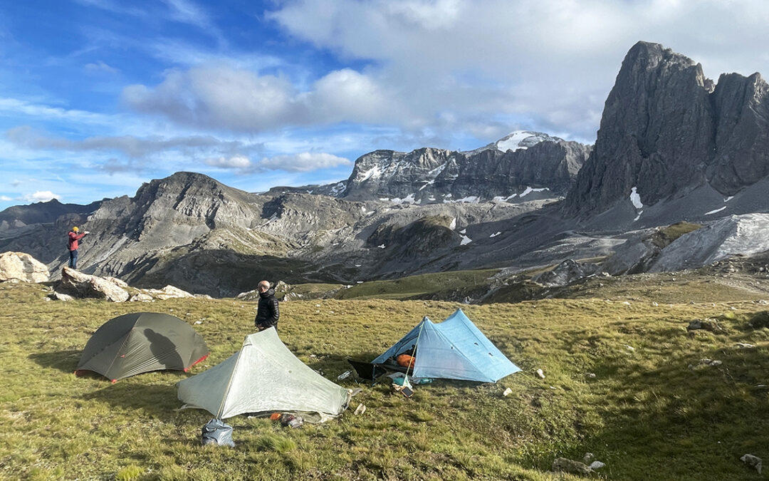
After a one hour break we took off for our final ascent of the day, to Col du Palet. No more than 15 minutes later we reached the elevation of 2.652 m (8,700 ft), which would be the highest point on my entire GR5 hike this year. Above the col we found yet another lake, icy and muddy, surrounded by a lunar landscape of pale rocks. A bit further on the terrain was just a bit more level and grassy enough to offer tenting opportunity. We took quite some time to find the right spots, while Max continued on the trail down to the town of Tignes to try his luck there.

Bivouac at Col du Palet
When we finally agreed on the ‘best’ spots, we hurried to set up our tents, because a cold wind was starting to emerge. At 2.600 m. altitude this was the highest point I ever camped in Europe. It was so cold that after cooking a quick dehydrated meal there was nothing better to to than crawl into my tent, wearing all the clothing I had. I hid deep inside my duck down quilt, read a few pages of Camus and fell asleep before sunset, happy as a man can be.
Day 10: Col du Palet to Refuge de Plan du Lac
Start: Col du Palet, 2.656 m (8,714 ft)
End: Refuge de Plan du Lac, 2.385 m (7,825 ft)
Distance: 24 km (14.9 miles)
Elevation gain: 972 m (3,189 ft)
Elevation loss: 1.249 m (4098 ft)
Highest point: Col de la Leisse, 2.761 m (9,058 ft)Time: 6:30 hrs moving time, 9:15 hrs total time
Date: August 9, 2023
A milestone day on the GR5: day 10. Initially I followed the alternate route of the GR55 instead of the GR5 (see map above), but I changed my itinerary and hiked up to the GR5 trail to reach the Refuge Plan du Lac. This turned out to be the only refuge in the Vanoise that showed some flexibility towards hikers with a tent, offering space for bivouac (and showers).
Descent from Col du Palet

Sunrise at Col du Palet (2.656 m)
I do not carry a thermometer on my hikes, but I could feel the night had been literally freezing cold at Col du Palet. When I woke up half an hour before sunrise, I began packing my backpack efficiently and quietly without considering a breakfast. Vincent was awake as well and when we were finished packing we started our descend together, after saying goodbye to our friend Christophe who just happened to stick his head out of his snug tent.
Starting at high altitude, our early morning descend was fast. We crossed a vast area of ski slopes, where the metal giants supporting the many ski lifts were scattered around the meadows. From above we saw the town of Tignes. In the harsh backlight of the morning the town looked ugly.

Ski lift at the slopes above Tignes
Within one hour we were all the way down in the valley. At eye level with the Tignes high rising buildings the place looked even more desolate. But there was a good public toilet and, after some Google searching, Vincent found a nice little bakery, La Gourmandise. He treated me to breakfast of orange juice, tea and a sweet pastry called Croix de Vanoise.
Tignes to Col de La Leisse
We found a shortcut trail directly towards Col de Fresse, avoiding most of Tignes altogether. The ascend was tough, but beautiful. The landscape had changed completely from one side of the valley to the other. Gigantic rocks, brown of color, backed by dark and bare mountains.

Ascent to Col de la Leisse
After less than an hour the trail bent southwest, below Col de Fresse. We met a small group of hikers who had come all the way from Nice, pushing north towards all the places we had left behind in the previous 9 days. It made me think back to all that happened and all the people I met in this short time – and to all that lay ahead of me. For now, the first thing ahead was the Col de la Leisse and it would take another half hour to reach it.

Col de la Leisse with a view of Grande Motte (photo by Vincent Nicod).
At 2.761 m (9,058 ft) Col de la Leisse was the highest point on the GR5 – although this col is actually on the GR55 and there is one higher Vanoise mountain pass on the GR55 (Col the Chavière at 2.976 m). So let’s state it this way: it was the highest point on my Grande Traversée des Alpes. And a marvelous one, with a view of the giant white dome of Grande Motte in the distance.
Plan de Nettes
South of the col we entered a broad valley (Plan de Nettes) full of rocks and scree. At the bottom there was a clear and deep blue alpine lake: Lac des Nettes. It looked so beautiful, only the ice cold wind was holding me back from jumping in once I reached its shore.

Lac des Nettes
Of course the least I could do was to dip my feet in the freezing water. My loyal hiking companion Vincent was patiently waiting for me. When we continued hiking through this glacial valley we passed another small lake with a little iceberg floating on the surface. The trail was rough, with big rocks and some boulders to negotiate, so it took about an hour before we caught a first glimpse of the next hut.
Refuge de la Leisse
It was noon when we reached Refuge de la Leisse. The refuge consists of three small wooden buildings on top of a bluff called Les Roches Blanches (the white rocks). The refuge has an expansive view of the valley below (Vallon de la Leisse).

Refuge de la Leisse
When I walked towards the wooded picnic tables in front of the hut, the first thingI heard was someone calling my name with the typical French pronunciation. There were Flore and Emily, last seen two days back in Landry, already enjoying food and drinks. We joined them with half a liter of thé vert and an excellent omelette.
After a long break (about an hour) we decided it was time to head on and Vincent and I set off, heading down into the valley.

Crossing the waters of Torrent de la Leisse, looking back at the refuge
Vallon de la Leisse
The hike through the valley followed the Torrent de la Leisse for about one and a half hour. As the trail was descending steadily all the way, I was hiking really fast. Soon I was hiking alone again. The views in this valley were absolutely stunning, with high walls on my right hand, and the wild stream below.

View of the south face of La Grande Motte from the Leisse valley
I reached a bridge called Pont de Croé-Vie, at which point the GR55 veers off towards the western part of the Vanoise. I continued straight ahead on a trail that was not the GR55 anymore, but also not yet the GR5. In between this no man’s land of GR-trails, lies a small hut called Entre-Deux-Eaux (between-two-waters). At this hut I reunited with the others, and we tried to order some drinks. But the family that runs the hut seemed very much irritated by their own clientele and obviously did not want to serve anyone. That’s when we all left together for a last stretch to the next hut.

Crossing Torrent de la Rocheure, just below Refuge d’Entre-Deux-Eaux
Below the hut we crossed another the bridge, where the south bound GR5 was on the right. We headed left towards Refuge de Plan du Lac, so now we were actually hiking the GR5 in opposite direction. Yes, all these trails in the Vanoise are so confusing. I was happy to bring large paper maps with me to be able to understand all the different options.
Refuge de Plan du Lac

Refuge de Plan du Lac
To reach the refuge we had to make one last steep ascend, which took about an hour. When we arrived at the high plateau we saw the refuge in the middle of a vast green meadow, a lake beyond and huge mountains all around. Wonderfull surroundings for drinks at a picnic table. Soon our hiking group was complete again: me and Vincent, Flore and Emily and finally Max arrived as well. We drank and talked until our glasses were empty and everybody got somewhat restless. We wanted to go pitch our tents, but the warden wouldn’t let us before 6 pm.

Bivouac area at Refuge de Plan du Lac
Before six o’clock many hikers were waiting around the field behind the refuge and once one of us started unpacking, the field was filled with little tents within 10 minutes. I cooked my dinner in front of my tent (saving some money, not buying food from the hut). After studying my maps and discussing various options for the next day with my fellow hikers, I went to sleep quite early: not only because I was dead tired, but at this elevation, out in the open, the evening was getting really cold.
Day 11: Refuge de Plan du Lac to Le Verney/Modane
Start: Refuge de Plan du Lac, 2.385 m (7,825 ft)
End: Le Verney, 1.212 m (3,976 ft) / Modane, 1.062 m (3,484ft)
Distance: 20,2 km (12.6 miles) to Le Verney
Elevation gain: 247 m (810 ft)
Elevation loss: 1.402 m (4,600 ft)
Highest point: Plan du Lac, 2.388 m (7,835 ft)Time: 4:50 hrs moving time, 6:15 hrs total time
Date: August 10, 2023
Day 11: eventually I was forced to abandon both the GR55 and the GR5 for a while, because there was not a single spot in the Vanoise for my tent. I hiked down to the village of Termignon and tried to continue to Modane on the GR5E variant through the valley. But this alternate trail was too hot, too long and too boring. Halfway I caught a bus to Modane.
Pan du Lac to Bellecombe
It was a beautiful morning when I woke up. After breakfast I talked to Vincent and Max about wether or not to follow the GR5 to Refuge Arpont and to try our luck further on in the Vanoise. But soon we decided not to. We were all a bit fed up with the strict regulations at the Vanoise, making wild camping impossible (bivouac is allowed almost everywhere else in France).

The unnamed lake at Plan du Lac, just above the refuge
The three of us descended from Plan du Lac and within half an hour we reached Auberge de Bellecombe, which consisted of a giant parking lot and a restaurant, which was closed for construction work by the way. This was also the junction where the GR5 comes in from the east and an exit-trail to Termignon descends in southern direction.

On the descent to Termignon, off-GR5
The landscape on the descent to Termignon was impressive: a new mountain range was waiting to be conquered the next days. But today I felt a lot less motivated than the previous days. I couldn’t imagine crossing the high mountains ahead and I longed for a shower, a real bed and a deep and lengthy sleep. Approaching civilization our smartphones resurrected from the dead. Walking through the green meadows I found myself swiping and clicking through various hotels and B&B’s in Modane. I booked a tiny apartment, and the prospect of one night of luxury rejuvenated my spirits.

The rocks above Cascade de la Chavière
Now we were definitely off-GR5: the scenery changed from rugged high mountains to lovely meadows and tree covered trails. The temperature was rising as well: France was experiencing a heat wave and being below an elevation of 1.500 meter the hot air felt like an invisible woolen blanket. I was happy to find a little waterfall on the trail, the Cascade de la Chavière, to cool off.

Walking towards Pont du Chatelard
Three hours from Bellecombe, we were drawing near to Termignon. On the opposite of the river a campsite was visible (Les Mélèzes), which seemed to be a good place to stay, if it would have been much later in the day. The village was divided by a fast flowing river, the Doron de Termignon and Flore suggested we’d have a swim before continuing to Modane. An excellent idea, so I started scouting the village for acces to the water.
At the confluence of two rivers, just south of the bridge I spotted a small pebble beach that could be reached by scrambling down two meters of steep rocks. This was a lovely spot. We all immersed our overheated bodies into the running water to cool down – this felt so good! We made it a beach picnic and enjoyed our various food supplies while we exchanged ideas about trail food. Flore introduced me to her trail food blog and I explained her how I made my own dehydrated meals.

Termignon, at the confluence of Doron de Termignon and L’Arc
After about an hour I decided it was to to move on. Flore, Emily and Vincent decided to try hitchhiking to Modane, but I was determined to reach the town on foot.
The next one and a half hour was not a highlight of my tour, to put it mildly. I followed the GR5E through the valley of Val Cenis. This alternate GR5 trail – marked with large yellow signing – is called Chemin de Petit Bonheur (Path of Little Happiness). However, for me this trail was just hot and after some time outright boring. I had completely miscalculated the length of this trail. I expected to reach Modane within 2 hours from Termignon, but after 1,5 hours I read on a sign that Modane was still four hours away. Then I tried, without success, to hitchhike. Eventually I was extremely lucky when a regular bus stopped 50 meters ahead of me. I had to run like crazy to be on time but I made it. With 10 minutes I covered the four hour distance to Modane.

Avenue de la Liberté at Fourneau/Modane
A small and cool apartment was waiting for me at Modane, just across from the railway station and bus stop. I stocked up on food at Monica Fruit et Legumes, a small Italian deli – delicious indeed!
In the evening I visited my hiking friends at the campsite Les Combes, on the other side of the railway station. According to Google Maps I’d have to walk more than half an hour to reach the campsite via a long detour around the railway. But I found an underground passage below the railway tracks. It was a damp and narrow tunnel, completely dark so I had to use a flashlight, but I reached the campsite within 10 minutes.
This evening not only marked the end of Stage 3 of the GR5, but was also the final goodbye to all my hiking friends. They would all be taking a rest day tomorrow or head in other directions. We said farewell with hugs and kind words before I returned to my luxurious, but lonesome, B&B.
< Previous: GR5 stage 2: Les Houches to Landry
> Next: Gr5 stage 4: Modane to Briançon
0 Comments