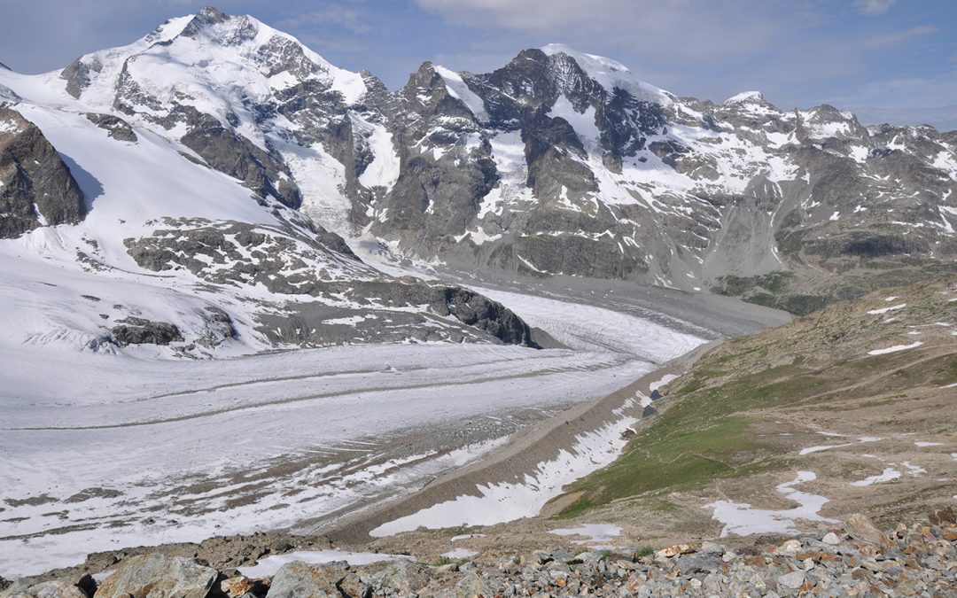
The Morteratsch Glacier is one of the biggest glaciers in the eastern Alps. A guided tour leaving from the almost 3000 meter mountain viewpoint Diavolezza offers a wonderful day hike, crossing two glaciers with views of stunning high peaks.
The Morteratsch Glacier trail
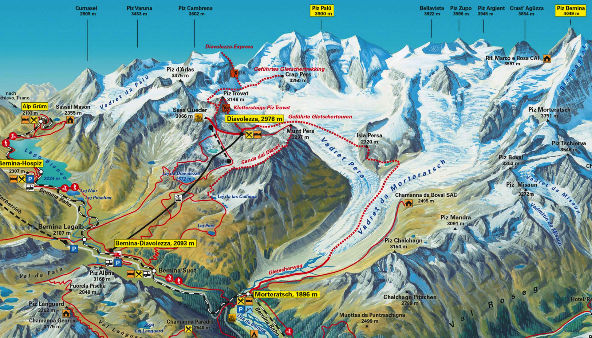
Location: The canton of Graubunden, southeast Switzerland
Distance: 12 km (7.5 miles)
Elevation loss: 1.082 m (3,550 ft)
Highest point: 2.973 m (9,754 ft)Time: 5 hours, including breaks
Start guided tour: 10 a.m., daily
Costs: ± 25 CHF single ascent aerial cableway; ± 65 CHF for the guided tourHiked: July 2009.
Update 2023. Things can change in 14 years: the price for the guided tour has gone up to CHF 125; tours start at 9 a.m. on wed/fri/sat/sunday. Reservations must be made online and will be confirmed the day before in an App.
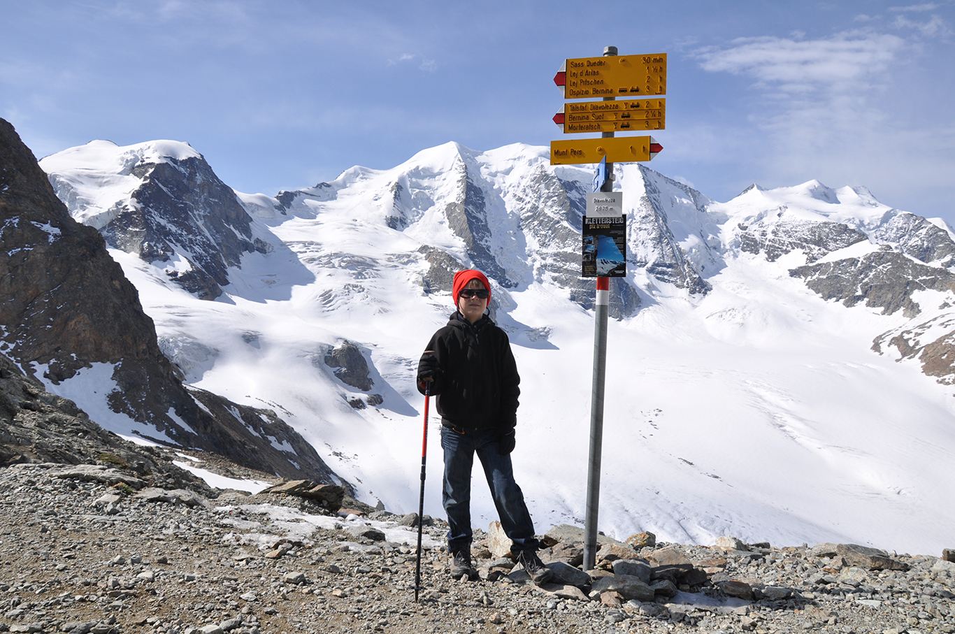
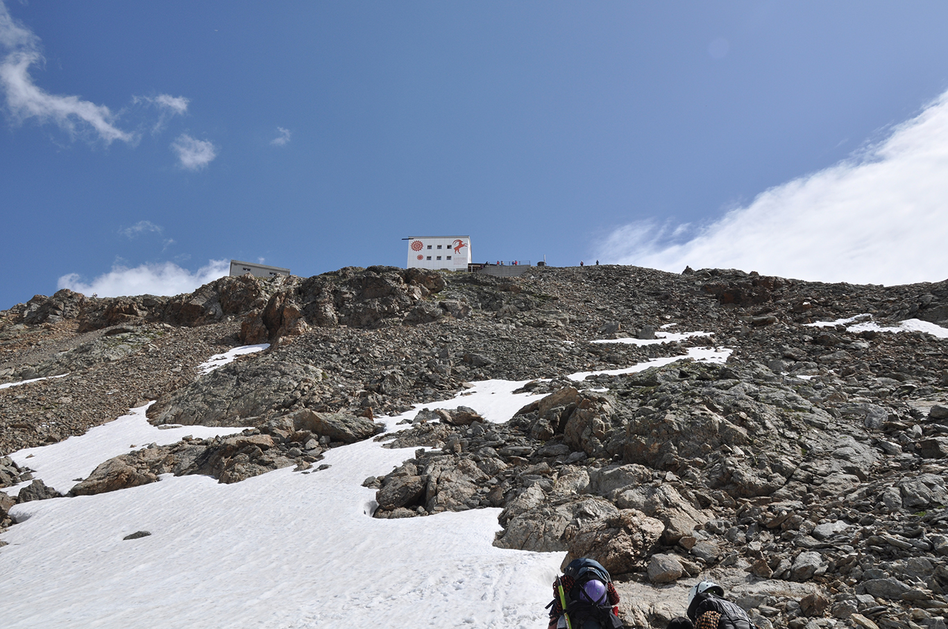
A Trailhead at 2.973 m
The highest point of the trail is the mountain viewpoint Diavolezza (2.973 m / 9,754 ft), which is also the starting point of the trail. To reach the trailhead, take the aerial cableway from Bernina-Diavolezza, a small train station about 15 minutes from the town of Pontresina.
The trail takes you across the Pers Glacier, on to the Isla Persa (Lost Isle), sitting in the middle of two glaciers, and then all the way down along the Morteratsch Glacier to the Morteratsch railway station (at 1.896 m / 6,220 ft).
Although the trail is rated with the highest ‘T6’ rating (Difficult Hike), the guided tour is a moderate hike. Children of 8 years and older are allowed on the guided tour. I did this trail with my then 9 year old son Melle without any problem. But definitely bring a hat, sunscreen and sunglasses.
.Although we left as early as we could, our train from Pontresina was already fully packed with mountain enthusiasts. Still we hardly had to wait at Bernina-Diavolezza for the aerial cableway all the way up.
High on the mountain, just in front of the big Diavolezza Berghaus, we found the little kiosk where we got our tickets for the guided tour (bring cash!). Every day at 10 a.m. the guide from the Bergsteigerschule Pontresina will go down the glacier with any hiker that shows up. We did not need to make any reservations, but things might have changed since 2009.
View of the Mountain Tops
The glaciers are surrounded by many high mountain tops, with Piz Bernina being the highest at 4.092 m / 13,425 ft.
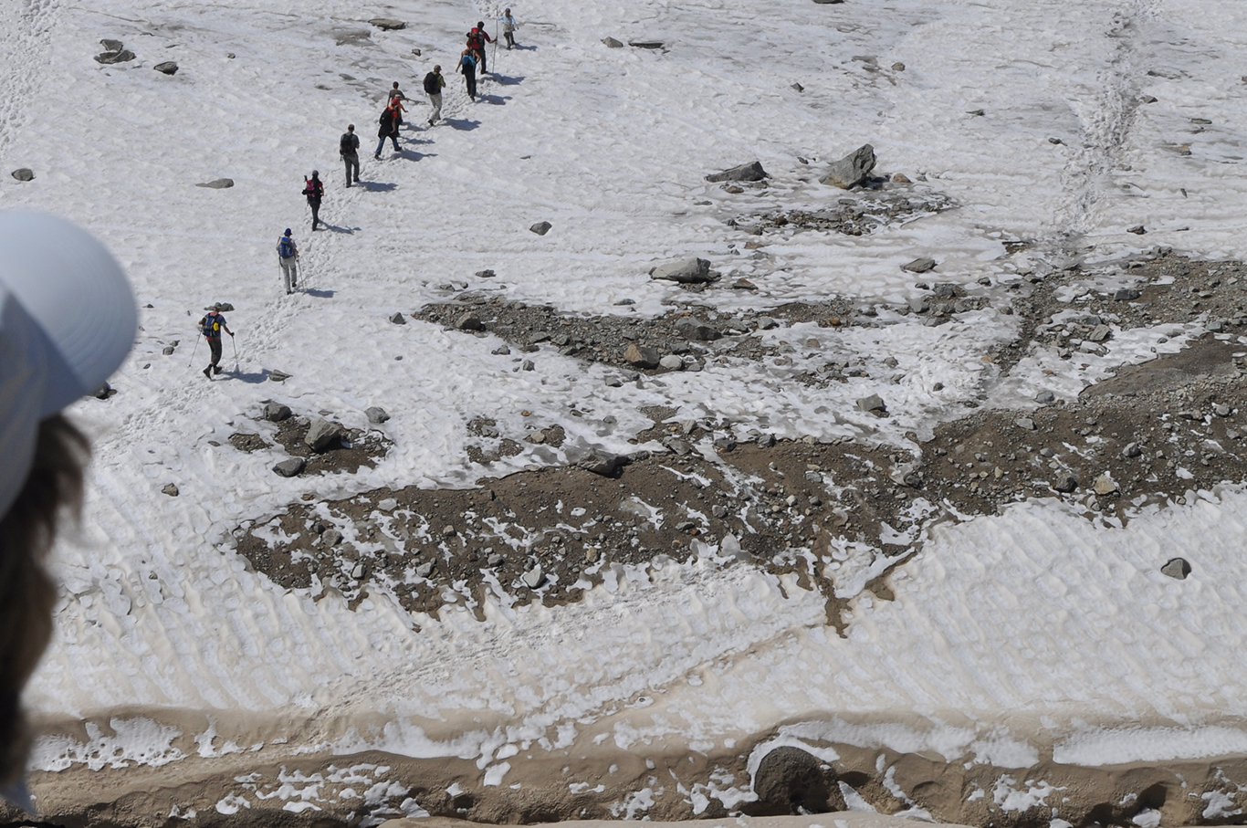
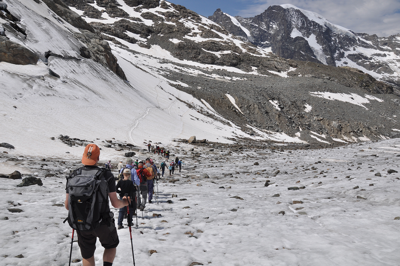
From above we could already see another group of hikers down on the glacier. We couldn’t wait to get going! As you can see, some people brought trekking poles, which is a good idea. We actually took just one with us; we could have used two each, especially going down the steep moraines the first part of the trail.
We had taken some extra clothing with us, just in case. But we didn’t need any of it – it was quite hot as soon as we hit the glacier. We took off our jackets and extra shirts quickly.
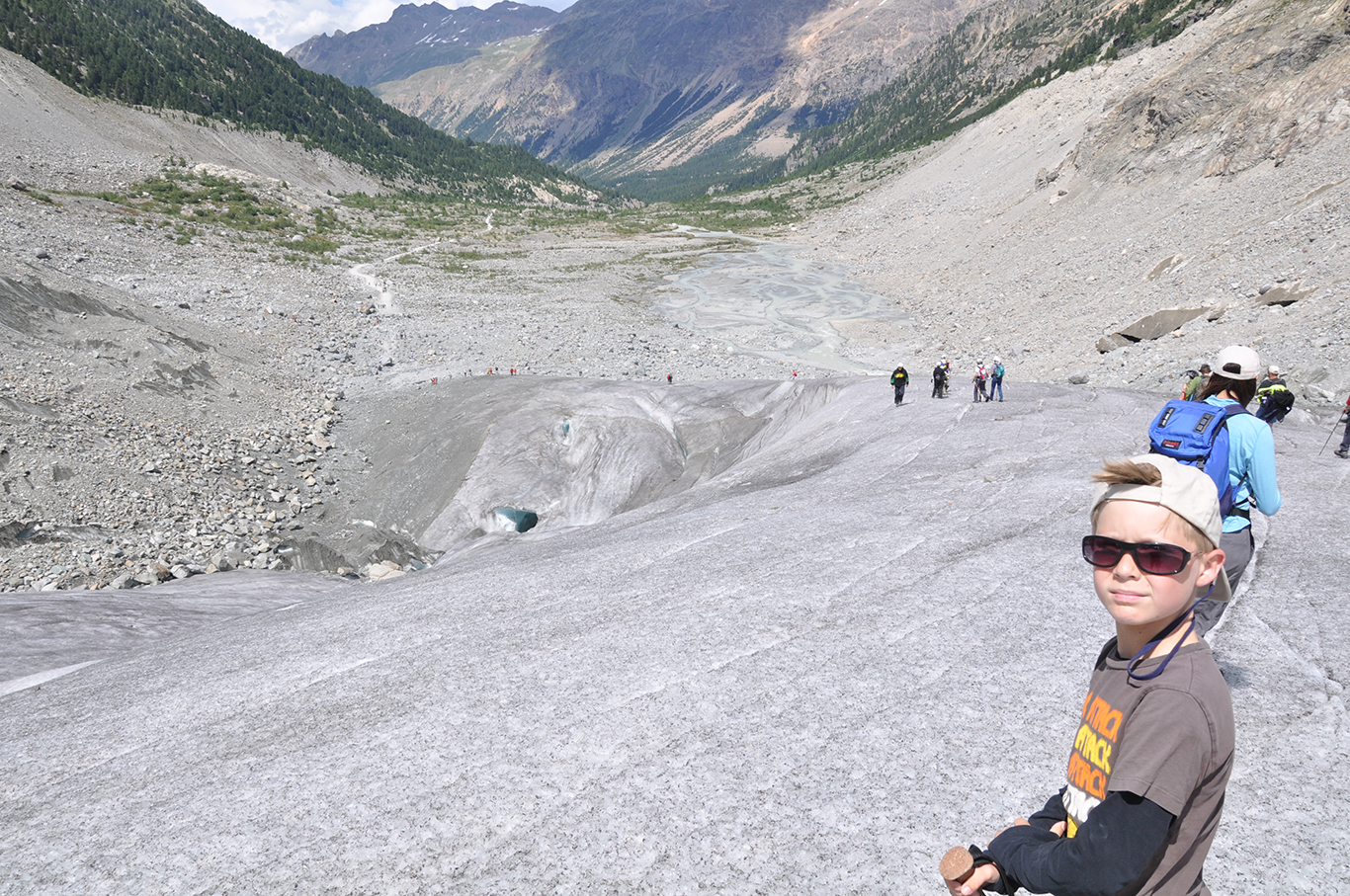
Traversing the Pers Glacier with Piz Bernina on the right.
We traversed the Pers Glacier in a long line of people, following the guides footsteps. Although we were walking with a group of about 30 people, it did not feel crowded at all. The landscape was so enormous, I hardly noticed the other people around me.
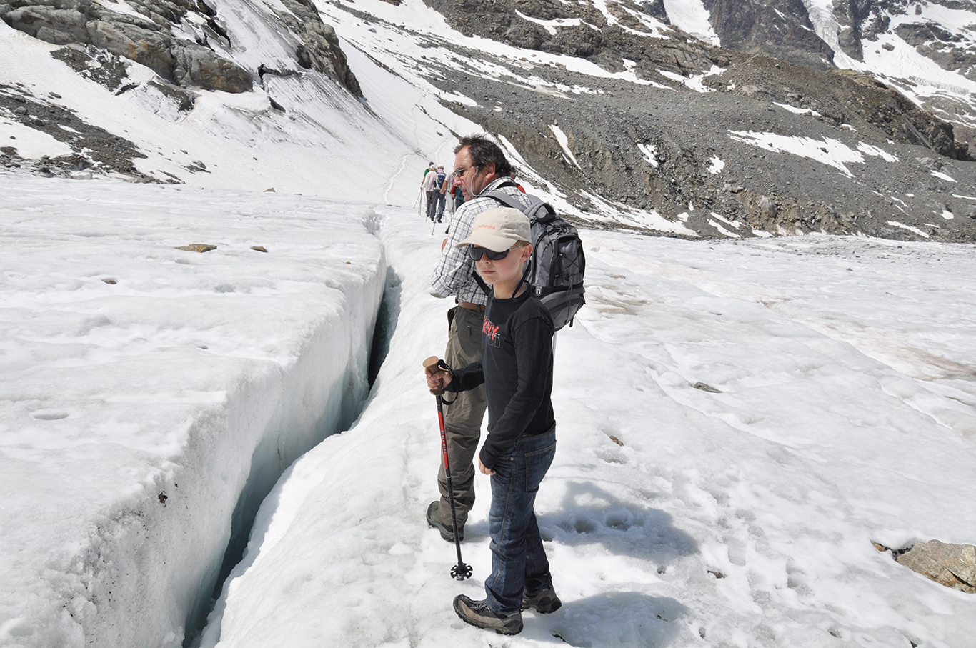
Many crevasses were visible along the trail, but no dangerous crossings. The sun had made the snow on the glacier a bit slushy. Waterproof hiking boots are recommended here.
Isla Persa, the Lost Isle
About halfway, wedged between the two glaciers, lies the Isla Persa, a small island in a sea of ice. Hiking up the island across an easy path of stone slabs, we saw the glaciers as what they really are: giant frozen rivers.
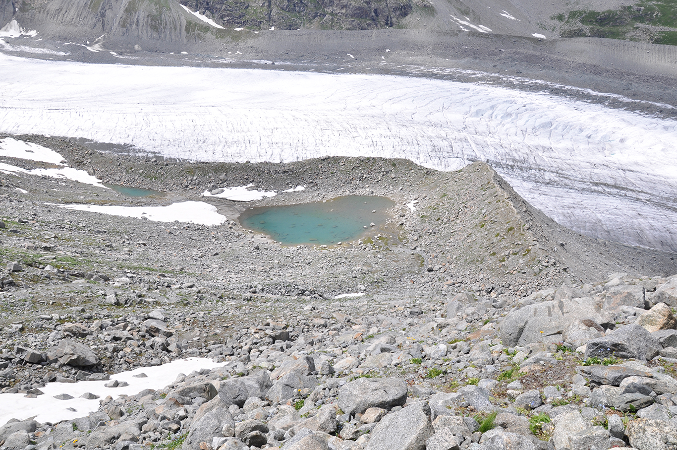
Looking down from Isla Pers to a small green blue lake above the Morteratsch Glacier.
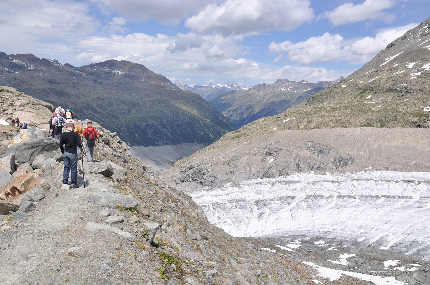
The Pers-Morteratsch Junction
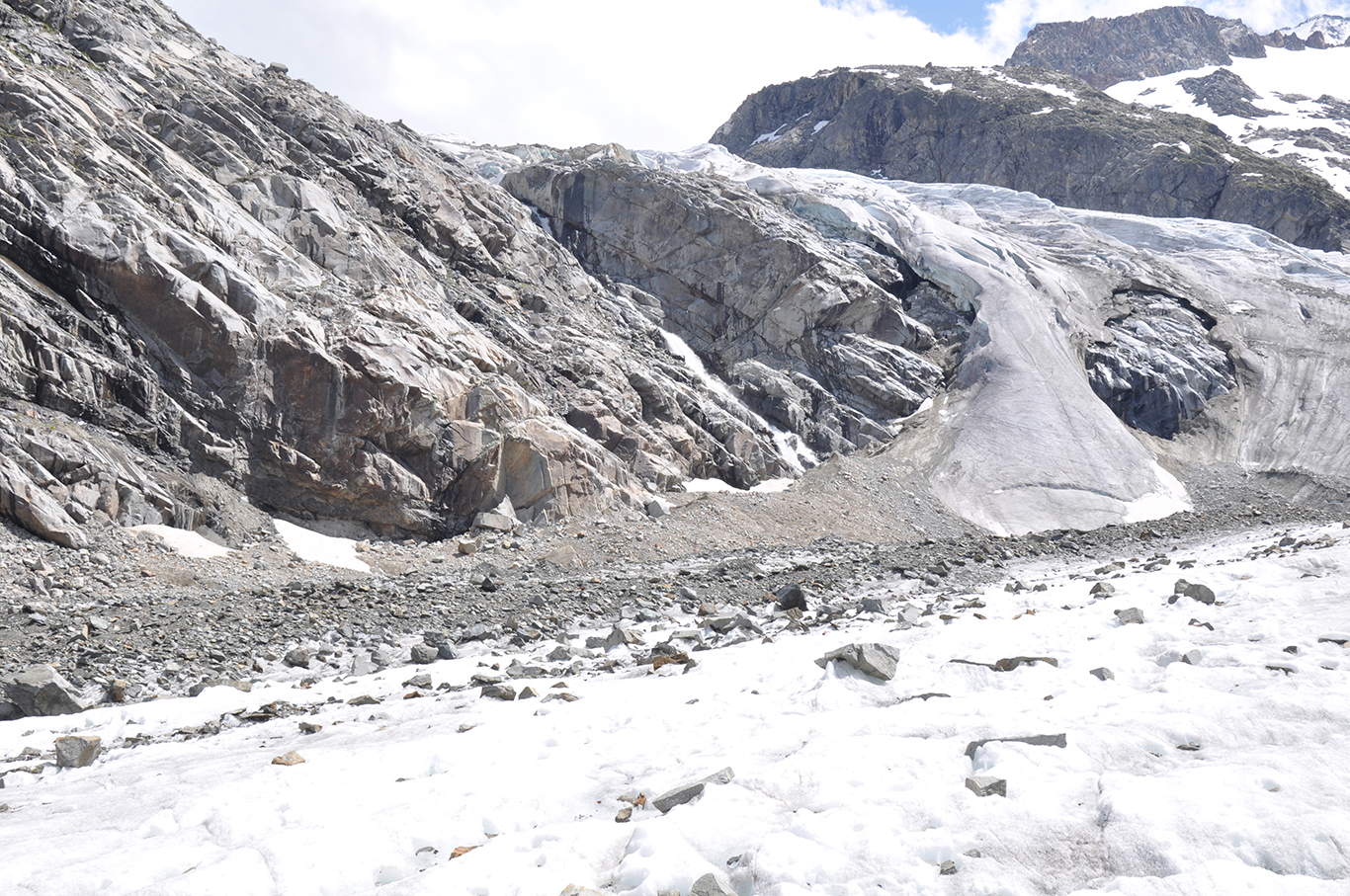
After about 3 and a half hour we came to the end of the glacier – but not the end of the trail yet. There was still 2,4 km / 1.5 mile of trail beyond the glaciers end. The color of the ice was more gray than white here, because of all the little stones and gravel that are appearing on the surface.
A Melting Glacier
The Morteratsch Glacier is, unfortunately, well know for its retreat. Ever since measurements of the glacier began in 1878, it melted away for about 2,5 km (1.5 mi).
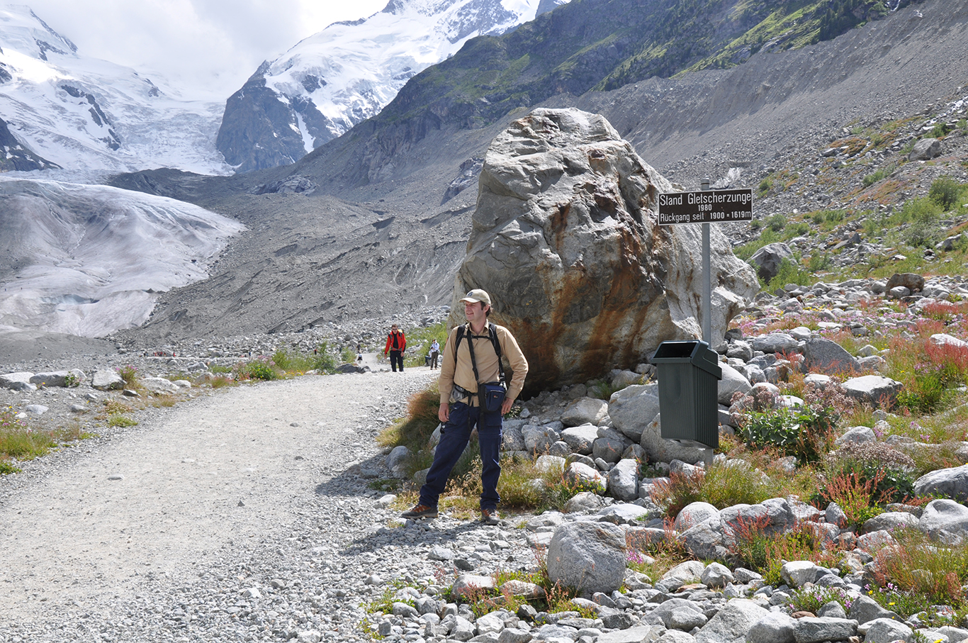
The retreat of the glacier increased in more recent years. At the end of the glacier numerous signs were put up to mark the glaciers end in earlier years. At the photo above I’m standing at the sign that marks the point where I descended the glacier as a twelve year old with my father in 1980. In the background the end of the glacier (in 2009) reveals how much ice has melted away since then.
The Morteratsch Glacier Trail is an impressive hike. Crossing two glaciers is very special and not something you will experience many times in your life. I did it twice. Once as a son, then 29 years later I went back as a father. Both hikes are unforgettable.