A perfect dayhike in the Swiss Alps with spectacular views of snowy mountain tops, green valleys and lakes of the deepest blue. A steep climb is rewarded with the unforgettable view from the Fenêtre de Ferret overlooking the Italian valley and alps near the Grand St. Bernard pass.
Fenêtre de Ferret trail
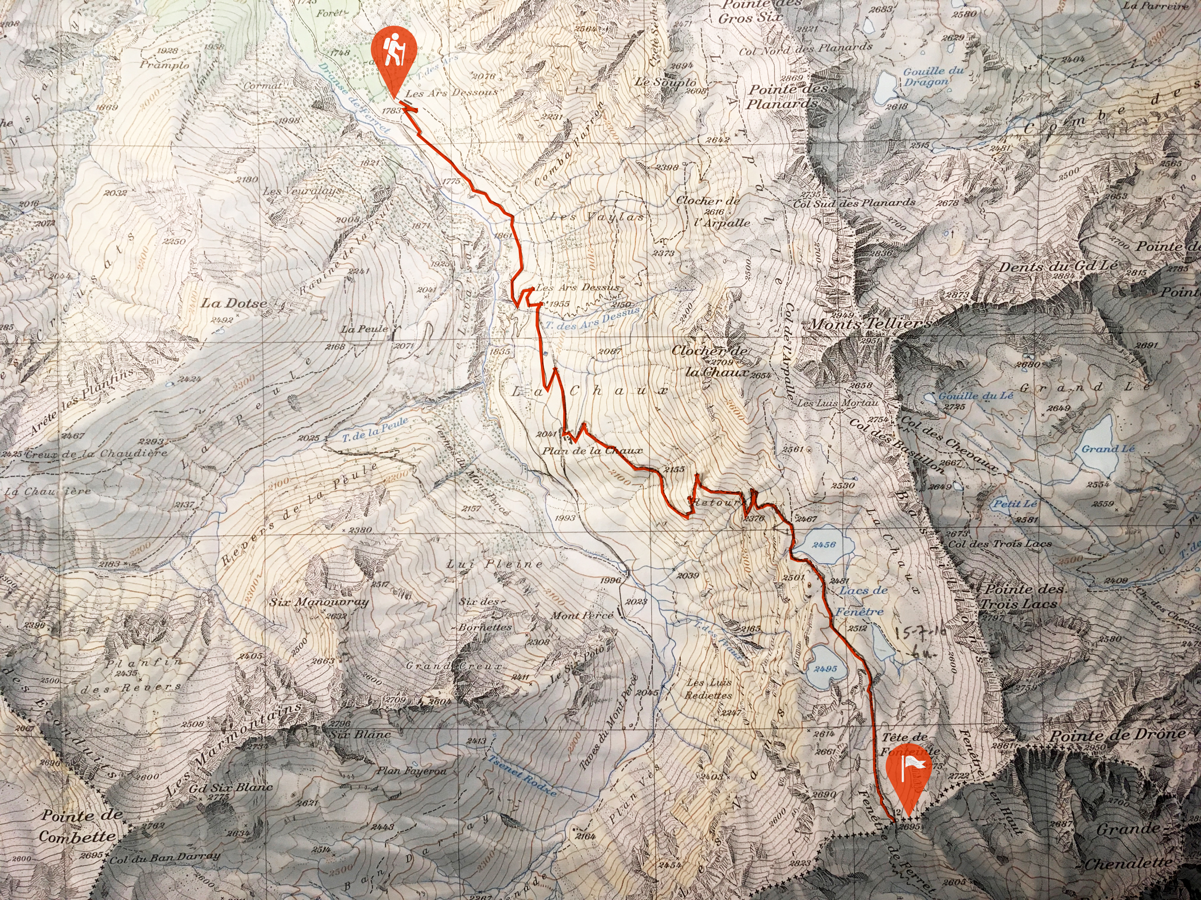
Trailhead: Les Ars Dessous (5,840 ft / 1.780 m)
Distance: 4.4 mi / 7,1 km round trip
Highest point: 8,851 ft / 2.698 m
Total elevation change: 6,000 ft / 1.836 mTotal time including breaks: about 5 hrs
Hiked: July 2016
Our base camp: La Fouly, Valais, Switserland
Our map: Carte Nationale de la Suisse, GD St-Bernard 1365
Basecamp La Fouly
The Fenêtre de Ferret (the window of Ferret) is a 8,851 ft / 2.698 m high mountain pass on the border of Switzerland and Italy, located in the canton of Wallis/Valais. The canton is bilingual, but in this area the main language is French.
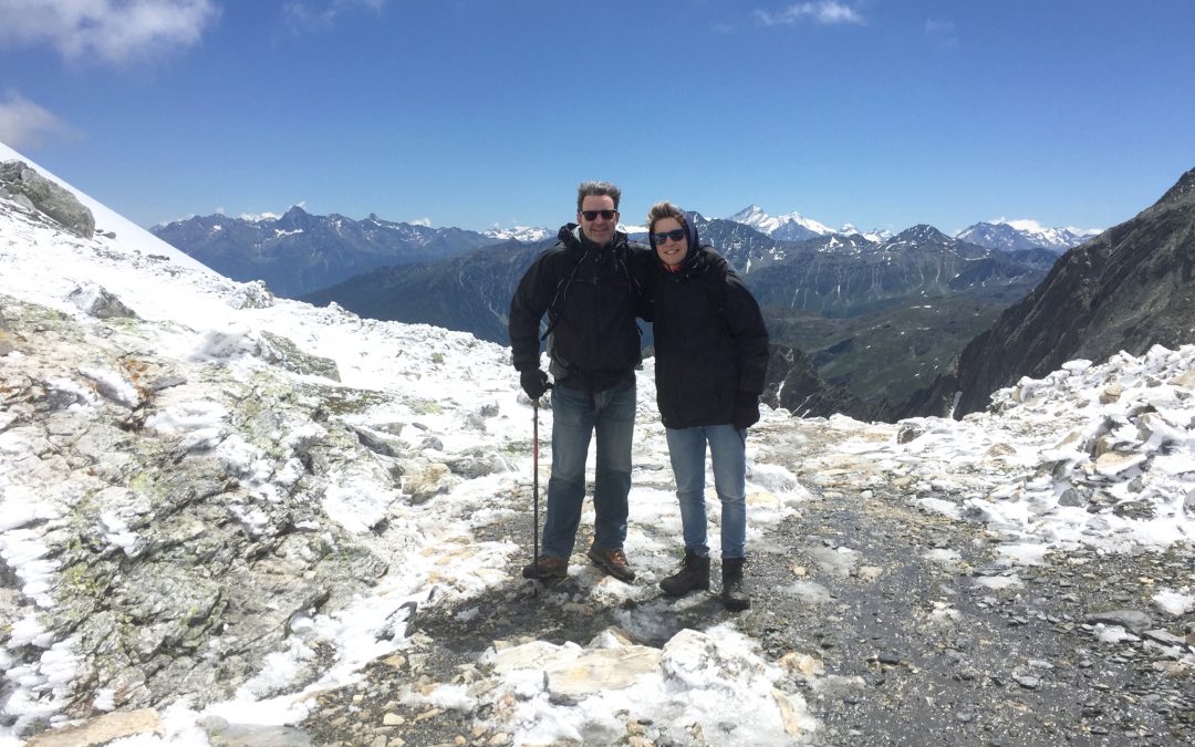
I hiked this trail with my then 16 year old son in the summer of 2016. We flew to Geneva and made a 2 hour drive to the village of La Fouly, where we camped at the amazing Camping Des Glaciers. This campsite alone is worth a visit, as it is located at the end of the Glacier de l’A Neuve at 5,250 feet / 1.600 m.
A note for American hikers: like in most other European campsites, there are no picnic tables (nor fireplaces) on the sites. Bringing lightweight camp chairs is a good idea.
La Fouly is a Tour du Mont Blanc hub and it can be a bit busy. Some tourist groups arrive with tour buses, but most people come walking all the way from Italy or France. And this creates a good atmosphere in the village.
La Fouly has a small grocery store and an outdoor shop next to one of the hotels. Be prepared that the groceries are very expensive, as to be expected in such a remote village. The hotels offer rooms and dormitories. There is also a small restaurant in the village with good pizza’s.
The trailhead: Les Ars Dessous
The trailhead is just a 15 minutes drive from La Fouly, heading south to Ferret. The trail is also a side trail from the Tour de Mont Blanc. We saw a lot of hikers at the first lake halfway up, although the trail itself was not crowded at all. At the top of the pass we only saw two or three people.
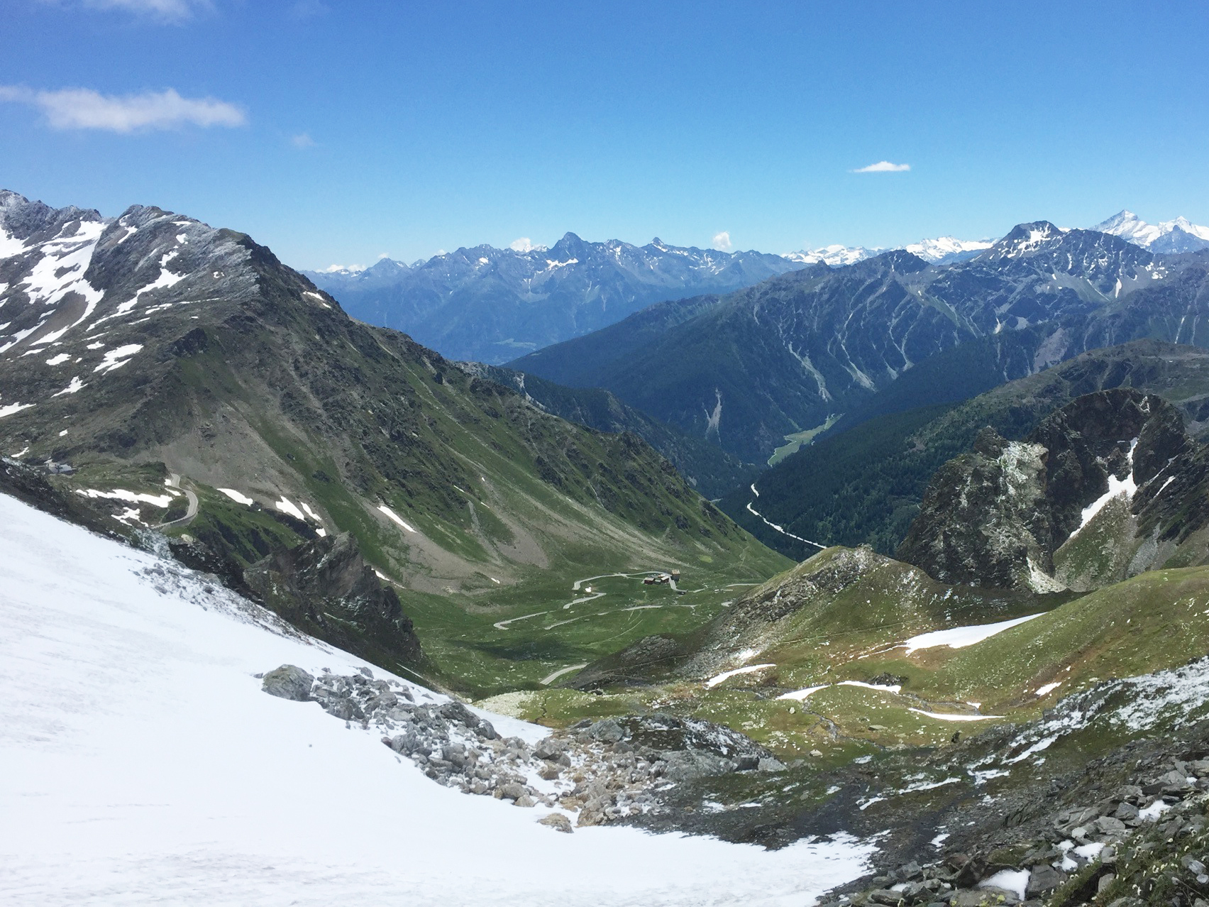
If you like an extra walk through the beautiful valley of Ferret, consider starting your hike in La Fouly. This will add another 4.2 miles / 6,8 km (round trip) to the hike. We took it easy and drove the 2.1 miles / 3,4 km south to the farm Les Ars Dessous (not to be confused with Les Ars Dessus, 1.8 miles / 3 km up the trail. Dessous = below, dessus = above). The farm sells Swiss cheese and soft drinks. A good place to have a rest after your hike.
There is a parking spot for one or two cars at the side of the road. You can also park your car a bit further down a gravel road to the right, where you will find a bigger parking lot at the riverside.
We had some trouble finding the trailhead so we walked the first mile on the asphalt road, whereas the real trail should have been a bit above us on the left. Soon we found an entrance to the higher trail and we could leave the asphalt. Most other hikers did not seem to know this trail and kept on walking the asphalt, a much longer and less beautiful route.
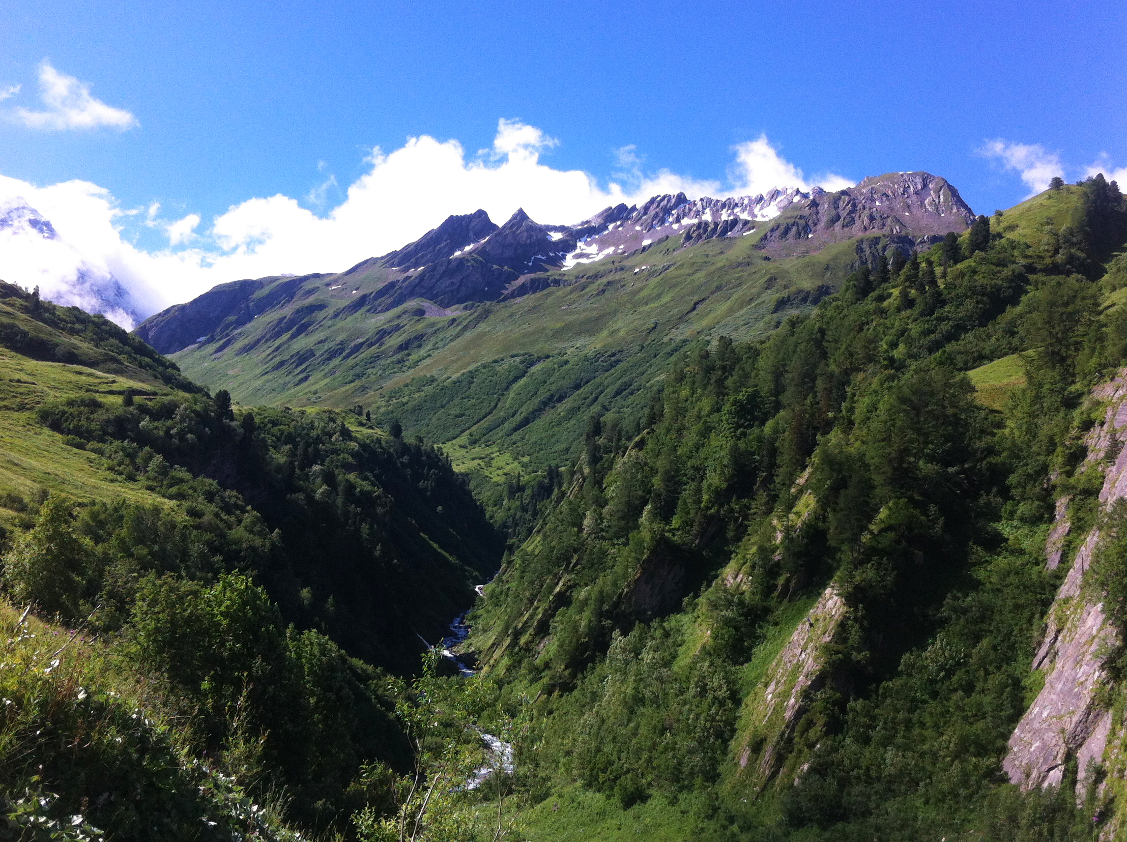
The first snowy mountain tops
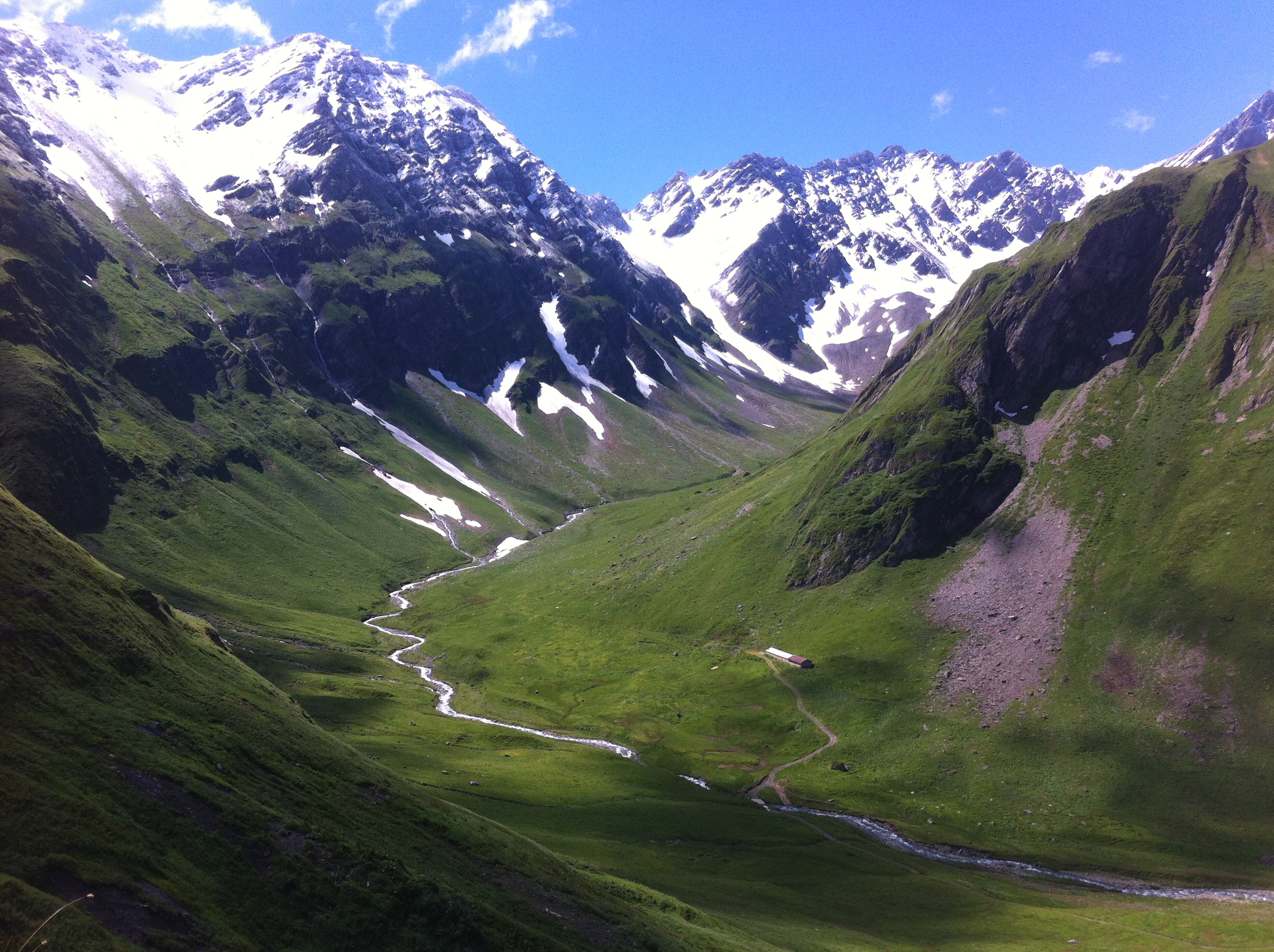
After we reached the last farm of the valley, Plan de la Chaux, the trail became steeper and I actually had a moment of altitude sickness (a nausea that soon went away after sitting down a few minutes). With every step more and more high and snowy mountain tops rose up behind the lower ones.
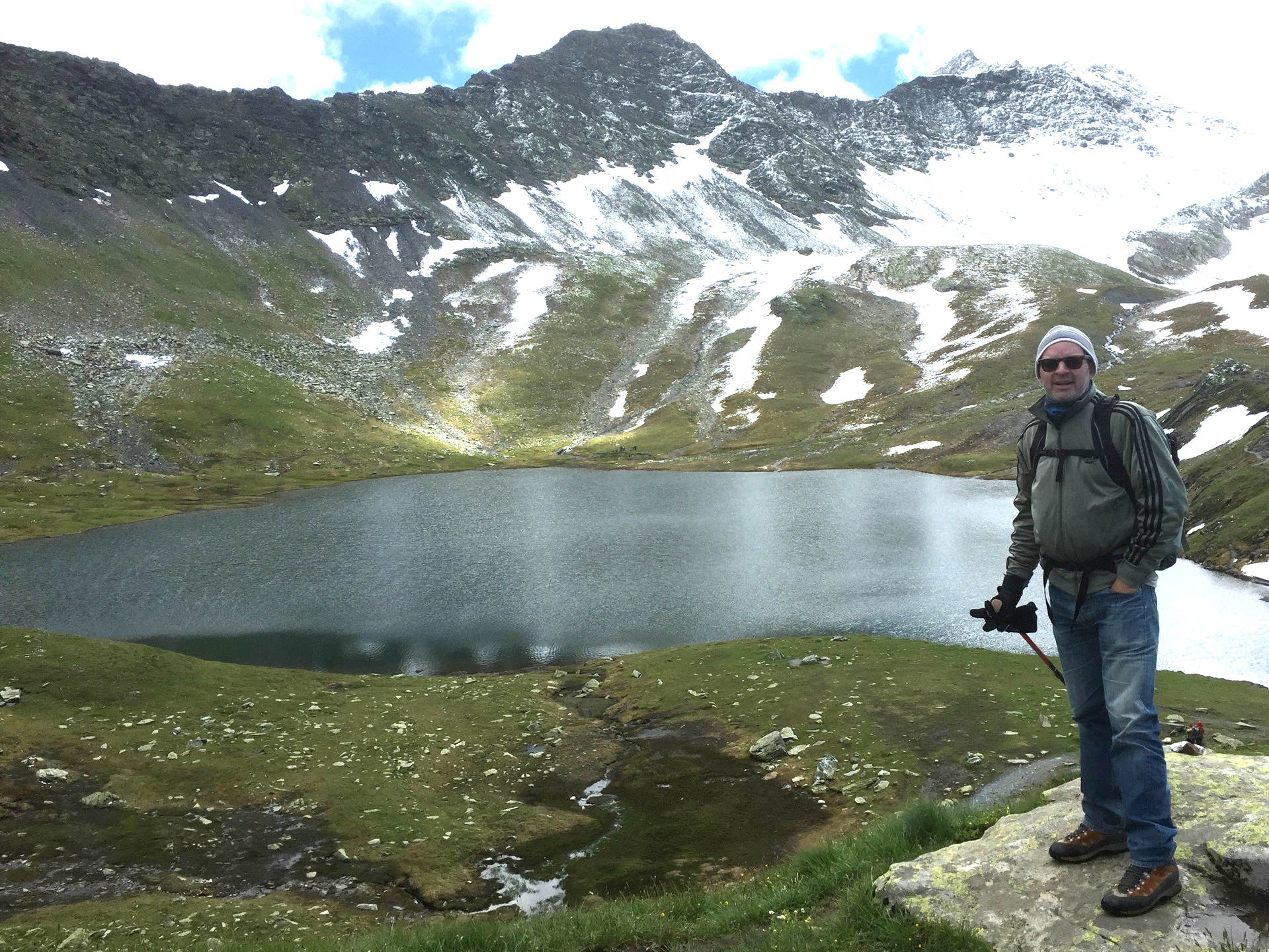
The first of the Lacs de Fenêtre, at 8,057 feet / 2.456 m.
The Lakes
About an hour before the pass there are three beautiful lakes, Les lacs du Fenêtre. Although it was a warm and sunny day, as soon as we reached the lakes it became colder and we put on our extra jacket, hat and gloves.
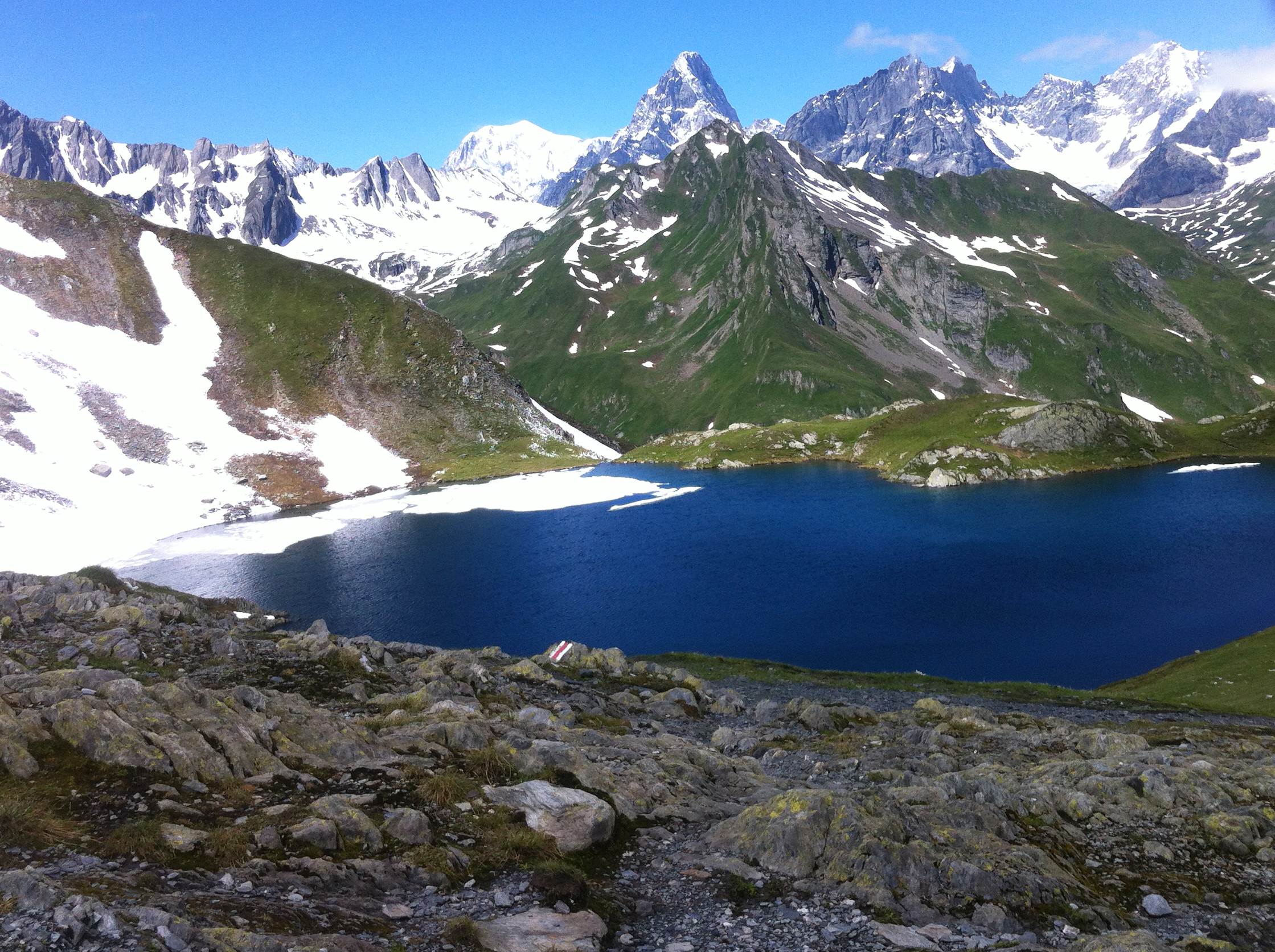
The views from the lakes were incredible. To the South the Swiss-Italian mountain tops rose up, to the North we saw the entire valley of Ferret behind us. We took a lunch break in a secluded spot above the lakes. We tried to boil some water for a cup of noodle soup. Here I learned that my Camping Gaz stove did not work at this altitude. Instead we used the hot water from a thermos bottle that I had intended for a cup of tea.
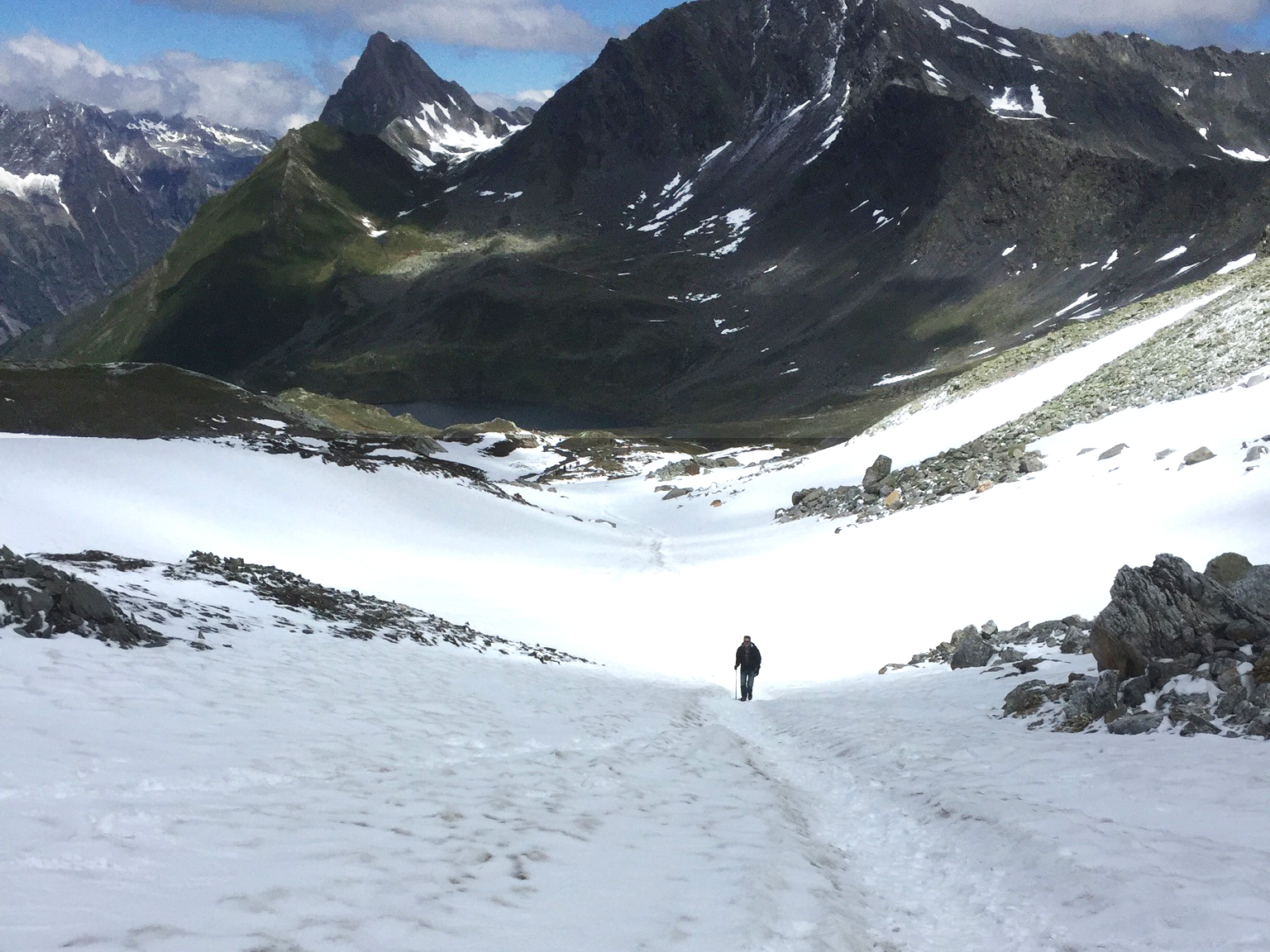
The Pass
The final stretch to the pass was through a big snow field. From down below this looked quite intimidating, with the fierce winds that were blowing. We put on our raincoats for extra protection and stepped into the snow. Within 15 minutes we reached the pass.
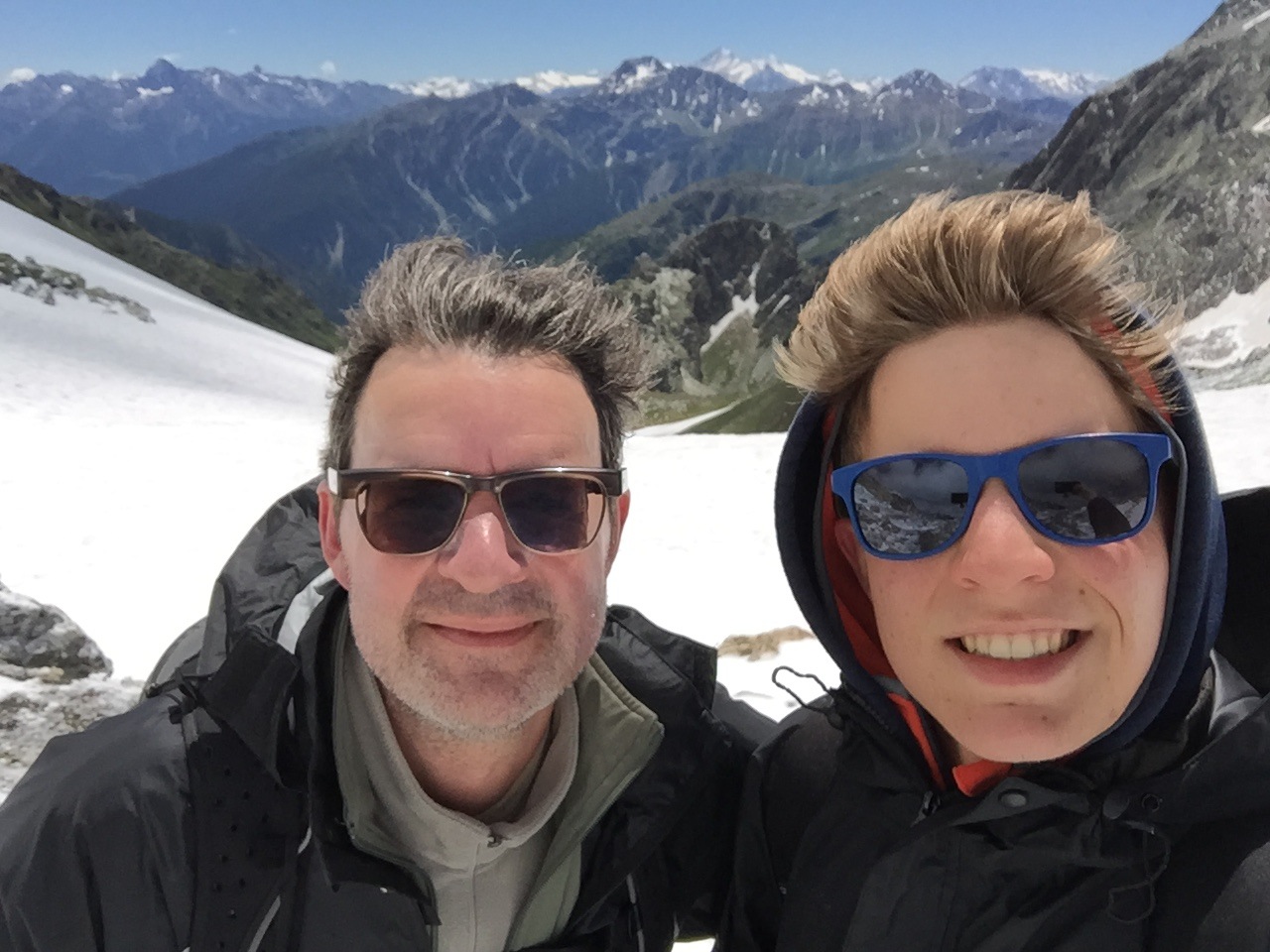
I was tempted to hike down to the Italian side of the pass to reach the Grand St. Bernard pass. But that would have required a much earlier start of our hike. We did take a couple of steps into Italy and then our phones started beeping with welcome messages from the Italian telephone company we connected to.
On our way back we tried to sleigh down the snowfield on our foam sit pads, which didn’t really work. So we continued skiing down on our boots. Which didn’t work either. But the snow was not intimidating anymore and before we knew we were back at the lakes.
Further down we peeled off our layers of clothing every 10 minutes until we walked in our T-shirts again. We got back to Les Ars Dessous where we sat down with a cold drink and a view back into the valley and amazing mountains we just climbed.