The tenth and final day of the Haute Route started with the nerve wrecking Charles Kuonen suspension bridge and featured more sketchy passages along the trail to Zermatt, the end of the thru hike.
Haute Route 10: Europahütte to Zermatt
Start: Europahütte, 2.220 m (7,283 ft)
End: Zermatt, 1.605 m (5,265 ft)
Distance: 21 km (13 mi)
Elevation gain: 700 m (2297 ft)
Elevation Loss: 1.365 m (4,478 ft)
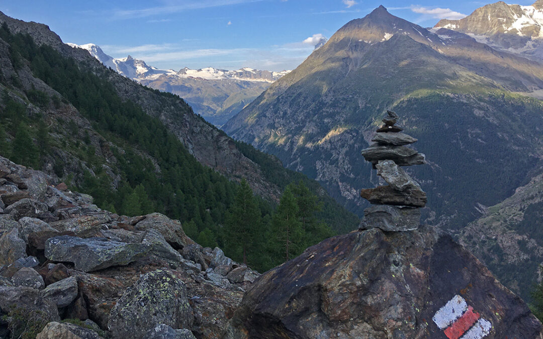
Highest point: about 15 minutes before Tufteren 2.349 m (7,706 ft)
Time: 6:45 hrs moving time; 8 hrs total time
Date: August 10, 2020

Haute Route day 10: Europahütte to Zermatt – Note: North is on the left
The Charles Kuonen Suspension Bridge
The breakfast in the Europahütte was served at 7 a.m., way too late for me. Being used to wake up much earlier, I was ready to hit the trail at 6 a.m. but I decided to wait for breakfast. This turned out to be the wrong decision, because the breakfast consisted of nothing more than cheap pop corn like muesli with lukewarm milk, stale bread and some jam. Not worth my time. Anyway, at 7:12 I was already hiking down to the first challenge of the day: the Charles Kuonen Suspension bridge.

The Charles Kuonen Suspension bridge
The suspension bridge just below the Europahütte spans 494 m. (1,621 ft) and runs 85 m. (279 ft) above the ground. As the bridge was getting closer, I started to feel rather nervous. Although I knew the bridge was built for a safe crossing of the ravine below, I was intimidated by the look of it. It took me just 5 minutes to cross the bridge, but I did not dare to look down and I tried to concentrate solely on the plastic orange balloon on the opposite end.

Another view of the almost hidden Matterhorn from the Europaweg
When I reached the other end of the suspension bridge, I met two Swiss hikers. One of them was having a bit of a panic attack. They decided to hike down the trail to Randa in the valley once they saw more vertigo inducing paths around the corner. The continuing path was rather sketchy indeed: a partly collapsed trail above steep scree slopes were awaiting, sometimes secured with ropes.

The Wildikin tunnel
Hiking on slowly and carefully, I reached the so called Wildikin tunnel piercing through the red-yellow rocks. It was pitch dark in the tunnel, although apparently solar powered lights should have illuminated the passage. It was pleasantly cool inside, a welcome feature now the hot sun had reached the slopes.

Looking back at the Wildikin tunnel with the Weisshorn in the background
After the Wildikin Tunnel there were no more scary parts and the trail felt like an easy and pleasant stroll.
There was no water source along this part of the trail, and although I had enough drinking water with me, I longed for a stream to cool down my feet and body for a while as the temperature was rising.

View of Täsch in the valley and Matterhorn in the distance
Just before a small bridge across Wildibach at the junction to the Kin Hütte, I found a field of Edelweiss flowers. A rare sight, as they only grow at a limestone rocks at a specific altitude about 1,800–3,000 m. (5,900–9,800 ft). It was only the second time in my life I saw the Edelweiss in the wild.

Approaching Täschalp
Täschalp
Halfway to Zermatt (about 4 hours from the Europahütte) there is a small village along the trail high above Täsch, hidden between two mountains: Täschalp. To confuse hikers, this village is called Ottavan on the signs, but Ottafe on some maps. To further confuse things, the local restaurant/lodge is called Europaweghütte (note the tiny difference in the name of the hut I left this morning). So future HR-hikers, note there are two huts very close in location and name.
I was looking forward to this village, especially to refill my water bottles and maybe to eat lunch at the restaurant. But when I got there, I found the restaurant closed, and so was the water fountain!

Looking East from the Mellichbach crossing
Leaving Täschalp I found a very nice spot under the wooden bridge crossing the Mellichbach. I filtered two liters of water from the brook and made myself an electrolyte drink. I had lunch with the last morsel of Swiss cheese I saved from Sankt Niklaus, cooling my feet in the ice cold water. A lovely place to rest, with excellent view both to the east and the west.
Blue grey clouds started to form above me, which I welcomed at first because it protected me from the blazing sun. But then light rain drops began falling and I knew it was time to move on.
Tufteren
The next part of trail consisted of very broad gravel paths, dotted with several metal shelters meant to protect travellers against rock fall. Later, a long stretch of trail had a concrete roof to hike under. Probably all built with the best intentions, but all in all it made this part of the hike less enjoyable.

The slate roofs of Tufteren
Now during the last part of the Europaweg to the hamlet of Tufteren something strange happened. I had been hiking this balcony trail for about 7 hours now, and the view of the Matterhorn in the distance began to loose its magic. When I looked across the valley for the twentieth time in a row, I began to feel bored with it even before I actually came up close to this world famous mountain. This is probably the price of hiking a wonderful trail like the Haute route: you become spoiled.
Zermatt
At Tufteren, the official Europaweg goes down directly to Zermatt. The guidebook of the Haute Route however directed me further south to Sunnegga. This detour would bring an even more spectaculair view of the Matterhorn for sure, but now it was all cloudy and the mountain almost invisible, I decided to hike down to Zermatt directly.

View of Zermatt from the final section of the Europaweg
Hiking down through the woods, I arrived at Zermatt within an hour. Suddenly I was walking on a tarmac road through the village but I did not have the feeling of achievement I should have had, finishing the Haute Route. It was just too strange to be in such a modern and busy village, with high rise houses, a lot of concrete buildings and too many expensive shops and expensive people around me (I almost bumped into the UK’s former prime minister Theresa May).

Zermatt camping behind the railway station
Hiking straight through the village I soon found the campsite, wedged in between the railroad, the Denner supermarket (handy!) and a kindergarten. The campsite was a bit primitive in contrast to the rest of the village, but it was cheap and a hot shower is always great, no matter what.
But before I could indulge in a shower and fresh food, I had to pitch my tent under a dark threatening sky. Exactly at the minute my tent was pitched, a heavy downpour started. I jumped inside, closed the tent tight and laid down on my sleeping pad. Thus ended my 10 day thru hike. After 186 km (116 miles), 63,5 hours of hiking, a total ascend of 11.024 m. (36,167 ft) and 10.165 m. (33,349 ft) descend I had finished the Haute Route. Listening to the raindrops hitting the thin plastic shield above my head, I was completely happy.
Epilogue: Pension Edelweiss
The rest of the afternoon I spent around the campsite, which was nice when the sun returned. The Denner next door is a paradise for hungry hikers and I had a dinner in front of my tent with a view of the Matterhorn lit by the last sun rays of the day.
The next day I took a short hike of less than 30 minutes up to Pension Edelweiss, where I had booked my final night before taking the train and airplane back home. This hut/hotel/restaurant is the best place to stay in the whole Zermatt area, in my opinion – away from the crowds, high on a rock with a view of Zermatt and the Europaweg (no view of Matterhorn though).

View of Zermatt from Pension Edelweiss
The food in Pension Edelweiss was delicious, the atmosphere relaxed and the staff very friendly. Especially the rooms were fabulous, with old creaky wooden floors and beautiful antique furniture. I spent the last day reading, writing and enjoying my meals and meanwhile I dried out my tent in my room.
Early morning the next day I grabbed a sandwich from the breakfast table and hiked down to the Zermatt train station and began my long journey home.
< Previous: Haute Route 9: Europahütte
Hi Pieter,Next week we are walking in Switzerland. The information of the stage between Grachen and Europahutte is very useful for us. It sounds as if starting at Herbriggen for that stage might be the better option.
After our walking holidays in the Dolomites the last years, we are looking forward very much to this walking holiday, and your website is very inspiring and useful. Thank you
Thank you for your compliments!
And yes, as far as I know, the Europaweg between Grachen and the Europahutte is still closed. Moreover, I have read that a bridge on the trail from Herbriggen is devastated. So the only option to reach the Europahutte would be an ascend from Randa. The bridge might be repaired by the time you get there – best to get information when you get to the valley in Sankt Niklaus.
Have a very good trip!
Hi Pieter, Great account. I will be on my way to do it in 2 days time and your account is fabulous. I too have a zpacks duplex and was thinking of not taking it but I do love camping and far prefer it to sharing a room. So I have noted the campsites you mention and it is definitely coming. After Cabane du Mont Fort I am heading for Cabane les Ecoulaies. I have not received a reply from them but hoping it’s early enough in the season for there to be space. Hoping I will meet someone like your friend Keimpe up there. It looks very barren and your photos show how it looks in bad weather. Thank you so much for sharing
Hello Alli, that’s great, I hope you have a good time on the Haute route. Taking your tent is a good idea, even if it is for just half of all nights on the hike.
Le Ecoulaies: I think you have a good chance that there is place for you, and if not, just a short hike further on you will find another (unmanned) hut: La Barma. In case of emergency you could always pitch your tent somewhere along the lake. Just watch out for the cows.
Hi Pieter, I’ve just read the whole of your account again. We’re all booked to hike the Haute Route in September 2022. Fingers crossed for reasonable weather.
That’s great to hear! Have fun, it will be beautiful no matter what.
What a great post! Thanks so much for all the info. I hiked the via Alpina with my daughter before Covid and had a great time. This summer I am planning the Eiger trail to Zermatt with my youngest son and will get to hike some of the Euroweg. As I will hike from Kandersteg to Leukerbad, I am trying to figure out the best way to Turtmann and maybe stay in Oberems. Then Gruben to Augustbord pass to jungen then cable car to St. Niklaus. I wanted your opinion on just staying in Randa and just do a loop to the bridge then back to Randa. Then I could train to Tasch and climb to Taschalp to Sunegga to Zermatt.
Lots of ideas as you can see… any ideas or suggestions would be much appreciated!
Best to you,
Marc
Hello Marc, thanks for your comment. I would like to hike the Via Alpina some day too!
As for your ideas: I think the Europaweg offers much more beautiful trails than the roads down in the valley. So I would recommend hiking up from Herbriggen instead of hiking up from Randa. The Europaweg trail to the Europahütte is not difficult.
The only difficult part is just after the bridge from the Europhütte. Then all the way to Tufteren and eventually Sunnega: the higher you stay the better, in my opinion. Zermatt gets crowded in summer.
Have a nice time!
Pieter
I appreciate your post. Fun to read about your experience. When did you do this hike?
Hello Kent, thanks! I did this hike in August 2020. Have you hiked this trail?
Thanks so much for this fantastic account of your hike. I plan to hike the Haute Route with my husband in September 2021 and this is just the best account I’ve read.
Hello Judith,
Thanks for your kind comment! Are you going to do the hike in 2022 or have you just finished it?