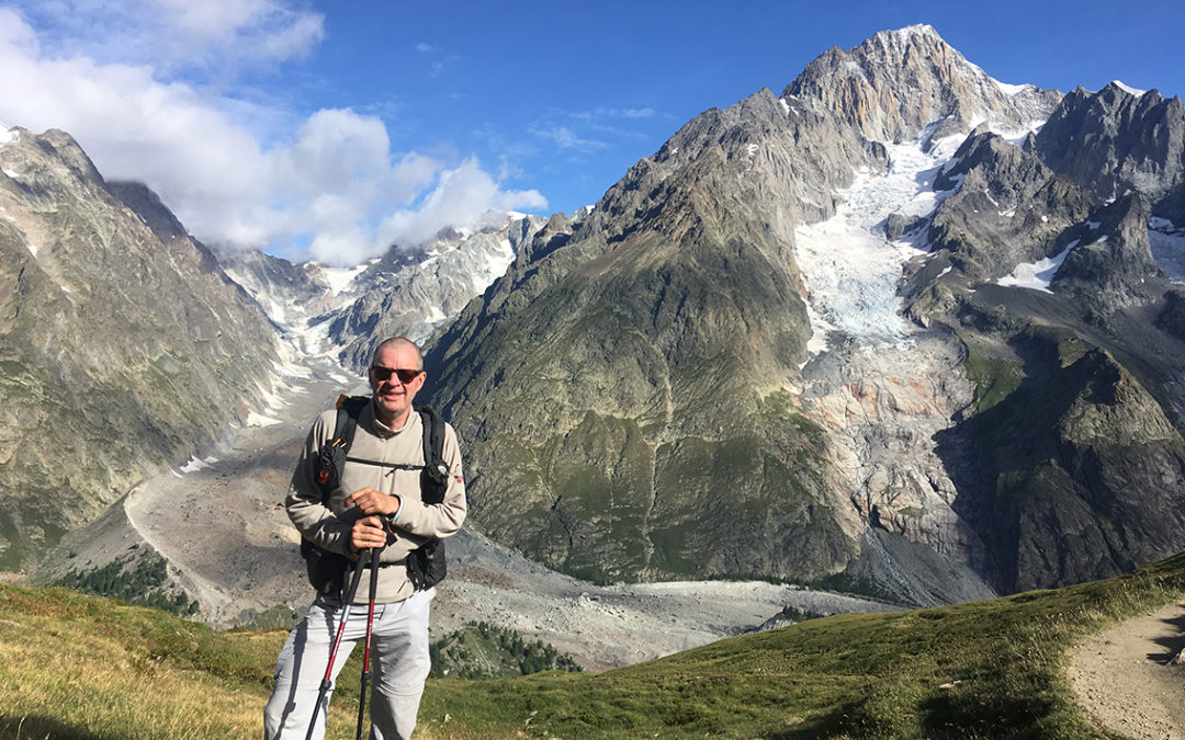
Day 4 of the Tour the Mont Blanc would be the longest day of all. Along majestic glaciers, mountain tops and refreshing lakes, I hiked all the way down to Courmayeur. And up again in search of a legal campsite. I reached camp after 12 hours of hiking and a distance of 32 km.
Day 4: Col de la Seigne – Tronchey
Start: La Casermetta (30 minutes east of Col de la Seigne)
End: Tronchey Campsite
Distance: 32 km (19,9 miles)
Highest point: Viewpoint above Arp Vieille 2.430 m (7,972 ft)Elevation gain: 1.382 m (4,534 ft)
Elevation loss: 2.114 m (6,936 ft)
Time: 9:00 hrs moving time; 12:00 hrs total time
Date: August 15, 2019
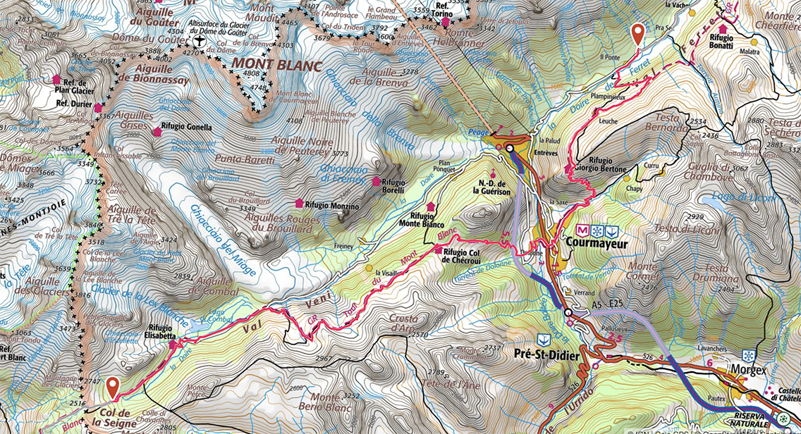
TMB Day 4, map by France IGN Topo / Gaia GPS
Val Veni
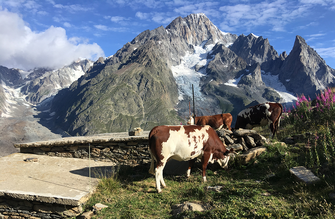
The night had been quite cold, with a fierce wind blowing. But the stone building of La Casermetta, were I camped with two groups of hikers, kept our tents out of the wind. The cows in the meadow below us were walking around all night it seemed, their bells were ringing until I was lulled into a deep sleep.
In the morning. before 6 a.m., I started packing and preparing my breakfast, with the sun rising above the valley before me. At 7.15 I was on the trail, after saying goodbye to my new Israelian friends, that were heading in the other direction, doing a clockwise TMB. My Belgian fellow-hikers were heading east just like me, so we would keep on meeting on the trail.
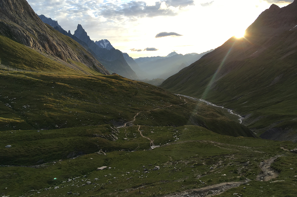
The view towards Val Veni, from La Casermetta
What a beautiful morning it was! Nothing is better than hike very early, with no one around except for the cows and a few marmots that crossed my path.
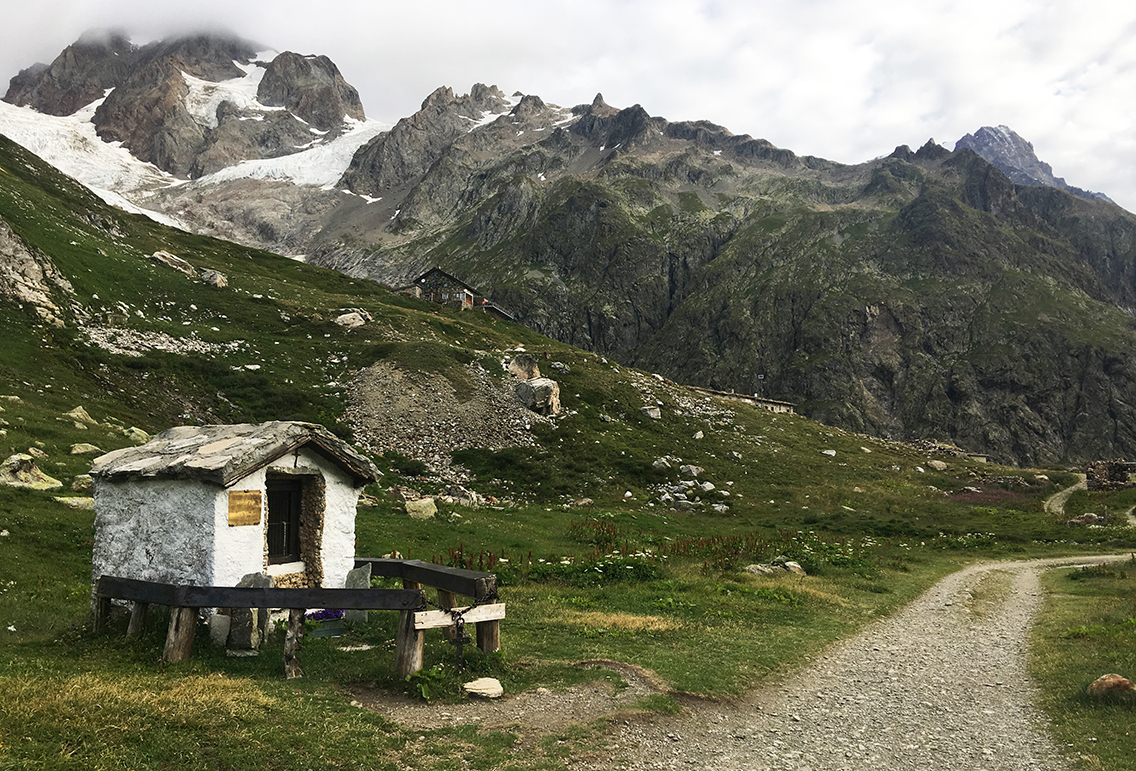
The chapel at Rifugio Elisabetta
The trail was going down easily for half an hour until I came close to Rifugio Elisabetta. It was way too early to have a break there (the hut would probably not be open anyway at this hour). The rifugio was situated higher above the trail, and seemed to be very close to a big glacier, a very dramatic scene. Closer to the trail were a lot of abandoned buildings, half in ruins.
The rifugio was awaking. Just when I passed the hut, the first group of hikers on a guided tour were coming down just behind me.
Lac Combal
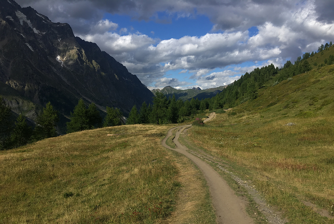
The trail took a few sharp turns and then I walked into the Val Veni, over a very straight and flat gravel road to the Lac of Combal. The Lac Combal is not a big lake, it looked more like a swamp. The surroundings were already very beautiful here, with the mighty walls of rocks around me. I could not know how much more impressive it soon would be.
Just before the bridge to Combal hut on the left, the TMB turns right, up to L’Arp Veille on a steep and rocky trail. Studying the signs, the Belgian hikers Jelle and Suzy already catched up with me. They were such fast hikers! I would loose their tracks within 10 minutes again.
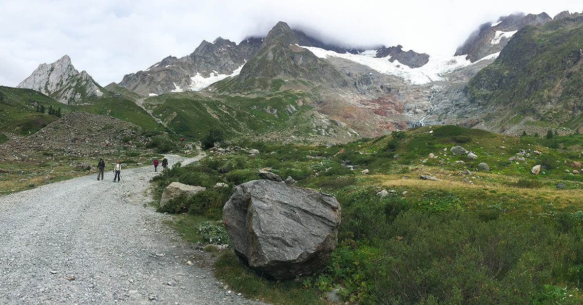
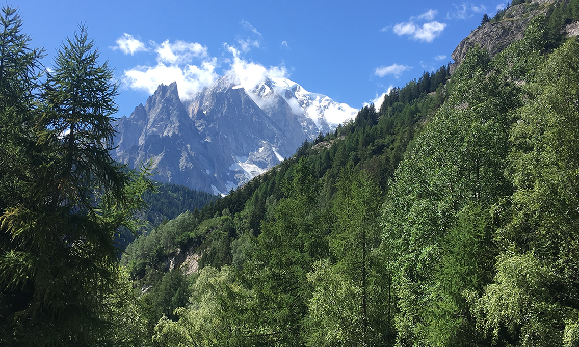
Miage glacier from l’Arp Vieille
Getting above the tree line at l’Arp Vieille, the Miage glacier presented itself, a mass of ice, covered with gravel, flowing from the great Mont Blanc massif. The sun was out now, the meadows sunny, promising a beautiful day.
It was beginning to get busy on the trail, even some cyclists were heading down on the footpath. I wasn’t too happy about that, although most of there were very friendly. But I still cannot really understand that cycling is allowed on such an already fragile trail.
View into Val Veni and Val Ferret
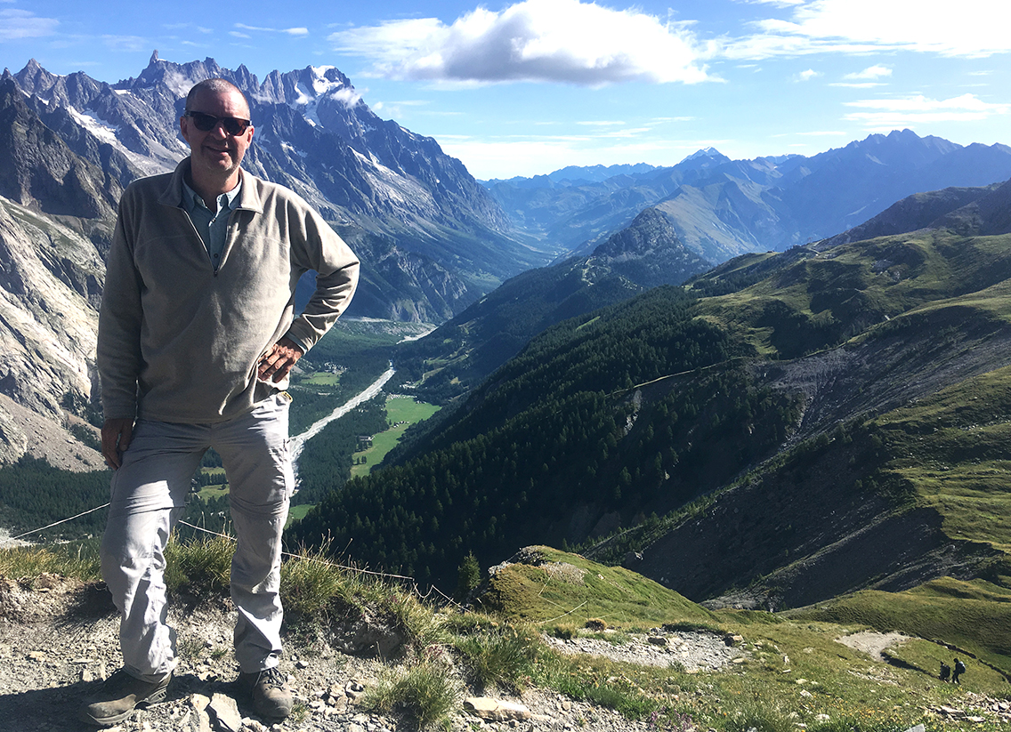
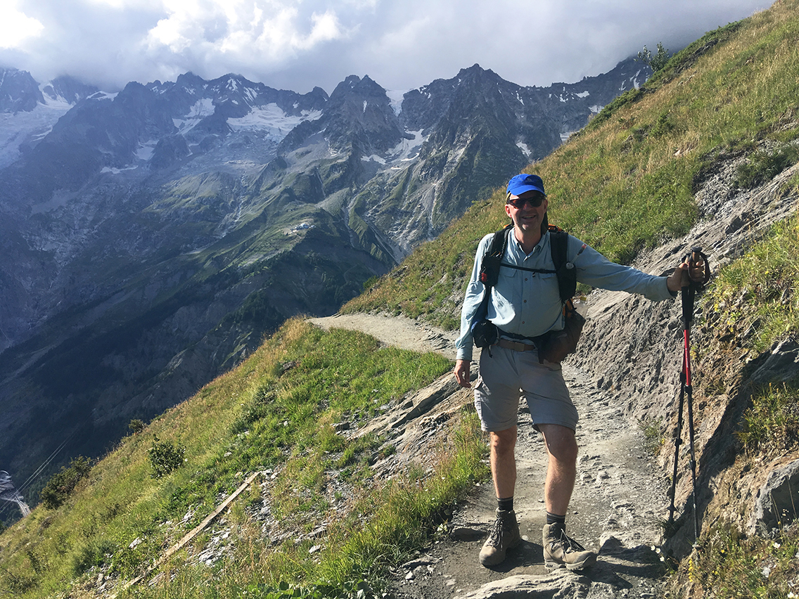
The trail was getting higher and higher, until it turned around a hilltop, the highest point of the trail today (2.430 m / 7,972 ft). The view of the plus-4.500-meter high mountains and the valleys beyond was really stunning. looking north-east, Switzerland was already visible – two days of hiking away.
I shared the view with two dozen other hikers (and some cyclists). I could have been annoyed by this small crowd, but there was a really friendly atmosphere among the hikers. So I had a relaxing break with a snack, before starting the 4 hour descent to Courmayeur.
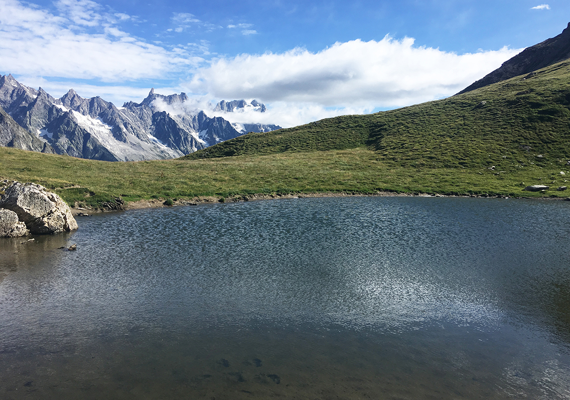
Lac des Vesses between the high viewpoint and Checrouit
Wat followed was one of the most pleasant parts of the TMB. An absolute amazing view, a trail going down very easily, not too steep. And within half an hour a small but beautiful lake, Lac des Vesses. I took the opportunity to cool down my feet in the water, where I saw small black tadpoles swimming around.
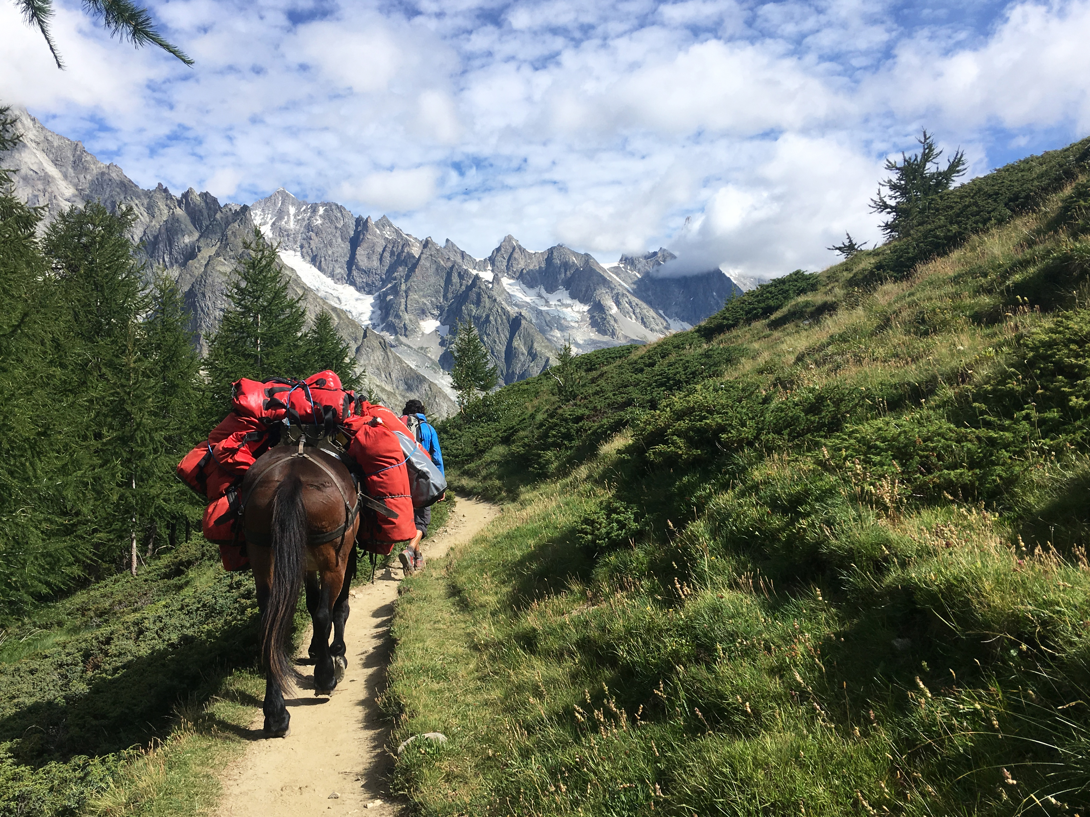
A familiar sight now: the mule with the red packs.
Lac Chécrouit
Refreshed from the small lake, I headed on towards Col Chécrouit with refugio Maison Vieille. The name is French – not Italian! – for ‘Old House’. The trail was still very beautiful, but it was starting to get hot now, although it was not even 11 am. After about an hour, I reached a bigger lake, Lac Chécrouit.
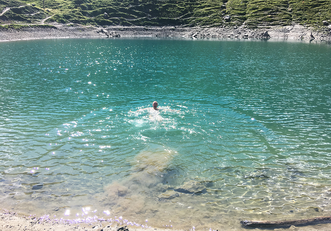
Lac Chécrouit (thanks to Jelle for the photograph).
Lac Chécrouit was of the clearest turqoise water, and it was beckoning me to jump in. I was melting hot from the last hour of hiking, so I stepped down from the trail, towards the lake. When I came to the little beach, there were Jelle and Suzy again! Jelle had just taken a dive and now it was my turn. Stripping off my clothes except for my underwear I dived right in. The freezing cold water made my skin tingle like a thousand needles and the water was so cold, I was afraid I would faint. But really, it was one of the best dives in my life.
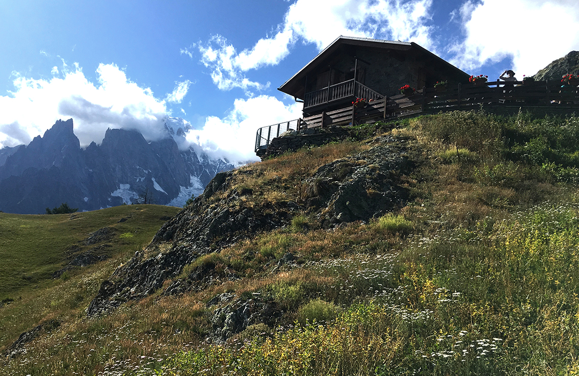
Refugio Maison Vieille
After another 2 or 3 jumps in the lake, I wanted to move on. I didn’t even bother to dry my body, except for my feet. I just put on everything over my wet skin. Thus I created a natural airconditioner that would keep me cool for the next hour.
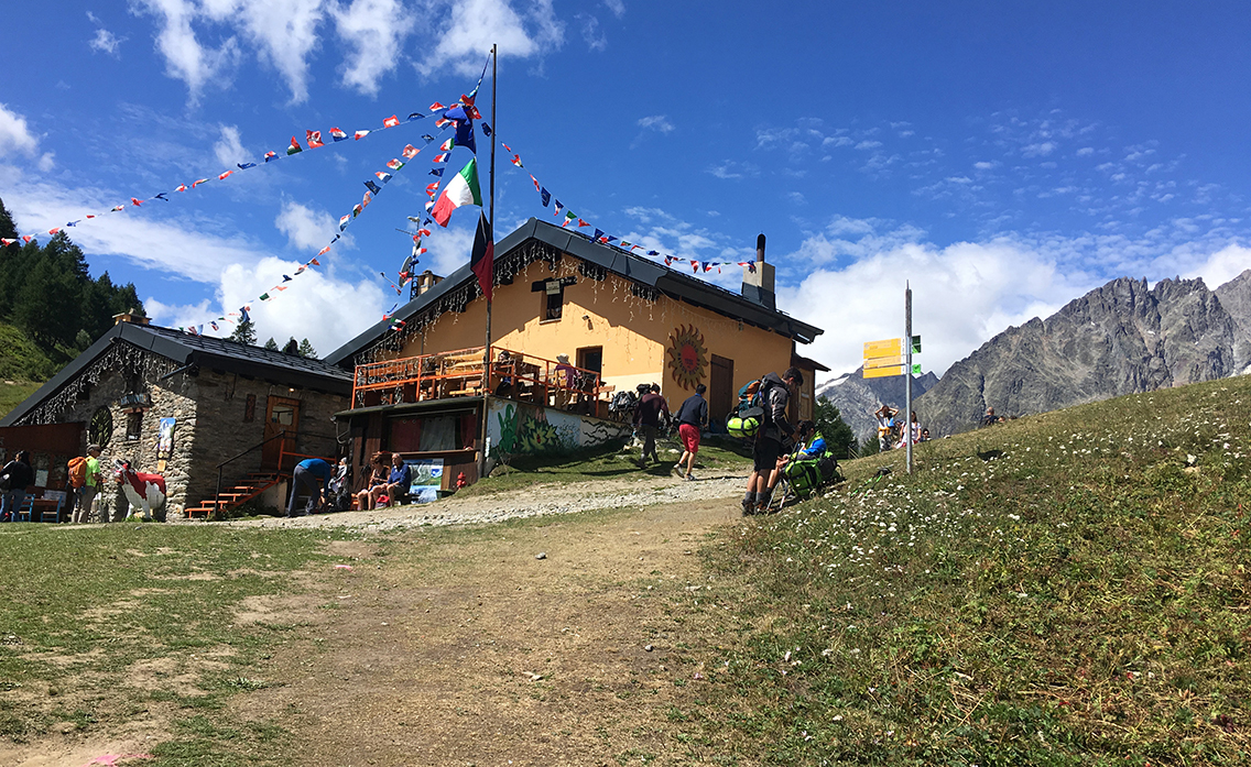
Maison Vieille
The closer I came to the Maison Vieille, the more people were climbing up the moutain towards me. Not hikers, but people in flip-flops and very clean shirts. Apperently they had come up with the gondola’s a bit further on.
It was about noon when I reached the rifugio, on top of the Col Checrouit, looking over the Valey of Courmayeur. The refugio had a real nice and open atmosphere, but it was kind of crowded and there was hardly any shade. I joined one of the British hikers from the group I met before, sitting on the ground in the narrow stretch of shadow of one of the buildings. I had a drink and ate some food. Refilled my water bottles and tried to charge my phone with the solar charger for a while.
As usual, a half an hour break is enough for me, so at 12.30 I got up and walked underneath the ski-lifts and gondola’s.
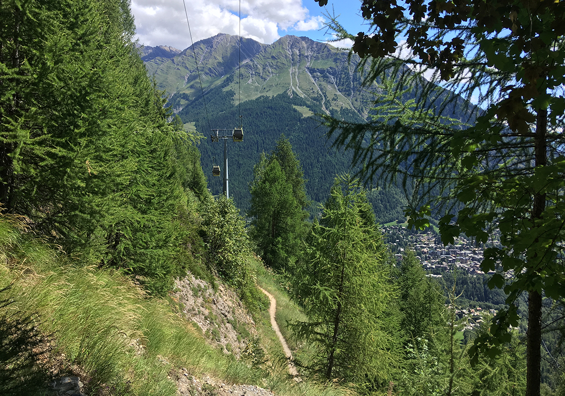
Courmayeur
The trail down to Courmayeur was sweltering hot, but at least I was going down – it would be much harder later on the day going up again! The trail was going underneath the gondola lifts from Courmayeur to La Vieille Maison, but remained under cover of the trees most of the time. The trees gave some shadow, but the heat coming up from the valley was quite exhausting.
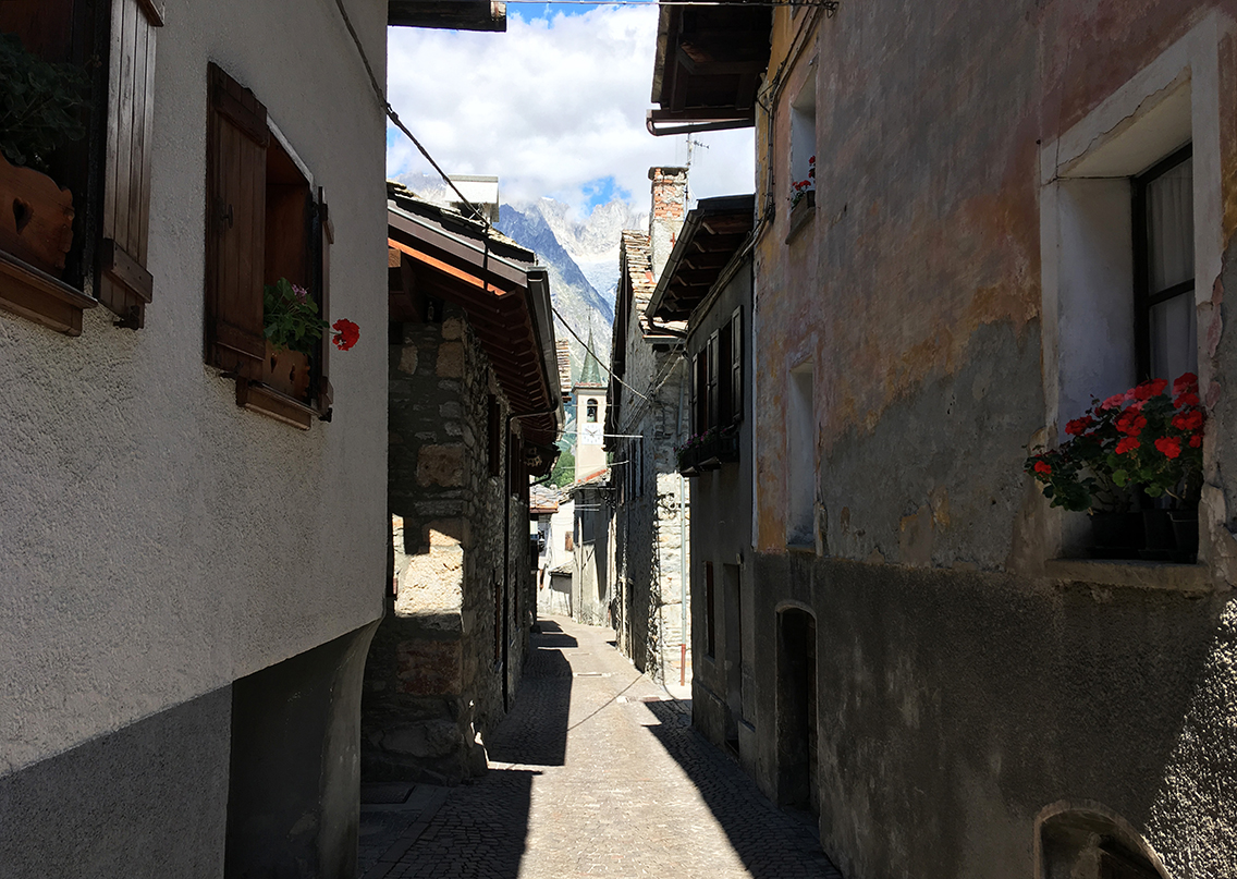
After one and a half hour I reached Courmayeur. The village had nice shady alleys inbetween old houses …and a lot of waterpumps! I soaked my buff with cool water, as soon as I could (having lost my hat at Col de la Seigne, I used my buff as sun-protection).
When I reached the village center, I found a little grocery store, where I bought 4 little yoghurt cans and a box of raspberries. In front of the shop were two tables and some chairs – I really like that service!
It was about two o’clock, I could hardly believe that I had been hiking for 7 hours now. I knew I still had a hard stretch to hike in the afternoon, but I was still feeling strong, and to my own surprise, not really dead tired yet. I still had to buy myself a new hat, so I found a shop where I got myself a blue hat, and walking out of the store, I came across John and Grace again, the siblings I already met on the rainy day 1, and actually on every subsequent day. We were happy to see each other again, and surprised, because we had followed such different routes in different speed.
Rifugio Bertone
Following a road out of of the village, I came to a parking lot, where I caught a glimpse of the Mont Blanc again. The trail went up again, into the woods. Now came the hard part of today’s trail: hot, steep with no cool breeze nor cold lakes, just up, up, up for the next two hours. The higher I got, the steeper the trail seemed to be. NOW I was getting tired. I rested for 5 minutes every 15 minutes. No wonder it took me so long to reach rifugio Bertone at the top.
As always, just when I thought I could not go any further, the rifugio came into sight. Rifugio Bertone lies on a perfect spot, with views of Mont Blanc and the valley. But for now I was more interested in the fresh water spigot and the picnic table in the shade.
Bertone is a nice spot to rest, have a drink and they let you use their toilets for free, which is a good thing.
On the other hand, I never saw so many prohibitive signs. No camping, no sitting here, no shoes inside, no entrance. This seems to be a very Italian thing, all these signs. I didn’t see them in France or Switzerland.
It was 5 pm, and I rested for half an hour, drinking my apple juice, refilling my bottles and calculating the time it would take me to reach the valley.
The trail turned around the mountain and opened to a wonderful view of the glaciers high above, and the entrance of the Mont Blanc tunnel down below. In comparison to the mountains, the tunnel, an amazing engineering project no doubt, seems just a footnote to the Mont Blanc massif that it is going through.
Tronchey
Although it was getting later, about 5:30 pm, and it was cloudy, the sun began burning my skin so fiercely, I eventually wrapped my buff all around my face and head, hiking further, Korean Hiker Style.
From above I had a perfect view of the valley. To the left (west) I saw the camping Les Jorasses, and to the right I saw Tronchey, which looked much more attractive to me with all the green grass and trees.
When I finally reached the bottom of the valley, I ended up the main road, next to Les Jorasses. Now I could clearly see that this was indeed really more like a parking lot for RV’s, no grass and very very crowded. So I took an extra 15 minutes hiking east to Tronchey.
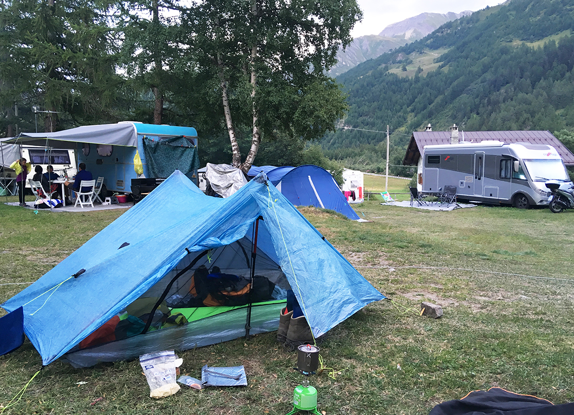
When I stepped into the camping Café, it was 19.15, exactly 12 hours after I left La Casermetta this morning. I was exhausted.
Camping Tronchey is a big family camping, Italian style. This means a lot of big RV’s in a field, very close to each other, televisions, young people walking around in bathrobes with hairdryers in their hand. Such a contrast with the handful of minimalist hikers that camped here!
But I really didn’t mind too much. I was happy to meet with Suzy and Jelle again, who were camping right next to me! They had taken a shortcut today, skipping Refugio Bertone altogether, following the valley floor from Courmayeur.
While I had a beer with Suzy and Jelle, I ate my late dinner: a bag of rehydrated scrambled eggs, one tortilla and about 3 mini yoghurts that I bought in the café for just 50 cents each – which made me totally happy.
> Next, day 5: Tronchey – La Fouly
< Previous, day 3: Les Lacs Jovet – Col de la Seigne
0 Comments