The Sequoia Kings / SEKI Loop is a less crowded alternative for the John Muir Trail, without the difficulty to get a permit. I had been planning my SEKI-Loop trail thoroughly last year. But of course, everything went completely different. Because not a million spreadsheets, vlogs or gearlists can prepare you for the devastating beauty and power of the High Sierra.
Day 1: Roads End to Upper Vidette Meadow
Start: Roads End, Bubbs Creek Trailhead
End: Upper Vidette Meadow campground (Wenck JMT guidebook nr. 11.10)
Distance: 15.7 miles (25,3 km)
Elevation gain: 4,690 ft (1.430 m)
Time: 7:30 hrs moving time; 11 hrs total time
Date: August 30, 2018
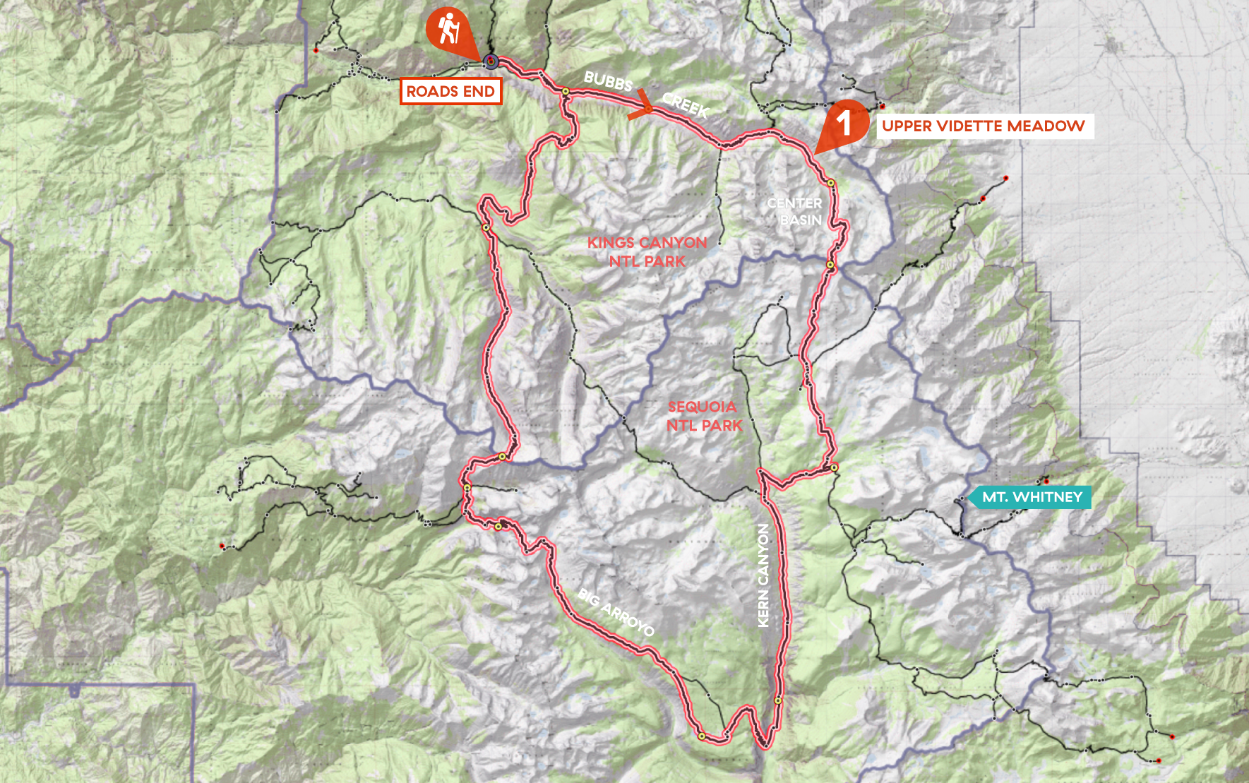
Day 1 of my SEKI loop, map base layer by Sierramapper.
Trailhead to Bubbs Creek
The first day of my thru hike started at 6 am on Sentinel Campground in Cedar Grove, Kings Canyon. Postponing my breakfast, I packed my tent, checked the contents of my Zpacks backpack for the last time and took my rental car for the 10 minutes drive to Roads End. I parked the car at the Copper Creek trailhead and stashed all food and ‘scented items’ that I would not take with me in one of the four sturdy bearboxes.
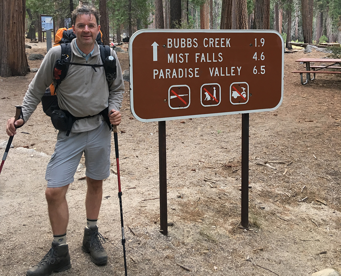
At the trailhead at 7 am, already a line of people gathered around the permit office. I was happy that I secured a permit long ago, and got the official permit the day before. After taking the obligatory photo of me at the trailhead, I finally put my first footsteps on the trail. I felt excited to be there after all the preparations last year. The air was cool and clear and I was full of energy.
Bubbs Creek Bridges and Fires
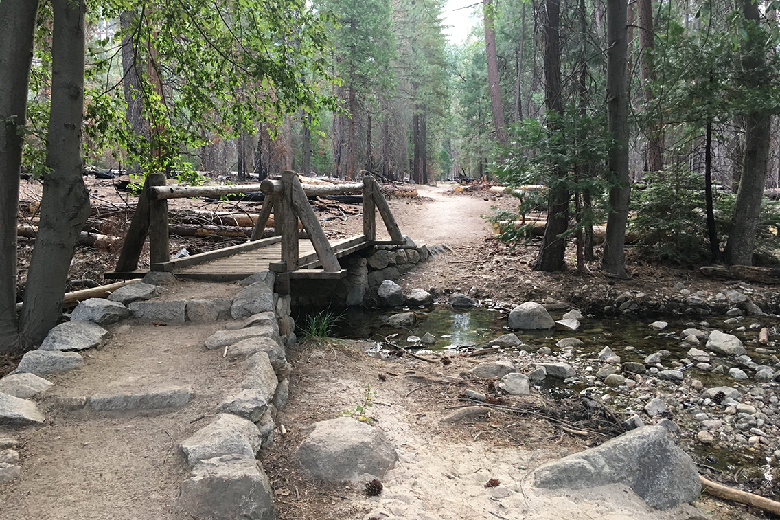
At 1.8 miles the bigger metal Bailey Bridge crossed the South Fork Kings River to take me to the northern side of Bubbs Creek.
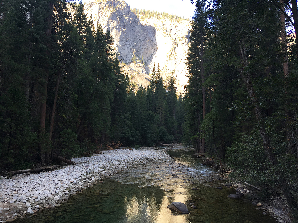
After Bailey Bridge a number of smaller wooden bridges appeared, most of them crossing now dry or very shallow creeks. In the last days of August, the High Sierra was rather dry.
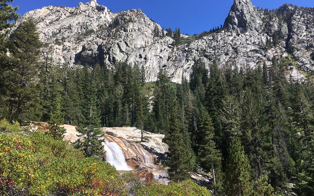
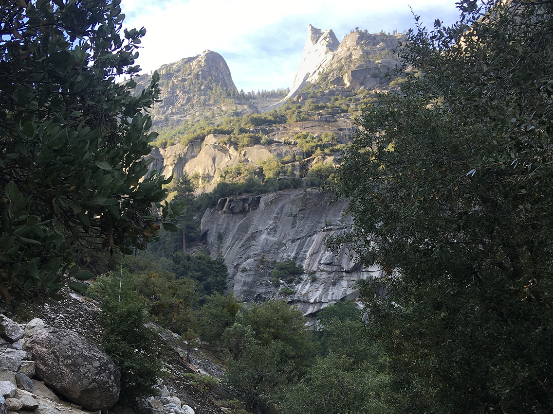
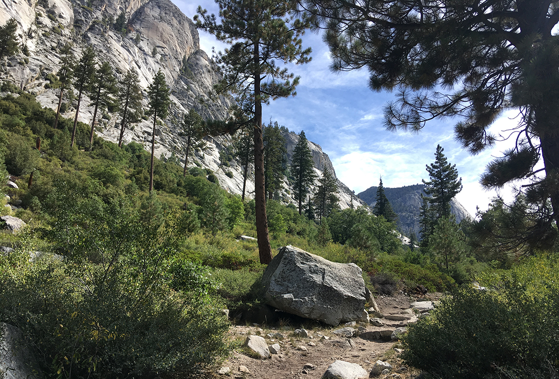
Next, a set of steep switchbacks took me from 5,085 ft (1.550 m) to 6,280 ft (1.915m). After the switchbacks the trail rose steadily higher and higher (finally to more than 9,800 ft (3.000 m) at Upper Vidette Meadow – but I didn’t think about that yet). For this the moment, the switchbacks revealed amazing views of the Kings Canyon to the West and to the Sphinx mountain top to the South.
Recently a wildland fire had been burning in the area: the North Bubbs Creek Fire. The ranger at the permit station had told me that the area was safe now for hiking. Still I saw a lot of smoking or burning trees and the area white with ashes, giving the trail a bit of a spooky atmosphere.
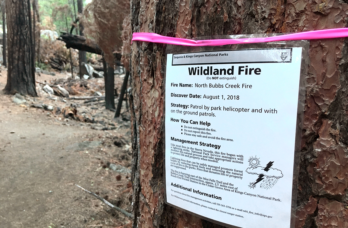
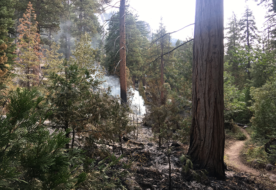
I met a crew of seven firefighters, still cleaning up the area. I thought about how heavy their job is: hauling all those hoses, pumps and extinguishers miles deep into the wilderness. I felt kind of humble compared to these men, with my lightweight pack and all.
Breakfast with Bears
After the fire area I thought it was time to finally have my breakfast. I took off my boots, soaked my freeze dried granola in cold water and sat quietly on a rock for about 30 minutes, enjoying my late breakfast. Little did I know there was actually a bear (or more) quite close.
Not much later I saw a bear closer than I ever saw one in a zoo. Just a few feet on my right hand, enjoying his late breakfast. I was terrified, for I did not know if walking on was a good idea. From what I’d read, you should never run from a bear, because it might incite his chase instinct. I wasn’t exactly running, but very speedy I walked! I just kept on singing to chase away other bears and kept up my high tempo for about a mile or two.
Filling up on water at Charlotte Creek
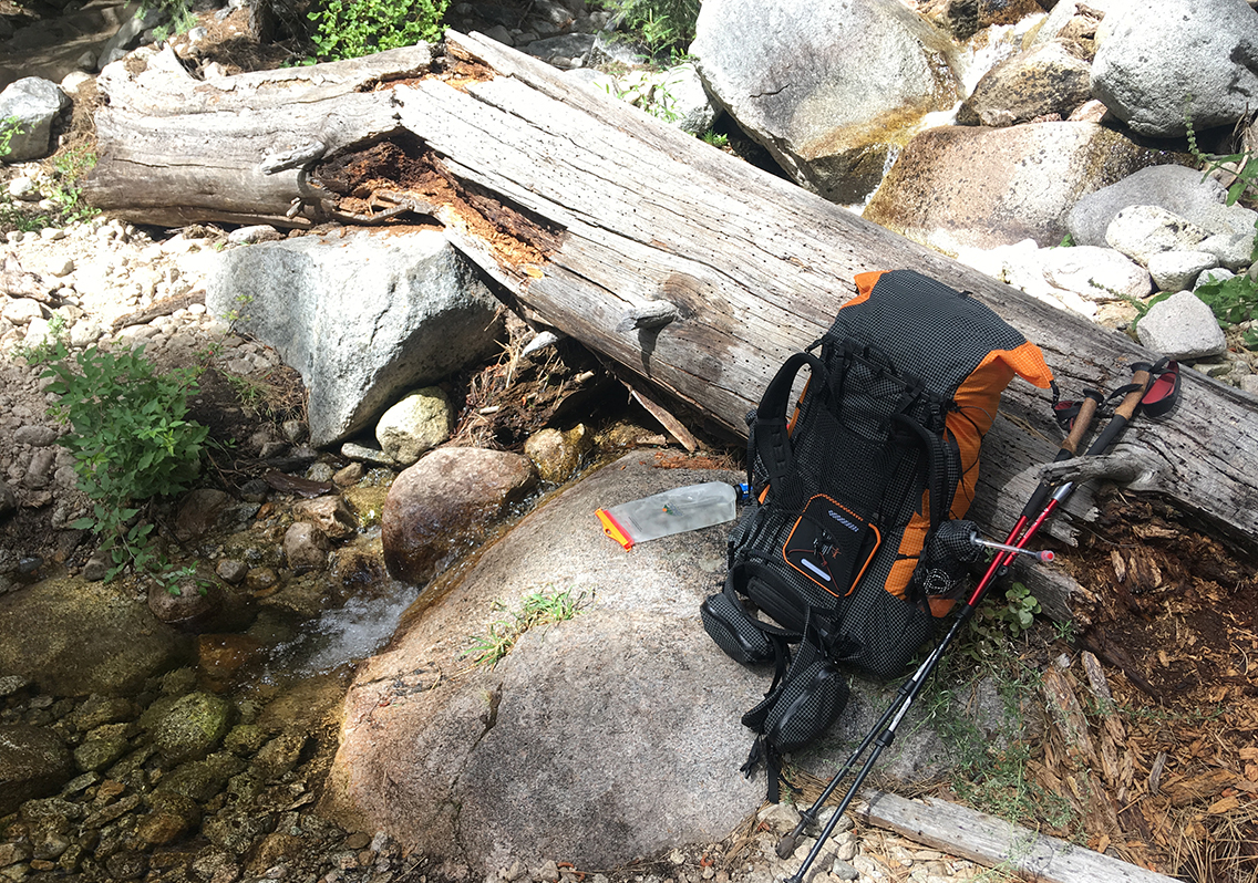
Finally I reached Charlotte Creek before noon (mile 6.9). For the first time I used my Cnoc Vecto Water bag and my Sawyer filter to fill up my two water bottles. The filtering process went really smooth and I felt kind of excited when l drank the ice-cold creek water.
My original plan was to camp at Charlotte Creek, giving myself an easy start on the first day on the trail. Although the campground just south of the trail looked shady and inviting, I felt my day hadn’t even really started (despite being on the trail for 4.5 hrs) and decided to hike on. Maybe Junction Meadow, about 3 miles up the trail, would be a better place to end my day.
Bubbs Creek fall
But about two hours later, as I reached Junction Meadow (mile 9.9), I had the same feeling, despite of the very good camp site. I wasn’t tired at all and wanted to hike a bit further and get myself to a higher elevation – I began to get a bit bored by walking under the trees. I was eager to have some views again and I climbed higher up the trail towards Vidette Meadow.
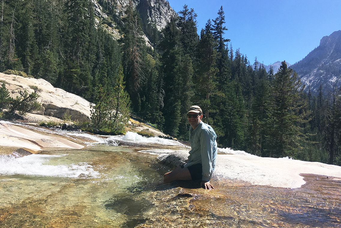
The water had hollowed out the mass of granite, sculpting a perfect little bath to rest my legs in. This was definitely the best spot on the trail this day.
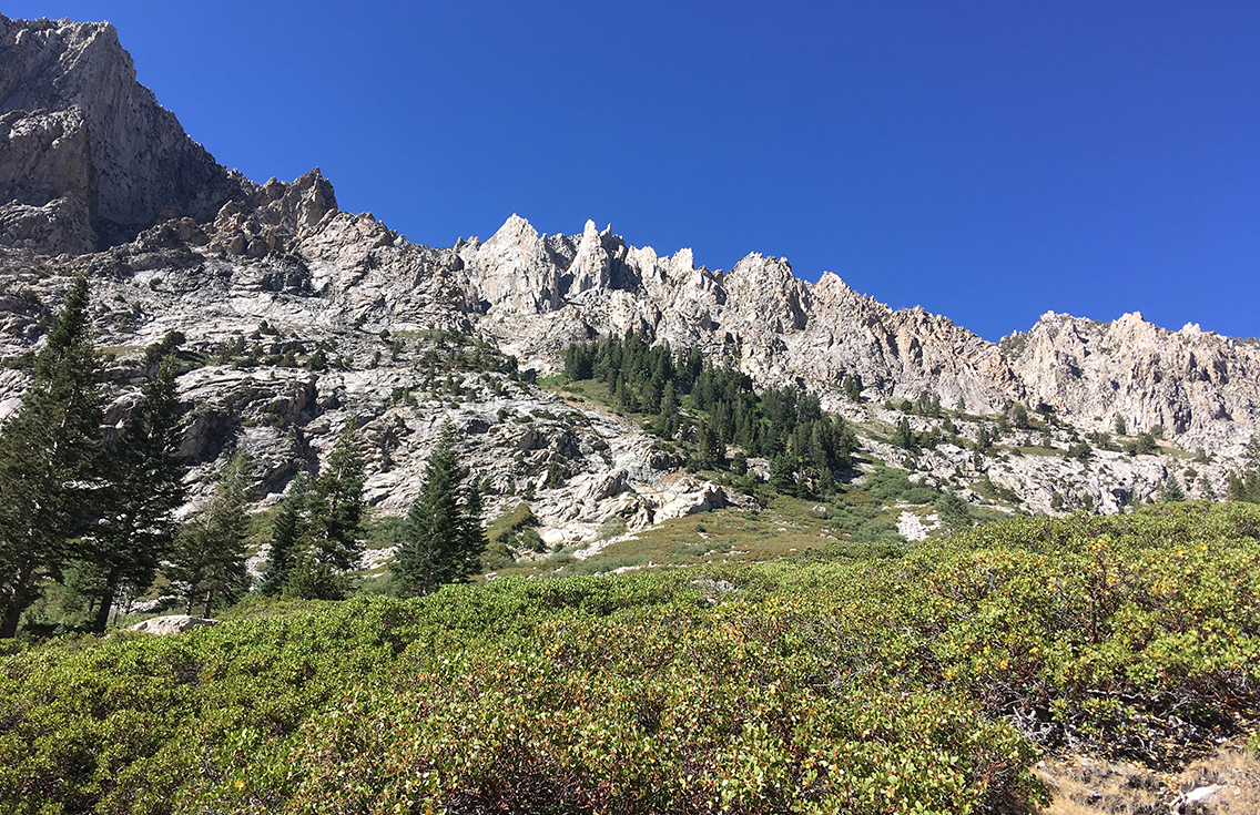
To me, one of the nice things of hiking is meeting other hikers going in opposite direction. Most of the time, after sharing the ‘How are you? I’m good, how are you? I’m fine’ a short discussion of the trail ahead followed. Starting point, bears, water sources and views were the main topics. Just above the fall, I told a westbound hiker to prepare for the outstanding view and waterfall below. He promptly told me about the amazing views I was about to encounter just a few steps up the trail. And he was right, finally the trail was completely open, with views of the jagged edge mountain range surrounding the trail to Lower Vidette Meadow.
John Muir Trail Junction
At 3 pm I reached the John Muir Trail Junction (mile 15.5) at Vidette. On the first day I was already hiking the legendary trail! Getting tired now, it was time to find myself a campsite. I was carrying 7 days of food, and despite of serious testing of my 10,65L Bearikade Weekender, not all my stuff fit into it. So I really needed a site with a food storage box this first day.
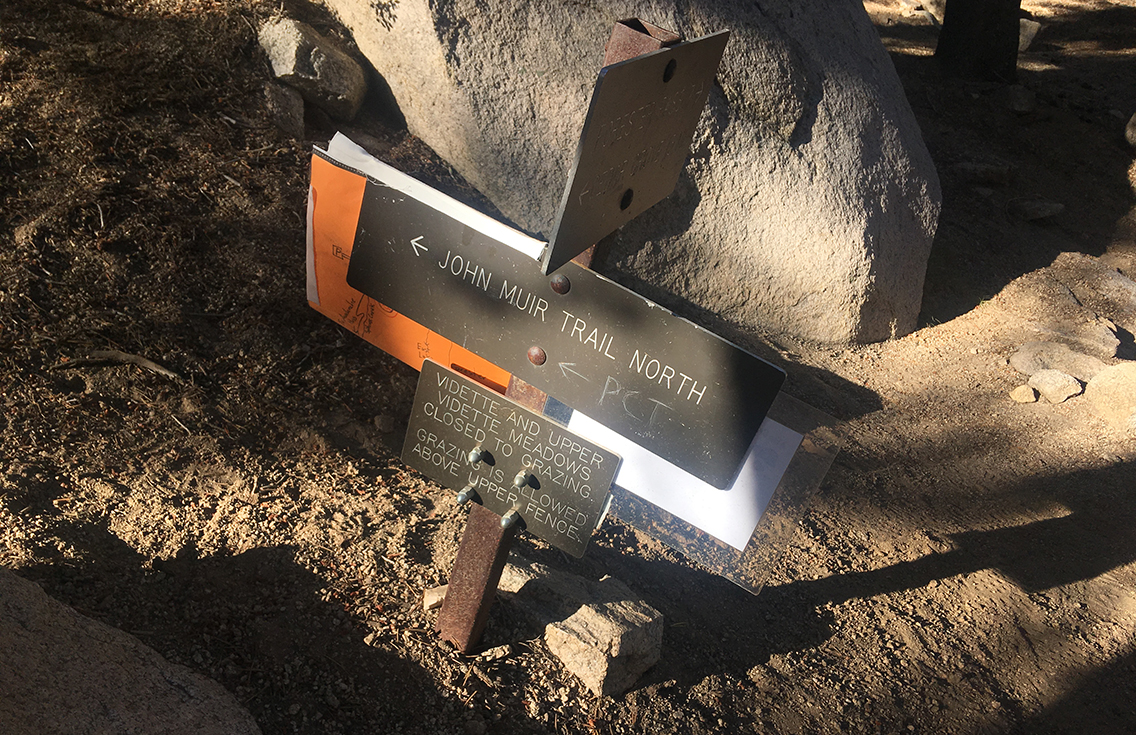
Checking my photocopies of the camp site list from the Wenck guide, I set my mind to camping at Vidette Meadow (Wenck 11.08). Unfortunately when I finally got there (the last miles are so much harder!), I read a sign that the food locker was permanently locked, due to trail vandalism (leaving garbage in the locker). Too bad, I had to pay for someone else’s bad behaviour with another mile of hiking to the next site with a food locker, at Upper Vidette Meadow.
Upper Vidette Meadow
Walking even slower this last extra mile, I encountered a mule deer on the trail. It was getting dusky already, the deer stood there, quietly looking in my eyes. We both stood still, sharing a magic moment.
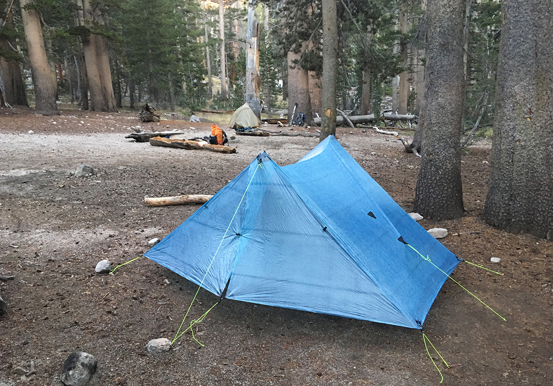
I finally reached the Upper Vidette camp at 6 pm. Being all alone in the camp site one mile back, I was quite happy to meet two friendly JMT hikers, Dev and Lily, in Upper Vidette. Almost too tired to cook my lasagna or set up my Zpacks Duplex tent, I still managed have a nice chat with them. Their friendliness, combined with the now hot lasagna, gave me some new energy. So I put up my tent, donned my merino wool sleeping clothes and hat, and fell asleep instantly at 7:30 am.
After 11 hours of hiking, I was almost an entire day ahead of my original schedule. I had hiked a total of 15,7 miles (25,3 km) and climbed 4,690 ft (1.430 m) to an elevation of 9,869 ft (3.008 m). My first day on the trail was done.
I read your series on the Escalante Route last year in preparation for my trip, and loved it. Very helpful. Your description of the Papago Slide was better than I found anywhere else. I look forward to reading the rest of this series in prep for my SEKI trip next year.
Hello Joel, thanks, I love to help. Good luck with the SEKI! As you can read I didn’t finish the entire loop as I planned. I takes a lot of perseverance and a strong will to hike on.