Day 6 of my SEKI Loop had a bad weather forecast for the afternoon. I decided to split the Elizabeth Pass Trail in two parts. So I enjoyed a relaxed morning at Hamilton Lake and then hiked up as high as possible towards the pass.
Day 6: Hamilton Lake to Tamarack Lake Junction
Start: Hamilton Lake
End: Tamarack Lake Junction
Distance: 4.7 miles (7,6 km)
Elevation gain: 961 ft (293 m)
Elevation loss: –1,129 ft (–344 m)
Highest point: Hamilton Lake/Valhalla, 8,228 ft (2.508 m)
Time: 2:30 hrs moving time; 4 hrs total time
Date: September 4, 2018
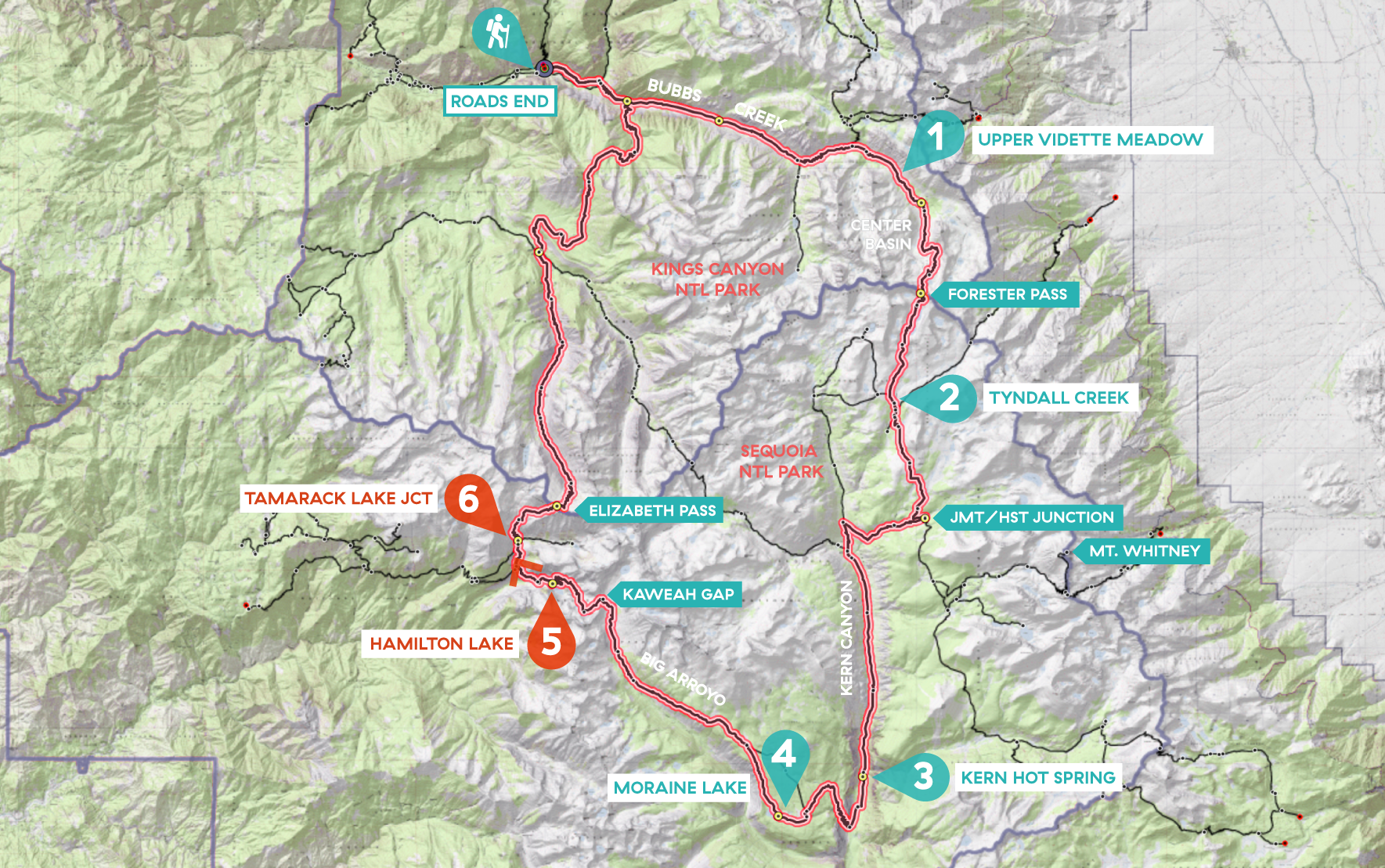
Day 6 of my SEKI loop, map base layer by Sierramapper.
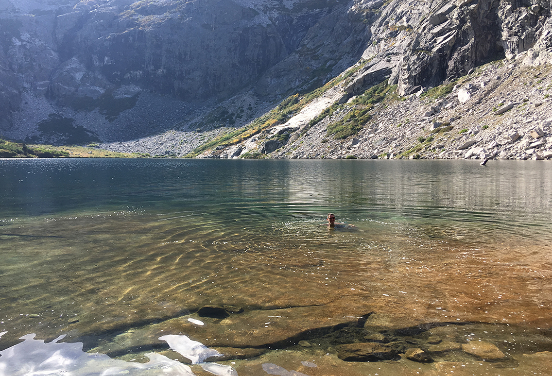
Deers and diving at Hamilton Lake
The campsite at Hamilton Lake had been quite full. At least 15 people were camping here, most of them on the gigantic granite slab that formed the beach to the lake. Quite a difference from all the previous nights! Luckily I found a somewhat secluded spot under the trees, just behind the same big rock, next to a food locker.
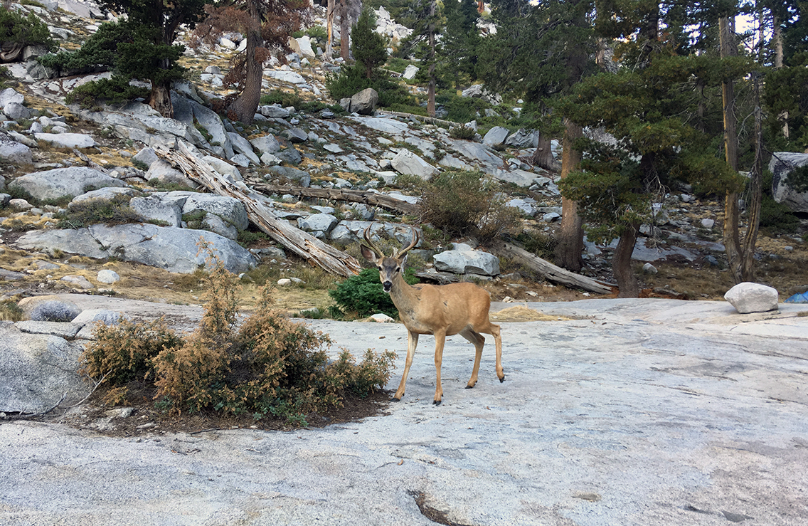
With just about 5 or 6 miles to cover today, I could have a relaxed morning before hitting the trail. It started with a good hot breakfast and a refreshing swim in the lake again. There were a few mule deer around the lake I had been warned about. They hunt for your clothing and gear. Apart from trying to eat your shirt or underwear, they especially like chewing on the straps of hiking poles, because of the salt that your sweat leaves on them. And indeed, there was a family of three deer roaming our camp so boldly, they could hardly be chased away. It made for some nice photographs though.
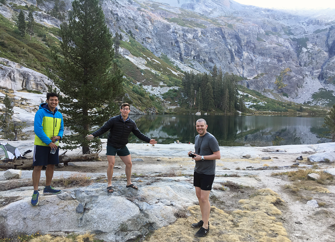
I met two Californian hikers Mike and Greg, and an Australian hiker named Anthony. All three of them were heading back today, down to Bearpaw Meadow or Crescent Meadow. Just like me they enjoyed a long and relaxed morning. At 10 am we were the last to leave camp.
My decision to break the Elizabeth Pass Trail in two meant that I had one extra day of hiking ahead. So I was short of one dinner for the extra day. Anthony and the others donated some of their food (risotto, Babybel cheese) and that made my day!
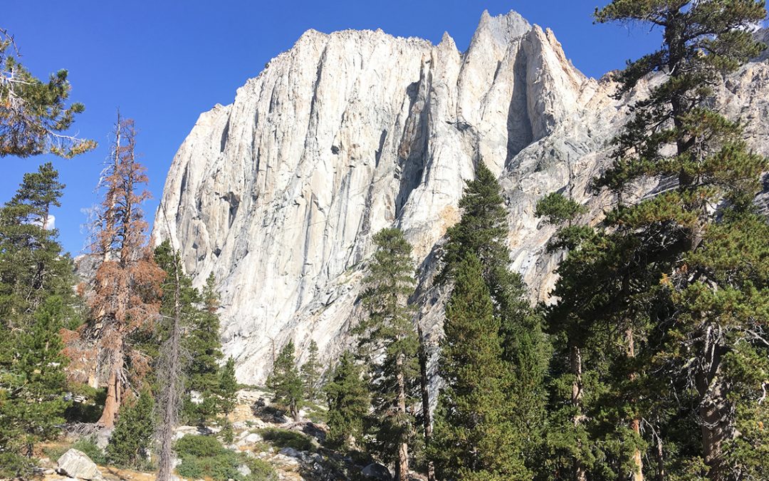
Valhalla and the last section of the HST
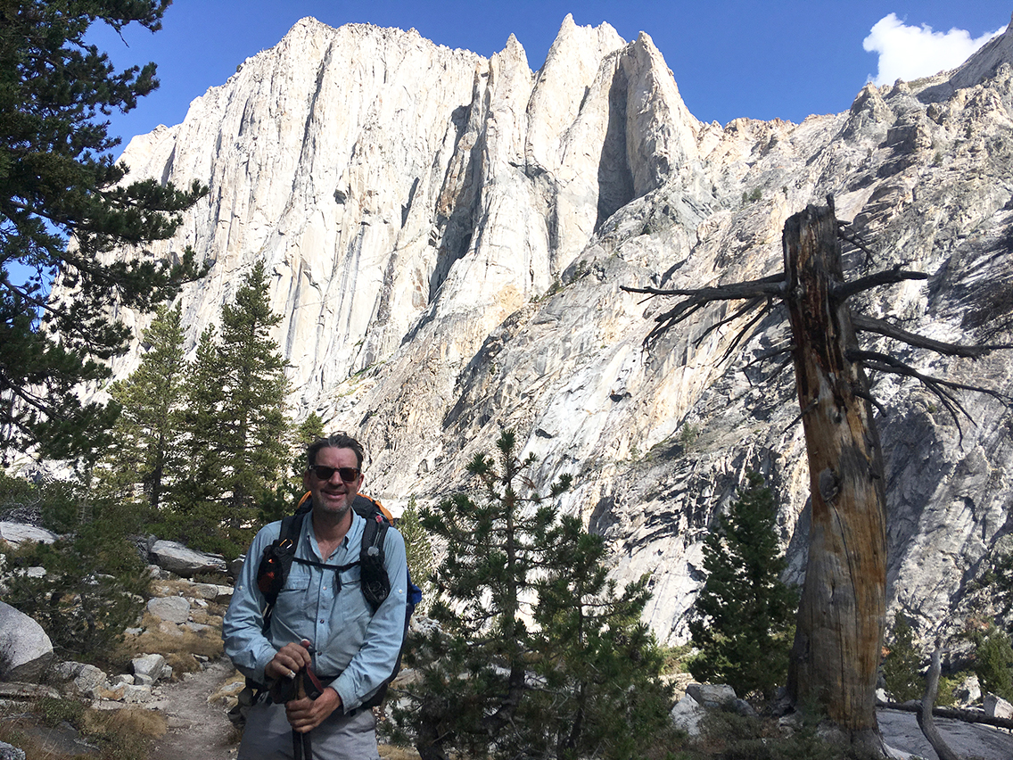
Anthony and I hiked down the trail together, which was nice for a change. I knew I had a big chunk of trail ahead of me where I would probably not meet a soul. We passed the big wall of Valhalla, also known as the Angels Wings and we had a chat while the trail took us to lower elevations.
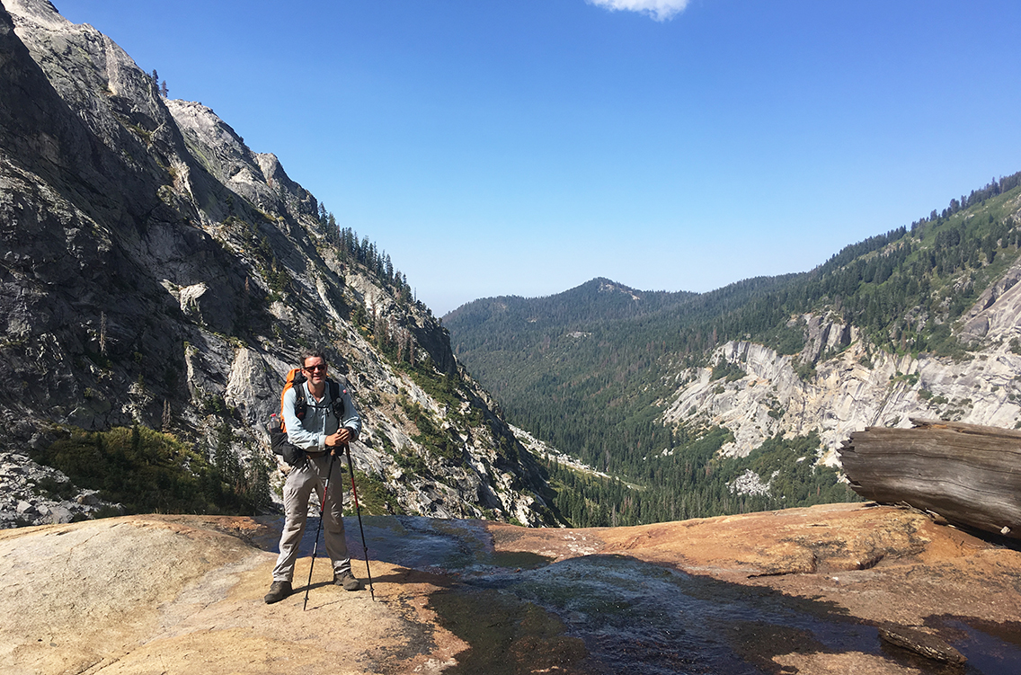
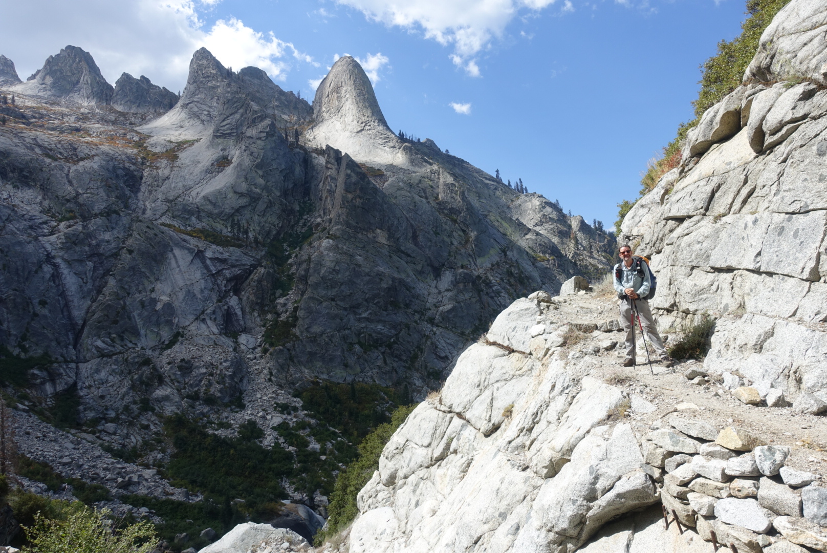
A short section of more exposed trail with some switchbacks and views of amazing granite mountain tops.
Along the trail we met quite some hikers going up. We kept telling everyone the story of the dangerous deer, we couldn’t get enough of it.
At one point we met with a young couple, the father carrying a little baby and two backpacks. I was really kind of worried, the baby not at all being protected from the sun. The guy looked tired and his wife seemed to be in worse shape. Moreover, they hardly had any water with them. Anthony gave them a liter of his; I didn’t – I really needed my water up to the pass, and I wasn’t sure to find a source above. I felt so bad about that.
Both parties walking on in opposite directions, I soon was very sorry that I hadn’t pressed them to go back. The lake would at least be another 2 hours of steep hiking for them. I could only hope they made it to the lake in time.
After about 2 miles the trail turned north and for the first time I could see the steep slopes towards Elizabeth Pass. I got a bit worried, because for the first time I had no idea where I would camp tonight. ‘I’m afraid I’ll have to climb those rocks over there all alone’ I said to my hiking partner. ‘Well, that’s what you wanted!’ Anthony replied. And he was right.
Elizabeth Trail Junction: Bear Territory Again
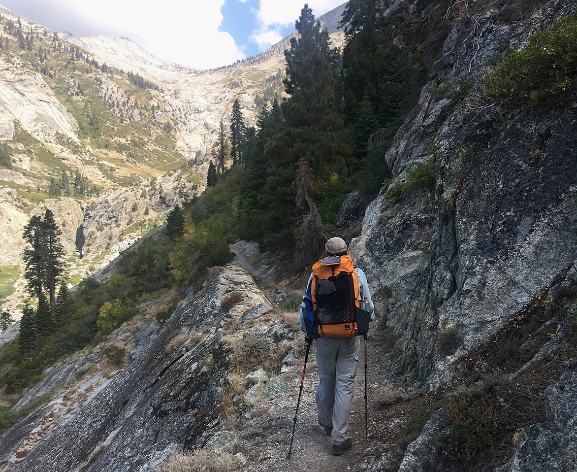
We parted our ways at the Elizabeth Trail Junction, shortly before the High Sierra Trail would continue over a bridge crossing Lone Pine Creek. I turned up north, just next to the creek, but wasn’t able to reach it for some extra water supply.
Elizabeth Pass Trail was very little travelled upon, and somewhat hidden in low berry bushes. My internal alarm bells went off: this was BEAR territory. And indeed: just a few steps up the trail, I saw bear scat, not just once, but again and again. I started singing and clapping my hands again, getting ready for a surprise every single time I turned a corner on the switchbacks. As I got higher, I saw more and bear scat, not dry now, but very fresh. I looked around and listened carefully, but didn’t see the bear, although it must have been very close. Turning back was, of course, no option. The only way was up!
Further up at the Lone Pine Creek crossing I shortly met a group of 5 somewhat rugged men. They were hiking towards Tamarack Lake and they told me of their plans of bushwhacking themselves further west from there.
They took a break at the creek (like I already had done, filling up on water) so further I went, alone.
In the meantime, the clouds were getting darker, and I felt I should hurry to find a safe place to camp.
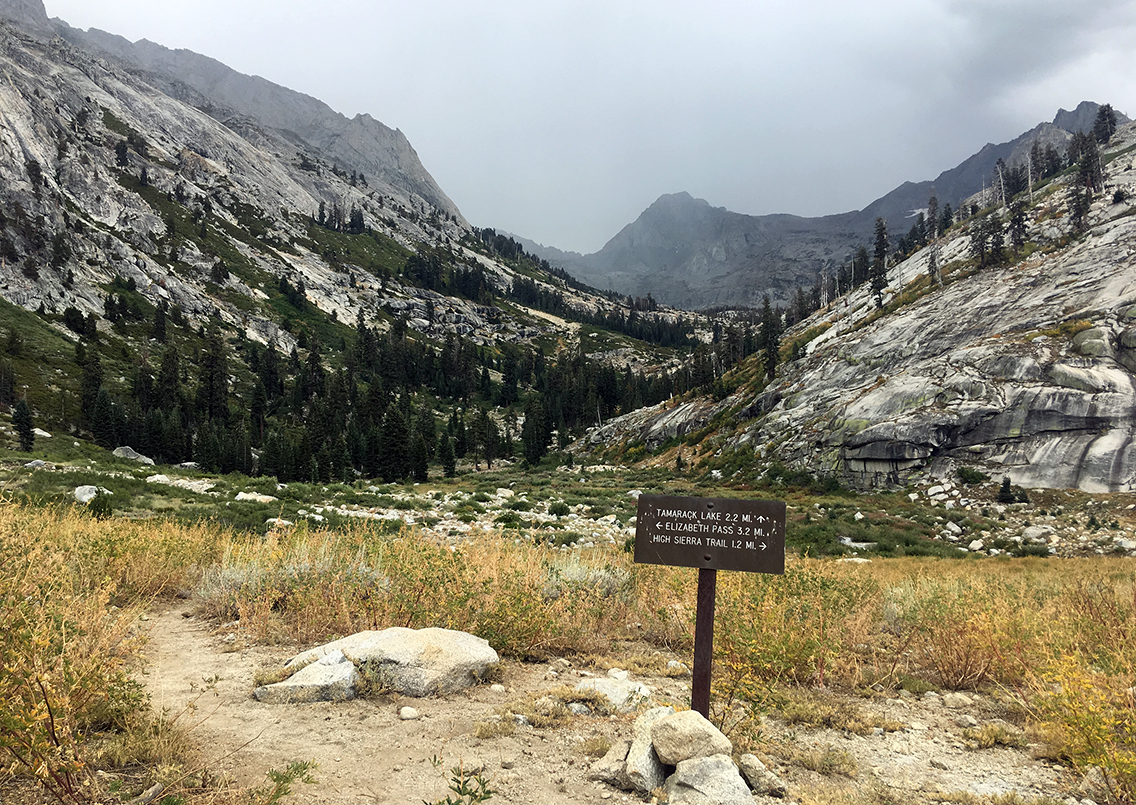
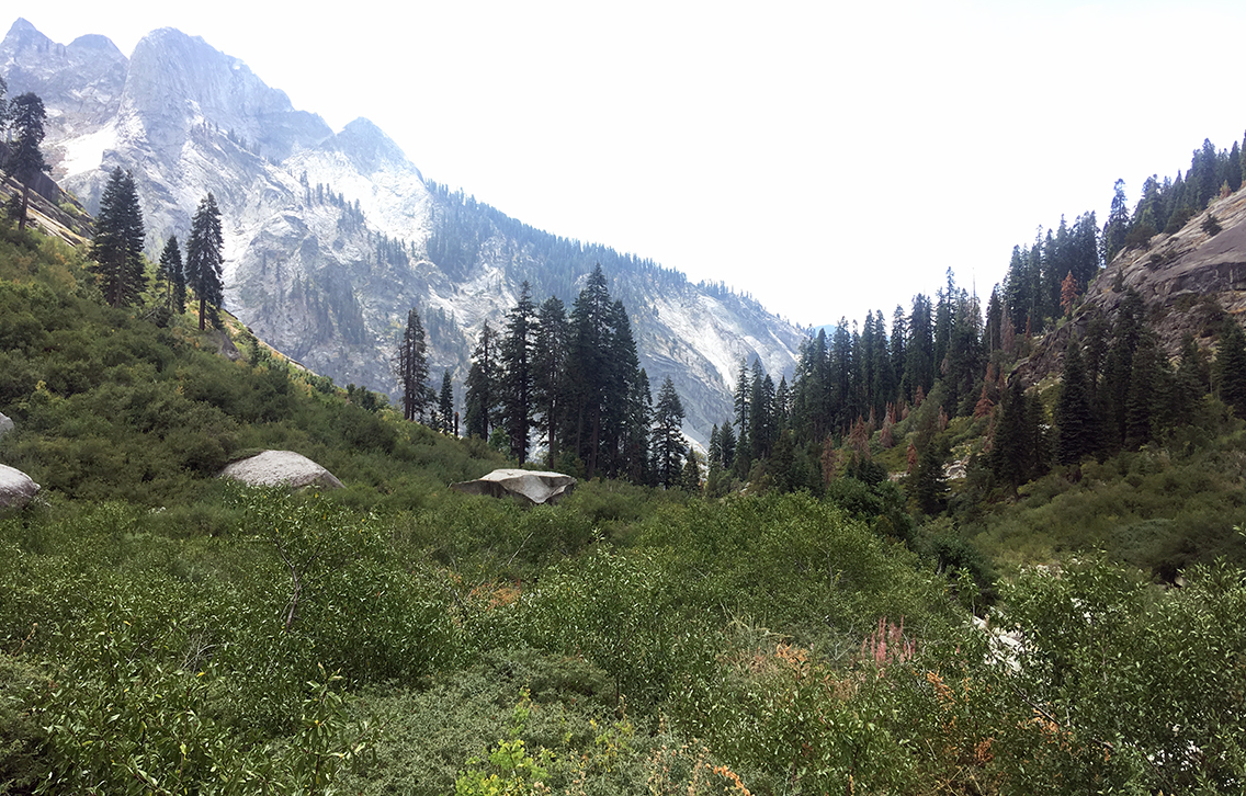
Tamarack Lake Junction
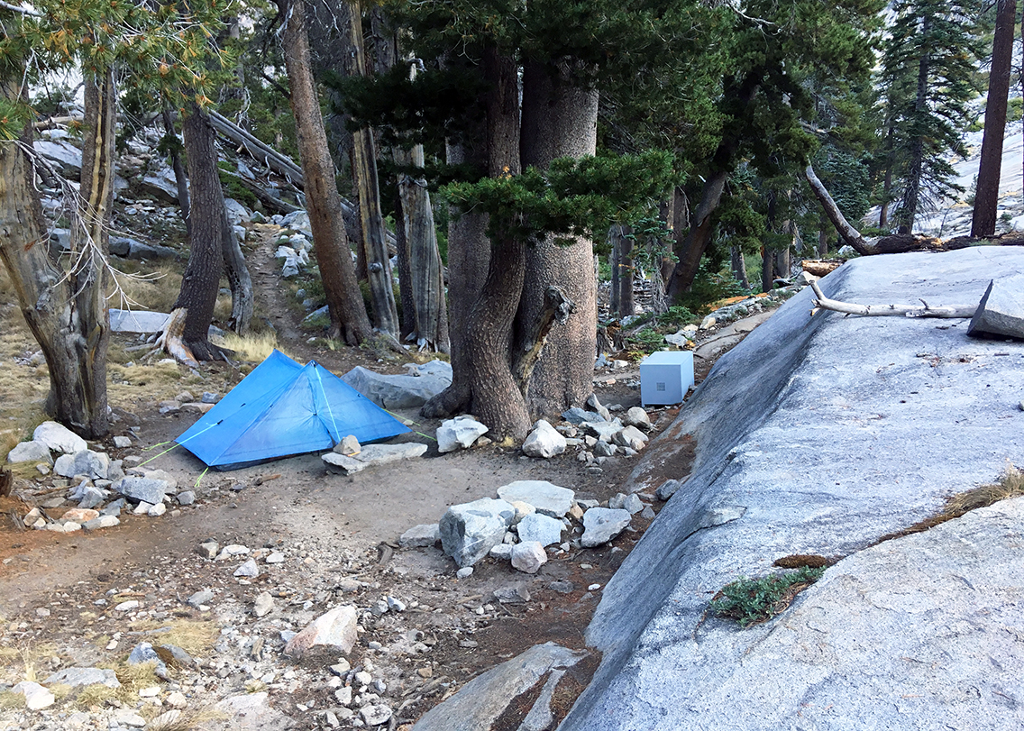
I reached the sign at Tamarack Lake Junction, in an open field, about 3 miles below the pass. I did not know if there would be a good camp site anywhere below Elizabeth Pass. With the dark clouds above me, I knew that this open field definitely was not a good place to stay. Heading further up wasn’t a sensible plan either. In the distance, down the Tamarack Lake trail, was a group of trees. I thought at least I would find shelter from the rain that started to fall on me now.
When I got there, I discovered that it was an established camp site already, very near to the creek. Big trees and a huge rock provided enough shelter from the rain.
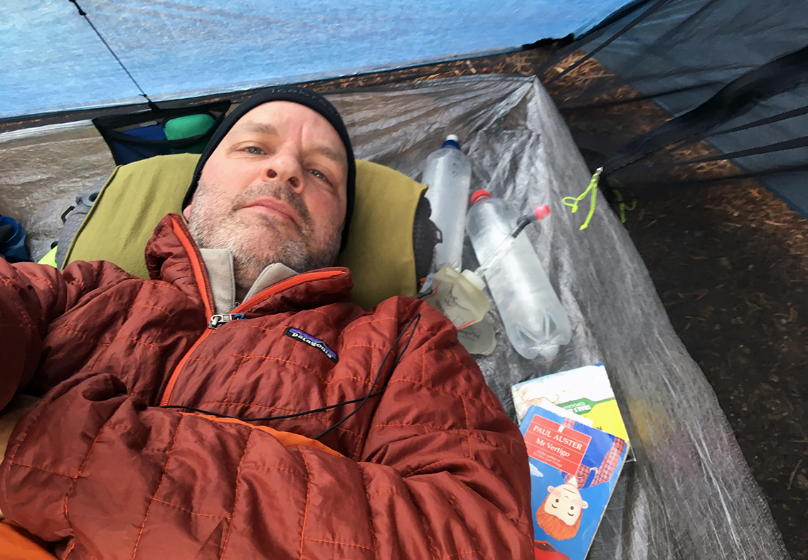
It was before 3 pm when I pitched my tent (in the rain) and there was nothing else to do but lie in my tent. A good thing I brought a book with me (Paul Auster’s Mr. Vertigo, which I’d already read 3 times – I wanted to be sure to have a really good book with me). Until now I thought carrying a 185 grams book was a bad idea, but this afternoon it kind of saved me. I read until it got dry at 6 pm and I was ready to eat my meal.
Then I read some more to keep my mind from bears that might go after me, until I fell into a deep sleep.
< Previous: Day 5: to Hamilton Lake
> Next: Day 7: Elizabeth Pass
0 Comments