SEKI Loop day 7: going up Elizabeth pass I conquered the steepest stretch of trail so far. With the spectacular views soon obscured by clouds, I hurried down Deadman Canyon. Then I hiked in the rain for a few hours until I found shelter at the Roaring River rangers station.
Day 7: Tamarack Lake Junction to Roaring River
Start: Tamarack Lake Junction
End: Roaring River Ranger Station
Distance: 14.7 miles (23,6 km)
Elevation gain: 3,235 ft (986 m)
Elevation loss: –3,956 ft (–1.206 m)
Highest point: Elizabeth Pass, 11,339 ft (3.456 m)
Time: 8:30 hrs moving time; 10 hrs total time
Date: September 5, 2018
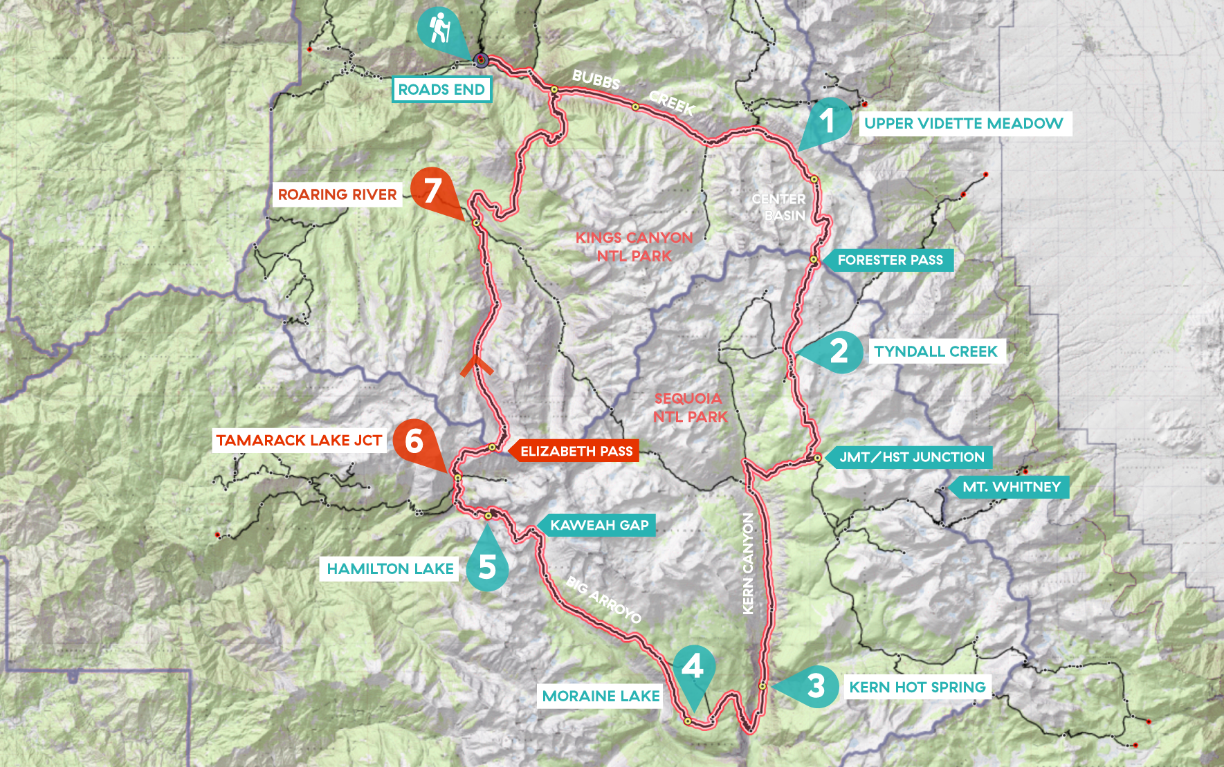
Day 7 of my SEKI loop, map base layer by Sierramapper.
Finding the trail to Elizabeth Pass
When I woke up, my first thought was: I have survived this night – I was not eaten by bears! I don’t want to sound hysteric about those furry mammals, but this nights camp was the most remote and lonely place I have ever been. So when I got out of my tent, the first thing I did was checking if my bear canister was still at the same spot I left it. And it was. So I really shouldn’t have worried at all.
I got up at 5.30 a.m., made good breakfast, rehydrating my milk-granola mix and I drank a cup of tea. When my tent was dry enough to put in my pack, I was ready to go and started my hike at 7 am.
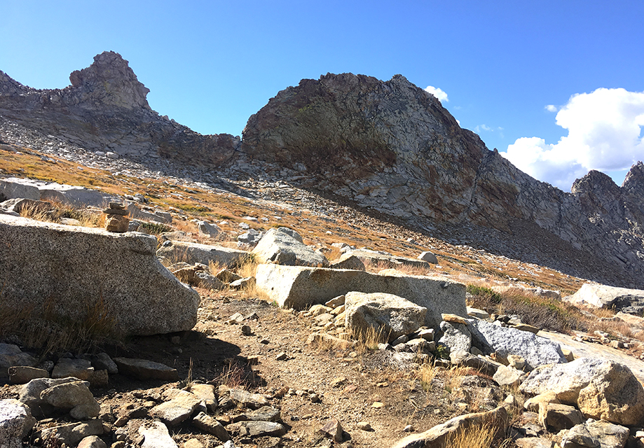
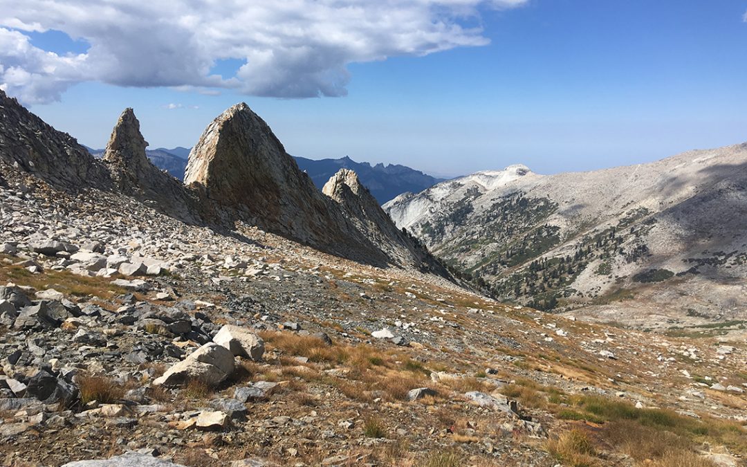
The ridges on the east side of the trail were getting more and more spectacular. Looking up, the trail was so steep, it seemed impossible to follow.
It wasn’t as hard as the climb up Forester Pass though. The altitude was much lower and of course I had more days of hiking in my legs.
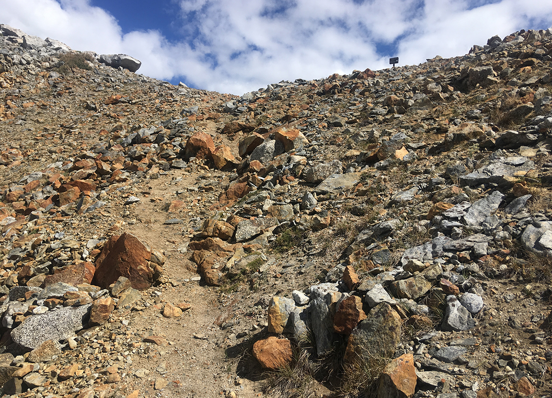
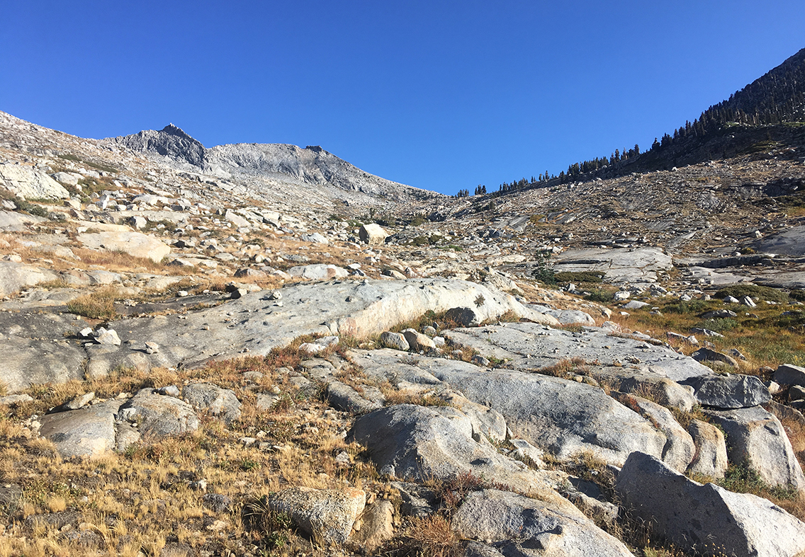
After about four hours of climbing, I finally could see the small brown sign on top of the pass. With renewed energy (helped with some M&M’s and dried apricots) I stepped up the final switchbacks up the pass.
Elizabeth Pass and Beyond
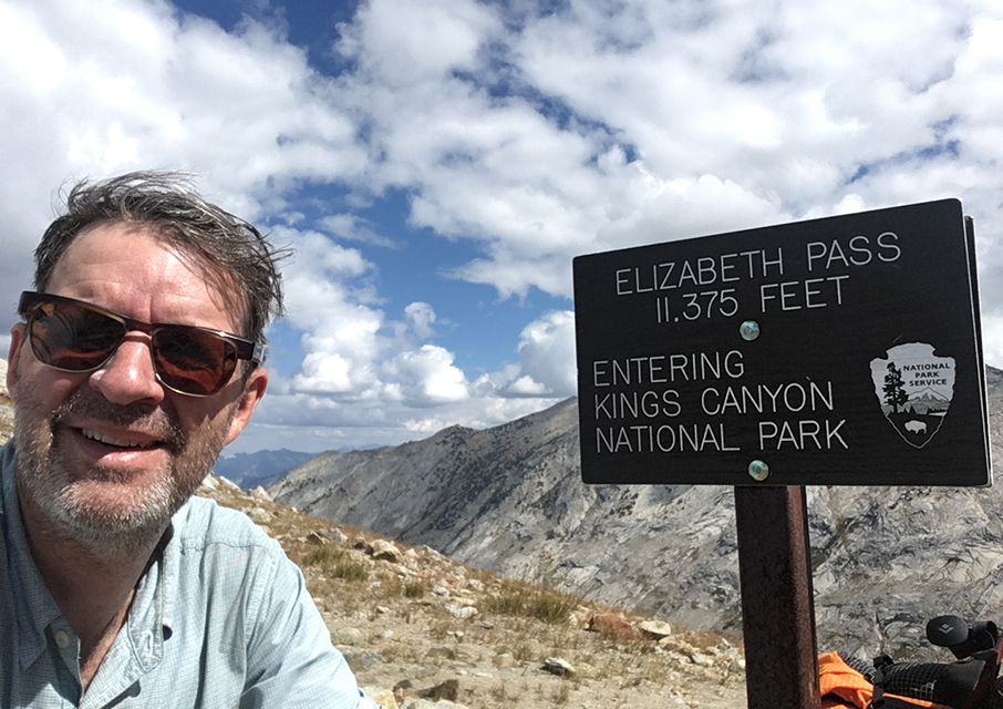
Never trust the signs, it’s 11,339 ft – still a good climb though.
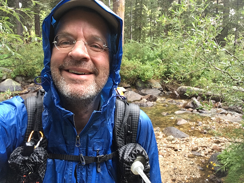
Being on top of Elizabeth Pass was quite different from Forester Pass, because there I had the company of four other hikers to share the victory of reaching the top. Now I was here all alone, no one to share my pride with but my iPhone – so I took the selfie.
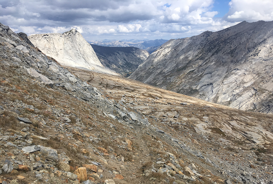
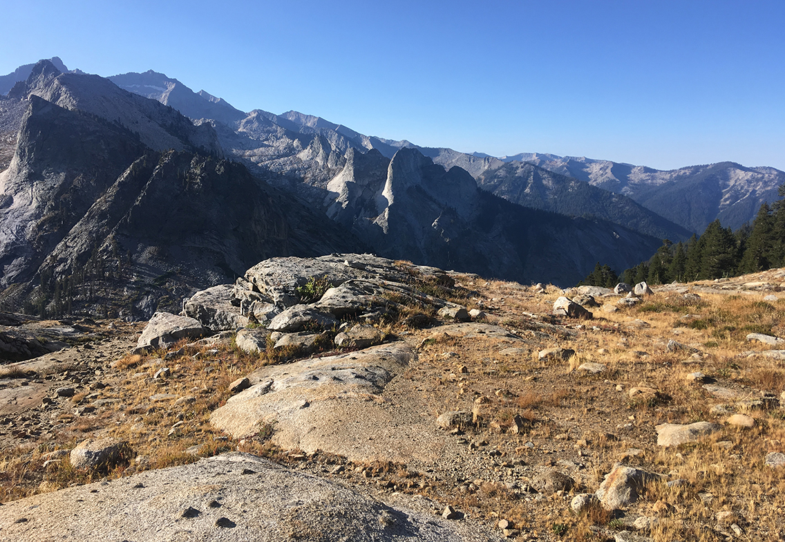
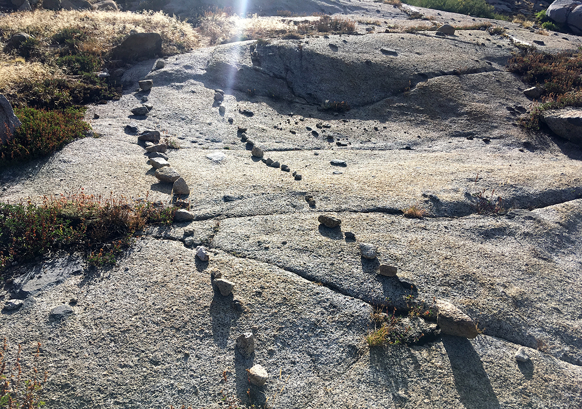
I have never lost the trail so severely as coming down from Elizabeth Pass to Deadman Canyon. It was steep, and all big rocks. I lost my way just shortly after the pass, wandering between slabs of granite and stepping into thick bushes and I did not find the trail back until I crossed the river all the way down the slope.
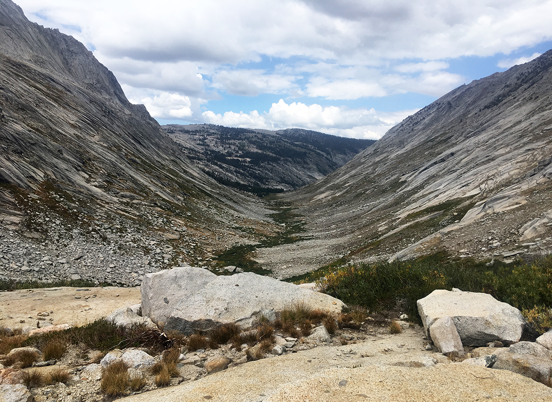
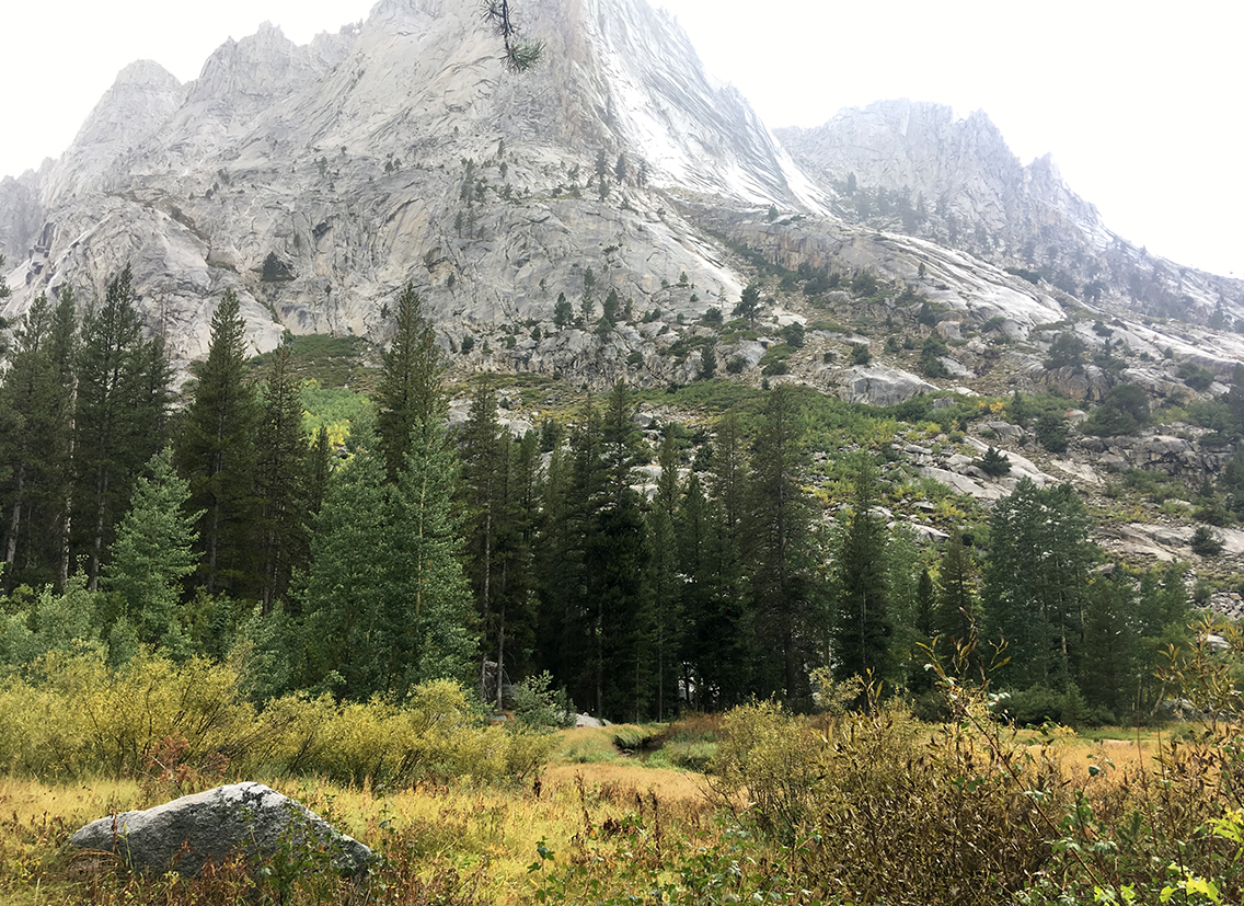
In front of me the enormous canyon presented itself to me. In the middle a green snake of vegetation that indicated the course of the unnamed river. Far away, a wooded area. Again, the clouds up above urged me to get to those trees as fast as I could.
I made sure to keep up my pace to get to the woods as fast as I could. Just when I got there, it started to drizzle. Time for a lunch break beneath the trees.
Deadman Canyon
Finishing my lunch, a tuna tortilla and a cup of water with rehydration salt drink, the rain was getting worse. I put my rain gear on and praised myself lucky that I would finally be able to put this gear to the test, and I had not carried it with me for no reason.
A good thing about the rain was that the three fingers that had been wounded in the past days, were soaking in fresh rain water for hours. At the end of the trail they were totally cleaned, all accumulated blood and dirt of the past days was gone.
When I took off my backpack later, I saw that also my underwear and second pair of socks, that I had kept in the mesh pocket on the back, were completely rinsed and clean.
Getting to the end of the canyon, I passed a grave with a timber fence, that read “Here reposes Alfred Momiere, Sheepherder, Mountain Man, 18— to 1887”. Apparently this was the dead man for which the canyon was named. I was too tired though to make a photograph.
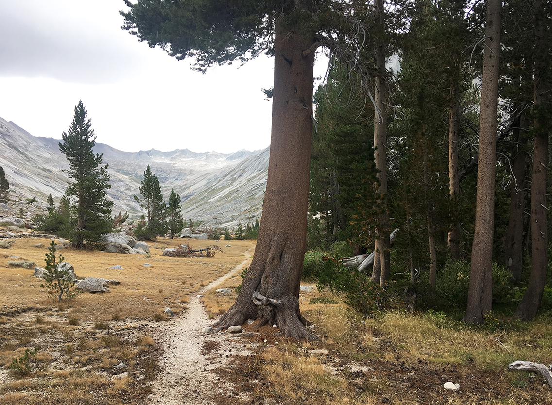
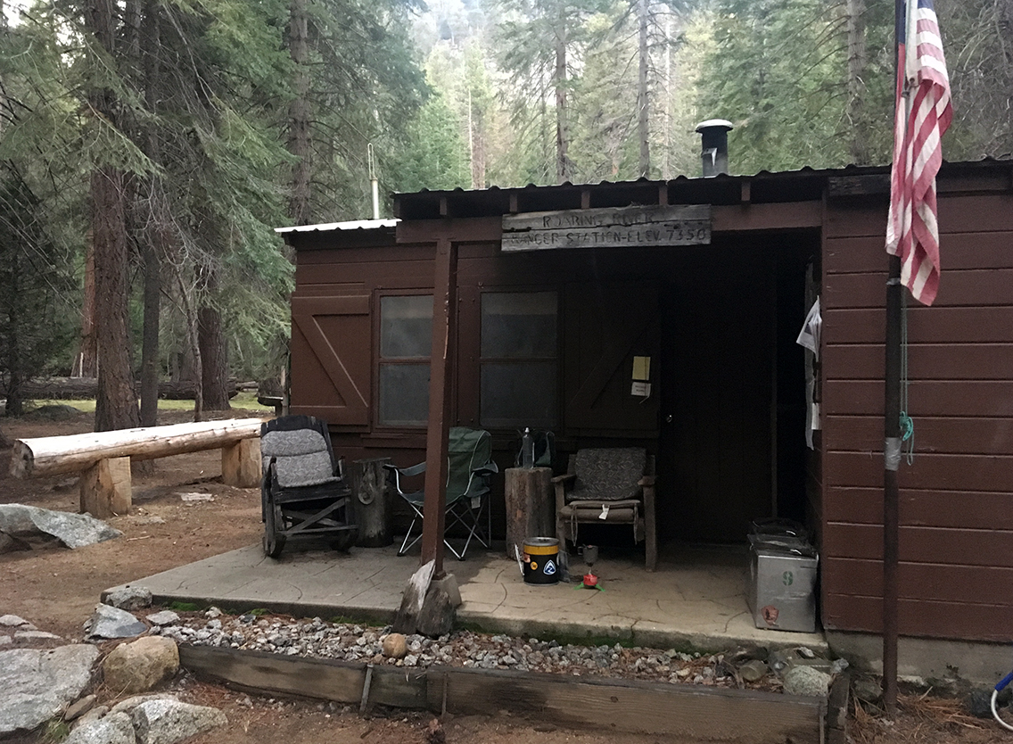
The last two miles were hard. It was getting kind of boring hiking through the woods, with all that rain. And for the first time on my thru hike I wished it would be over now. I was so tired of the rain, tired of walking, I had fantasies about the Rangers Station that I would reach at the end the trail today. I dreamed it would have a porch that would give me shelter from the rain, were I would hang my raincoat to dry. And there would be a big lounging chair, so I could sit comfortably as I was cooking my dinner. I knew this was only imagination, but it kept me going for those last miles.
Roaring River ranger Station
Sooner that expected though I spotted the wooden cabin of Roaring River. I saw a horse corral with some folding chairs and some saws, horse riding stuff, jerrycans. But nobody seemed to be present. I walked around the cabin, and then I saw that all my fantasies came true. There it was: the dry porch with a big comfortable chair waiting for me to sit on.
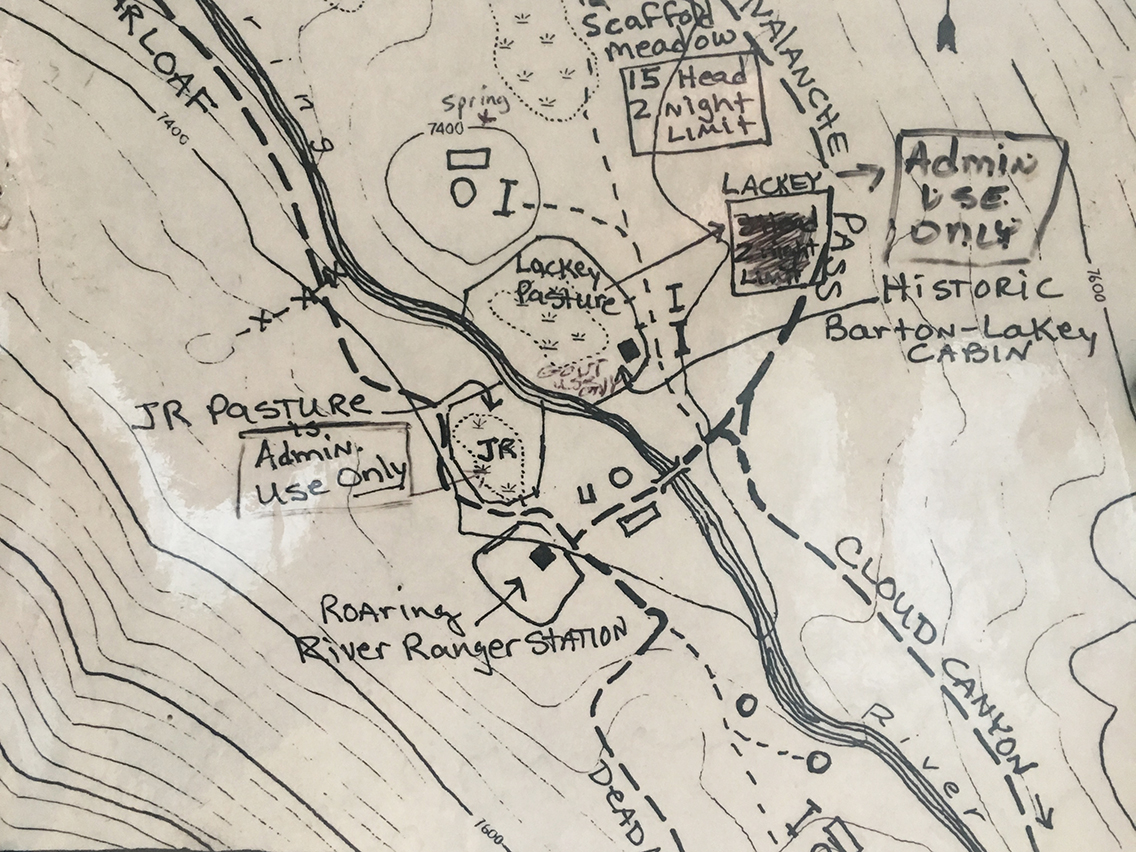
Plan of the Roaring River ranger station at the gate of the cabin, where I wrote my name in the guest book.
In the camp site were the first people I met today. Three other hikers who were all coming from different directions. I talked to a woman who came down from Avalanche Pass (which I had to face tomorrow). I had read that the trail up the pass was washed away and I shared my worries about finding the way. She said I would be o.k. as long as I had a GPS device, and some cairns would direct me anyway.
She also told me that there was a group of 3 hikers a bit further north, who would also head for Avalanche pass. So if I would meet up with them, it would be easier to find the trail together.
It was already getting dark when I put up my tent. I filled up on water at the creek next to the bridge and at 7:30 pm I closed my tent and I fell asleep soon after.
This is very helpful. It looks like the trail was pretty hard to find going up and down. Do you recall how much your pack weighed on this trip? We plan to hike this pass in 3 weeks. I’m wondering how it will be if it has snow on top. Thank you.
Hello Barbara, thank you. Yes, the trail was a bit hard to find. With snow it will even be harder. A good GPS-app on your smartphone will be very useful.
My pack weighed 16 kg, including 8 days of food + water at the start of the trail. I hiked Elizabeth pass on day 7, so it must have been down to about 12 kg by then.
Wonderful! Planning a trip and this info is very useful. What an adventure!
Hello Joseph, Thanks, good to hear my report is useful for you, planning a trip over Elizabeth Pass. Have a good time!