Hiking down the Grand Canyon on the Tanner Trail is time traveling through a billion years of rock sediments, while passing many different climate zones. Starting with snow at the South Rim, I ended at a desert oasis with my feet in the Colorado River.
Escalante Route Day 1: Lipan Point to Tanner Beach
Start: Lipan Point, Tanner Trail Trailhead (7,350 ft / 2.240 m)
End: Tanner Beach/Colorado River (2,700 ft / 823 m)
Trail: Tanner Trail (unmaintained)
Distance: 7.7 miles (12,4 km)
Elevation gain: 318 ft (97 m)
Elevation loss: 5,030 ft (1.533 m)
Time: 4:10 hrs moving time; 5 hrs total time
Date: November 11, 2023

Escalante Route day 1: Lipan Point to Tanner Beach (note: North is right)
The Trailhead at Lipan Point
I descended to the Canyon floor via the Tanner Trail. This trail starts at Lipan Point, 23 miles east of Grand Canyon Village. I had parked my rental car at the overnight hikers parking at Grandview Point (the end point of the 5 day hike), about 10 miles west from Lipan Point. I was quite worried that there would be nobody at Grandview to get a ride from to the trailhead at this hour. But 7.20 a.m. turned out to be the exact right time. It was just after the sunrise that a few dozen of tourists had been admiring from the canyon’s rim and many of them were returning to their car. The fifth person I asked was so kind to offer me a ride in his small tourist van, together with about 6 South Korean tech firm employees. Within 20 minutes I was at Lipan point.
Only two days ago, when I arrived at the Grand Canyon from the East entrance, I had stood at Lipan Point in a snow storm with the entire canyon shrouded in mist. Now I could see all the way to the North Rim and down to the Colorado River glittering in the bright sunlight.

Below Lipan Point the trail drops down through the yellow Kaibab Limestone
An Icy Descent on Tanner Trail
Before 8 a.m. I put my first steps on the Tanner Trail, which was covered in a layer of snow. I put on my new microspikes and immediately I was so happy that I brought them. With its metal teeth cutting in the frozen path I felt quite secure, especially when the trail changed to a series of steep switchbacks. This part of the trail was marked ‘expert’ on my map, but I think it was only moderately difficult aided by microspikes and trekking poles.
After half an hour the trail was clear of snow and I arrived at a steep draw filled with boulders. For the lack of cairns I followed my intuition and slowly found my way through the yellow rocks until I reached a good trail again, leading towards the red rocks of 75 Mile Saddle.
The Edgy 75 Mile Saddle
The 75 Mile Saddle is a narrow saddle between Tanner Canyon and 75 Mile Canyon. The name of the latter is based on the Colorado River Mile System, as measured from Lees Ferry, Arizona, the official ‘Mile 0’ of the river. The seasonal stream in this particular canyon happens to empty into the Colorado River at mile 75. From the saddle this side canyon can be seen on the west side, cutting deep through the rocks.

View west into 75 Mile Canyon from the saddle
Some have described the saddle as knife edged, but that is a bit of an overstatement. The saddle is narrow, but not dangerously so. I think there is always about a yard of trail width, and it’s mainly flat. I did have to climb a giant rock, using my hands and actually Alex-Honnolding myself 5 feet down off the rock – but I think I actually lost the trail for a few minutes at that point.

Passing more giant red chunks of rock I reached the north side of the saddle, where a relatively flat stretch of trail began. I had hiked for one hour now, and already tackled two of the four parts marked ‘difficult’. I was confident now that I would be able to do this hike all the way through.

Trail below Cardenas Butte
Contouring Cardenas Butte
The trail continued on easy terrain and made a long contour below Escalante Butte and further on below Cardenas Butte. Once I passed Cardenas Butte, another hour later, I saw the first glimpse of the lower canyon and the Colorado River. The view of the beaches was exhilarating and comforting at the same time, knowing that I would spend the evening and the night on that sandy beach next to the river.
After about 2 hours it was time for a break and I found a nice orange rock with a view where I sat down. I prepared myself my first tuna tortilla and drank half a liter of electrolyte lemonade. It was much warmer now than at the canyon rim and I packed my puff jacket and fleece away before heading on for the second half of the Tanner Trail.

Colorado River and the Palissades from top of the Redwall
Off the Redwall
According to the trail descriptions I was now on the Redwall, but the trail color was more white, yellow and orange. It was around 11 a.m. when I arrived at the top of the Redwall, the third challenge of the Tanner Trail. At this point the trail descended steeply to a grey/green hill, about 700 ft (200 m) lower.

Start of the descend off the Redwall, backed by the enormous Palisades of the Desert
Far below in the distance I saw the first hikers of the day. When I descended from the Redwall (not as difficult as I expected), a man and a woman were hiking up towards me from the hill. They said they had arrived with a raft at Tanner Beach this morning and were now hiking up to Lipan Point. A short time later I met with the rest of the group: a dozen rafters from various states in the US, heading home. After a short chat I moved on along a now yellow-colored trail with the most amazing views of the canyon ahead.

View of Colorado River and Unkar Delta
As I was getting lower and lower into the canyon, there was more grassy vegetation along the trail. The color of the trail changed to a greenish yellow and later to deep red. Within an hour I came to the last point of the trail that is regarded as difficult: the Red Dox Slope. But I wasn’t really impressed with that rating on my trail map anymore.
The Red Dox Slope
The trail on the Red Dox Slope was not very steep itself, but it was narrow and I had to pay attention because the slope was in fact a huge pile of loose gravel. Meanwhile the river was getting closer and closer and I had to be careful not to walk and watch at the scenery at the same time. Slipping and falling was not an option here.

The Red Dox Slope
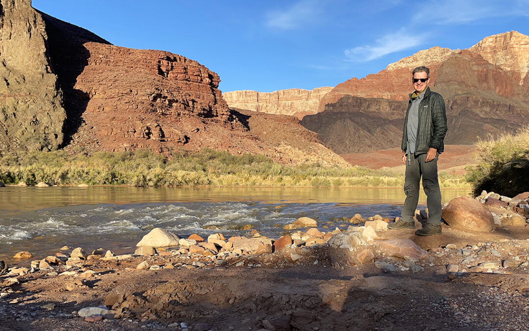
From the Slope it turned out to be no more than 30 minutes to the river. Leaving the red gravel, I suddenly found myself in the dry riverbed of Tanner Creek, leading towards the Colorado River. I was exited to hear the roar of the rapids already and before I knew I was surrounded by willow trees and tamarisk shrubs, while the trail had changed from rocks to fine sand. Finally, after 5 hours, I had arrived at Tanner Rapids and its beaches.

Colorado River and Tanner Rapids
Tanner Rapids and Beach
I could hardly believe it: it was 1 p.m. and already I had reached my destination. All my spreadsheets, gps-tracks, REI-orders, plane tickets, car rental and hotel booking eventually had brought me to this small paradise on a desert floor. I felt relieved, happy – and not even very tired.
The first thing I did was to locate a good spot for my tent. I was the first hiker to arrive at Tanner Beach, so I picked the best spot below the willow trees, with a view of the river, just west of the dry river bed. There were many other secluded spots, east and west of the river bed, close and farther away from the river. Later in the day a few other groups arrived and most of the sites appeared to be filled up by the evening.

Campsite under the willow trees at Tanner Beach
The Grand Canyon floor is either too hard or too soft for tent stakes. So I set up my tent using my new flex kit, without using stakes. To keep the guylines to my trekking poles tight however, I had to use the heaviest rocks I could carry and place them on top of the yellow string tied to a flat lying stake.
Then I walked to the river and hauled 10 liters of water into my foldable bucket. I set the bucket wedged between a few rocks to keep it upright. The Colorado water tends to be quite silty, and I let it settle for a couple of hours. I added a bit of alum to accelerate the process of sedimentation.
For the first time I carried a lightweight chair on a multi-day hike. And I was delighted when I sat down in front of my tent. It was definitely worth the extra weight.
I spent the afternoon clearing and filtering the water, journaling, reading and enjoying the view of the canyon.
At 5 p.m. the sun slowly began to disappear behind the canyon rim and I quickly put on my merino shirt and all other layers I had (fleece, hoodie and puff jacket).
> Next: Day 2 – Tanner Beach to Escalante Beach
< Previous: Planning the Escalante Route
0 Comments