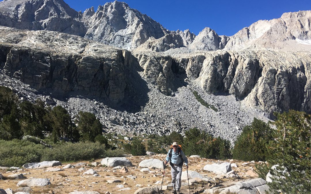
In the late summer of 2018 I hiked the SEKI loop (in Kings Canyon and Sequoia National Park), an eight day hike that combines the John Muir Trail, the High Sierra Trail and some other trails. Here are five things I learned hiking the SEKI loop.
1. Good Trail Food is Salty Food
Earlier hikes in my life always had some kind of accommodation at the end of the day where I could buy my food. So for my first real wilderness trip, I meticulously prepared a food plan for the trail. Studying many books and online video’s, I decided on the following menu.
Menu
- Breakfast: rice pudding or granola/milk
- Lunch: Tortilla, tuna and Nutella
- Snacks during the day: chocolate bars, M&M’s, jellybeans, dried fruit, cashew nuts
- Dinner: various Backpackers Pantry dry freezed meals + deserts
Chocolate
I really thought I’d need a big 10 oz (300gr) bag of M&M’s, plus one chocolate bar for each day. I also believed that I would eat an entire jar of Nutella (squeezed into a plastic tube) with my tortilla’s. And I figured that I would really crave a sweet and calorie-loaded desert in the evening.
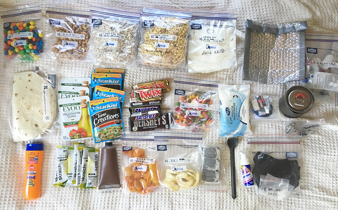
My 7 day ration of food and other consumables (about to be squeezed into my bear canister).
In my daily life I actually love chocolate way too much. So I was looking forward to eat all this delicious stuff on the trail without feeling bad about it, knowing that I would need as much calories as possible (peanut M&M’s count more than 500 kCal per 100 gr, there is no more calorie-dense food you can think of).
Breakfast
How different things turned out on the trail! First, there were days that I hardly ate any breakfast. I was so eager to get on trail as early as possible, that I would hike with just one candybar in my stomach until noon. Secondly, for lunch, just one tortilla with tuna was enough most of the days. And finally, setting up camp late in the day, I hardly had enough energy to cook my hot meal, let alone prepare a desert. So I never ate a desert at all, I rolled into my sleeping bag as soon as I could.
Salt and Hydration
There were only two things I started craving on the trail: cashew nuts (or any other salty nuts) and the Skratch hydration lemonade. Especially the hydration drink: I learned soon enough that these drinks were a much needed energy booster in the afternoon. It’s all about the salt and minerals or electrolytes (whatever they are) that you lose during the day. I never thought drinking this lemonade would revive me so good, so instantly.
Some days I drank two of them, knowing I was stealing one from a future hiking day. In the end I started drinking my ORS (Oral Rehydration Salts) from my medical kit, which had basically the same effect (but tasted less good).
I needed 8 days for my SEKI loop instead of the planned 7 days, but still I had more food with me than I could eat. After 8 days I returned to the trailhead at Road’s End with about 6 uneaten deserts, 2 tortilla’s, some Nutella and I believe one pack of tuna.
So on my next hikes, I will drastically cut the amount of food, and replace much of the sweets with salty nuts. And I will pack twice as much rehydration lemonade.
2. Never Underestimate Creek Crossings
Hiking in September, most of the creeks I crossed were very shallow or even completely dry. This was one of the reasons why I planned my hike in september in the first place (the other reason being the absence of bugs). When I encountered a creek crossing, most of the time there’d be enough stones to step on, or a dead tree for a convenient crossing.
On the third day of my hike though, coming from Tyndall Creek and heading west on the High Sierra Trail, I came upon Whitney Creek. Not a very menacing creek to look at. But just a few inches too deep to step in to.
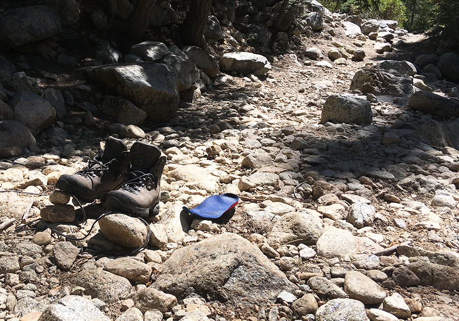
Just to be sure, I put on my water shoes and held my boots in my hand to cross the creek. But I took one wrong step, landed my foot on the bottom of the creek two feet down, almost got my foot stuck between the rocks and sank to my waist in the water, drowning my boots completely.
This left me with no other choice than to take some time to let my boots and feet dry in the sun. Luckily it was time for a lunch break anyway.
Looking back, I realize things could have been much worse, like injuring my ankle or even loosing my boots. So: never underestimate any creek crossing. Just never.
3. It’s the altitude, not the miles
The country where I live – the Netherlands – is not only completely flat, but it’s also partly below sea level. I happen to live just behind the sand dunes of the Dutch coast, at approximately zero altitude. For my thru hike in the High Sierra I had been training for about 10 months. Daily knee bends, squats and lunges, along with weekly hikes up to 22 miles (35 km) with full pack, to get me in shape once I would hit the trail.
Of course I knew that going up and down steep mountain trails would be much harder than hiking in flat terrain, so I already aimed for a much lower average of 12 miles a day (with a maximum of 18 miles). What I did not realize is that hiking in the High Sierra is not only harder because you go up and down constantly, but even more so because of the lower oxygen level at the Sierra’s altitude.
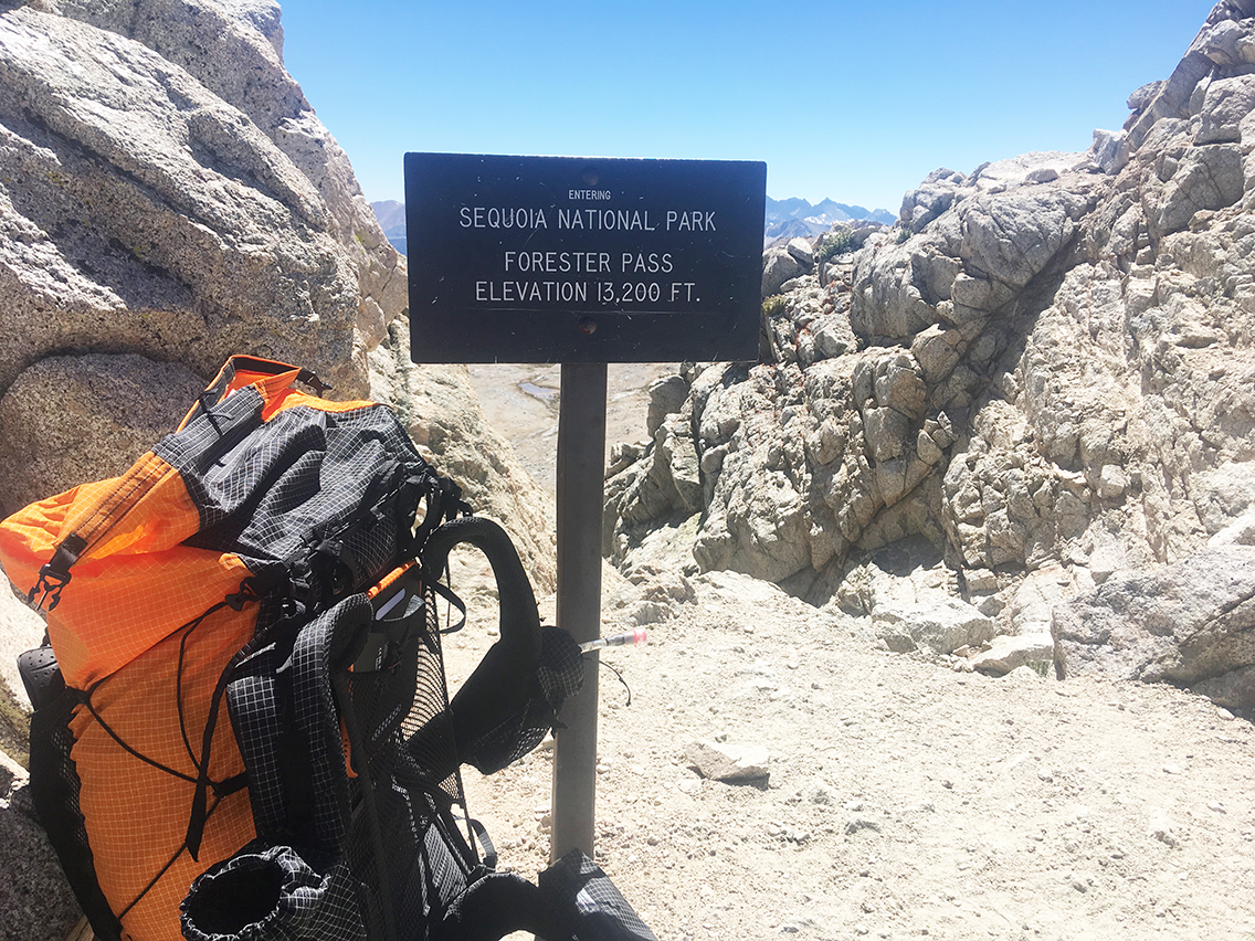
Forester Pass, at 13,153 ft (4,009 m) – never trust the signs.
On the John Muir Trail and High Sierra Trail you will hike at least at an elevation of 10,000 ft (3.000 m), most of the time. Above 11,500 ft (3.500 m) the air really becomes thinner and I was surprised about the effect this had on me. Especially hiking up Forester Pass, which is indeed exactly 13,153 ft (4,009 m) above my daily habitat, wore me out completely. Hiking up the pass I felt no pain in my feet or legs, I wasn’t actually very tired, but I felt a serious lack of oxygen. My heart was beating like crazy and my breath was heavy. It slowed me down so much that I really wondered if I would reach the pas before sunset.
I managed to reach the pass, and hiked down another 5 miles to a much lower camp site. But I will never forget how the altitude affected me. So I will seriously take altitude into account for my future hiking plans.
4. Do Not Fear Bears – but Take Care
In my home country, the most dangerous animal must be a cow. Or maybe a tick. As for animal life in the High Sierra, I had two fears: rattlesnakes and bears. The snakes apparently only live in Kern Canyon, where I was extra cautious, but the Black Bears seem to be almost everywhere. For this reason the trails are full of big metal food lockers – there was hardly a camp site without it.
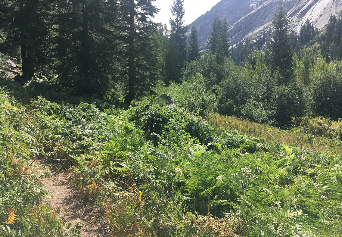
Typical bear infested bushes along Bubbs Creek Trail
As for for the bears, I did see one really close by, eating berries on the Bubbs Creek Trail. And I saw very fresh traces of bears on the Elizabeth Pass Trail. I also met hikers who told me about another hiker being bluff charged by a mother bear with a cub that crossed the hikers path, just a mile ahead of me (on Bubbs Creek). And I met a couple that warned me about a bear track in the sandy trail in Kern Canyon (I couldn’t find it). Probably everyone who has hiked in the High Sierra returns home with stories like this.
Bear Canister
On the other hand, while I was cautious about not cooking next to my tent and placing my bear canister at a safe distance from camp, most American hikers I met did not really seem to be bothered by the bears. ‘If a bear comes to our tents, we’ll just chase ’em away you and I’ a fellow camper on Tyndall Creek casually remarked. And I must say, although I was really startled when I saw my bear on Bubbs Creek, the bear didn’t pay any attention to me, did not move or make sound, did not even look in my direction.
So my conclusion about bears is: make sure to take all precautions: make noise, carry a bear canister and LEAVE NO TRACE. But I don’t let the fear of them keep you away from the mighty High Sierra.
5. Do Not Plan too Detailed
Is a 10 month period of preparations just too much for two weeks of hiking? Looking back I have to say: no. But also: yes.
For some aspects of the trip it was really important to start in time – especially since I was traveling from overseas. I had to book my accommodation in Grant Grove at least half a year in advance – otherwise that nice cabin would not have been available anymore. The same with getting a back country permit from the National Park service before March 1st. Or buying airplane tickets.
To be on time for these things, it means that you need to know exactly when you will be hiking, and where. And to be able to decide on these exact dates, you need to plan your hike day by day, long before you will travel.
Physical Training
Another thing you cannot start too early, is physical training. I started my training in October 2017, for a hike almost one year later. My training consisted of a lot of hiking and walking in weekends, sometimes carrying a full pack. I covered distances from anything between 5 to 30 km on a day. Besides that I did daily exercises like squats, lunges and push-ups. Later on the trail, I really benefited from this long training: I walked almost without blisters and no injuries.
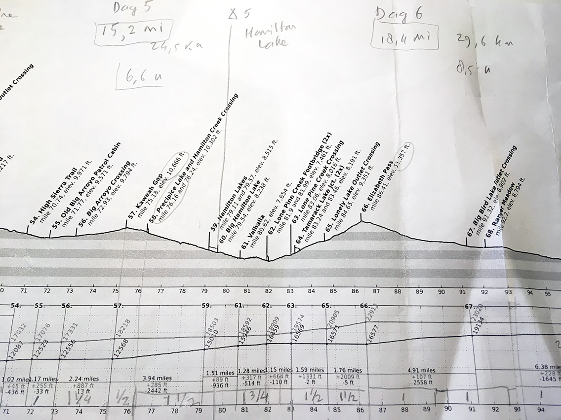
For detailed planning of the SEKI Loop, I used the elevation profiles from Sierramapper.
Mileage
On the trail, I learned that my planning was way too detailed in other respects. I had been figuring out my exact mileage and the precise camping spot along the trail. In reality however, I walked much more, or much less miles than I thought I would. I camped 3 nights out of 8 on a totally different spot than I planned. Moreover, it took me one extra day to finish the trail due to a thunderstorm.
During the hike I often decided on the spot to move on, or to stop. In Kern Canyon for instance, I was in good spirits and hiked the entire canyon in the afternoon, although I had planned to do that the next day. At Hamilton Lake, I decided to relax and swim an entire morning and only leave at noon for a very short hike that day.
The freedom to let the trail decide my mileage or camping spot was something that surprised my very organized mind a bit – but I really loved it.
What are the things that you learned on the trail? Let me know in the comments below.
I enjoyed reading your SEKI loop posts. I’m getting ready for the Rae Lakes Trip in a few days, starting at Bubbs Creek and going clockwise. I also have a permit for the High Sierra Trail in August.
I’ve done the John Muir Trail (in three parts), and agree that Forester Pass was the toughest climb on the JMT, even over Mount Whitney.
Keep up the wonderful commentary. Cheers!
Hello Dan,
Thanks for your comment! I hope to finally get to the Rae Lakes, hiking the JMT in the future. Have a good time at Rae Lakes and the High Sierra Trail!
Read the entire SEKI loop series – great pics and a good resource for future trip planning. I’ve been to the base of Elizabeth Pass and recognized the trail junction sign in one your pics – planning to do the HST this year (we’ll see if COVID messes with those plans). Happy hiking!
Hello Eric, nice to hear from you that my reports are useful to you for your future trip! Let me know what your trip was like when you finish!
Really enjoyed reading your journal of this hike. I’ll definitely put this on my list!
Thanks Brad. I hope you’ll have a good hike!